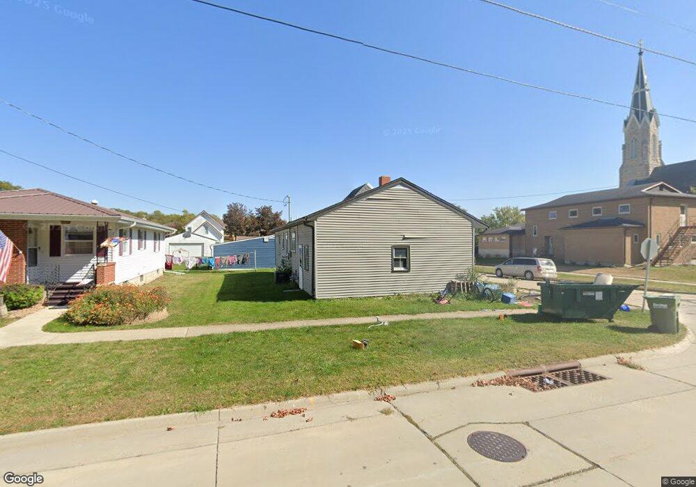
210 Boardman St Elkader, IA 52043
Estimated Value: $112,000 - $149,000
2
Beds
1
Bath
864
Sq Ft
$143/Sq Ft
Est. Value
About This Home
This home is located at 210 Boardman St, Elkader, IA 52043 and is currently estimated at $123,293, approximately $142 per square foot. 210 Boardman St is a home located in Clayton County with nearby schools including Central Elementary School and Central Middle School/High School.
Ownership History
Date
Name
Owned For
Owner Type
Purchase Details
Closed on
Oct 27, 2017
Sold by
Freedombank
Bought by
Schaffer Leo W and Schaffer Ashley L
Current Estimated Value
Home Financials for this Owner
Home Financials are based on the most recent Mortgage that was taken out on this home.
Original Mortgage
$1
Outstanding Balance
$1
Interest Rate
3.83%
Mortgage Type
Purchase Money Mortgage
Purchase Details
Closed on
Jun 12, 2007
Sold by
Mitchell Nathan D
Bought by
Kainz Robert F and Kainz Mary K
Home Financials for this Owner
Home Financials are based on the most recent Mortgage that was taken out on this home.
Original Mortgage
$61,200
Interest Rate
6.26%
Mortgage Type
New Conventional
Create a Home Valuation Report for This Property
The Home Valuation Report is an in-depth analysis detailing your home's value as well as a comparison with similar homes in the area
Purchase History
| Date | Buyer | Sale Price | Title Company |
|---|---|---|---|
| Schaffer Leo W | -- | None Available | |
| Kainz Robert F | $68,000 | None Available |
Source: Public Records
Mortgage History
| Date | Status | Borrower | Loan Amount |
|---|---|---|---|
| Open | Schaffer Leo W | $1 | |
| Previous Owner | Kainz Robert F | $61,200 |
Source: Public Records
Tax History
| Year | Tax Paid | Tax Assessment Tax Assessment Total Assessment is a certain percentage of the fair market value that is determined by local assessors to be the total taxable value of land and additions on the property. | Land | Improvement |
|---|---|---|---|---|
| 2025 | $2,106 | $99,411 | $4,630 | $94,781 |
| 2024 | $1,914 | $84,244 | $4,026 | $80,218 |
| 2023 | $1,732 | $84,244 | $4,026 | $80,218 |
| 2022 | $1,604 | $66,313 | $3,660 | $62,653 |
| 2021 | $1,490 | $66,313 | $3,660 | $62,653 |
| 2020 | $1,490 | $64,393 | $3,660 | $60,733 |
| 2019 | $1,364 | $64,393 | $3,660 | $60,733 |
| 2018 | $1,364 | $60,282 | $3,660 | $56,622 |
| 2017 | $1,408 | $60,282 | $3,660 | $56,622 |
| 2015 | $1,310 | $57,128 | $4,831 | $52,297 |
| 2014 | $1,232 | $57,128 | $4,831 | $52,297 |
Source: Public Records
Map
Nearby Homes
- 117 S Main St
- 301 N 1st St
- 106 Reimer St SW
- 302 N 3rd St
- 0 E Bridge St
- 702 N Main St
- 710 Woodland Dr NW
- 247 Franzen Ridge Rd
- 249 Franzen Ridge Rd
- 27766 Highway 13
- XXX Dolphin Ave
- 27455 Harbor Rd
- 14149 Iowa 56
- 108 E Washington St
- 108 Adams Ct
- 104 Adams Ct
- 306 S Monroe St
- 208 N Roosevelt St
- 36648 Crystal Rd
- 330 S Mill St
Your Personal Tour Guide
Ask me questions while you tour the home.