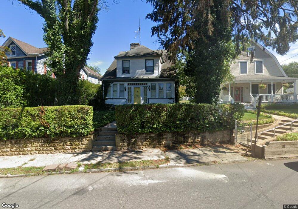
210 Branch Ave Red Bank, NJ 07701
Estimated Value: $601,000 - $718,000
3
Beds
2
Baths
1,323
Sq Ft
$514/Sq Ft
Est. Value
About This Home
This home is located at 210 Branch Ave, Red Bank, NJ 07701 and is currently estimated at $679,446, approximately $513 per square foot. 210 Branch Ave is a home located in Monmouth County with nearby schools including Red Bank Primary School, Red Bank Middle School, and Red Bank Regional High School.
Ownership History
Date
Name
Owned For
Owner Type
Purchase Details
Closed on
Feb 11, 2015
Sold by
Lemay Patricia
Bought by
Deponti Matthew and Deponti Stacie
Current Estimated Value
Home Financials for this Owner
Home Financials are based on the most recent Mortgage that was taken out on this home.
Original Mortgage
$200,000
Outstanding Balance
$153,072
Interest Rate
3.74%
Mortgage Type
New Conventional
Estimated Equity
$526,374
Create a Home Valuation Report for This Property
The Home Valuation Report is an in-depth analysis detailing your home's value as well as a comparison with similar homes in the area
Home Values in the Area
Average Home Value in this Area
Purchase History
| Date | Buyer | Sale Price | Title Company |
|---|---|---|---|
| Deponti Matthew | $260,000 | Two Rivers Title Co Llc |
Source: Public Records
Mortgage History
| Date | Status | Borrower | Loan Amount |
|---|---|---|---|
| Open | Deponti Matthew | $200,000 |
Source: Public Records
Tax History Compared to Growth
Tax History
| Year | Tax Paid | Tax Assessment Tax Assessment Total Assessment is a certain percentage of the fair market value that is determined by local assessors to be the total taxable value of land and additions on the property. | Land | Improvement |
|---|---|---|---|---|
| 2025 | $9,394 | $586,300 | $384,800 | $201,500 |
| 2024 | $9,408 | $497,300 | $303,800 | $193,500 |
| 2023 | $9,408 | $492,300 | $303,800 | $188,500 |
| 2022 | $8,671 | $437,200 | $256,800 | $180,400 |
| 2021 | $8,671 | $387,600 | $223,300 | $164,300 |
| 2020 | $8,479 | $373,200 | $223,300 | $149,900 |
| 2019 | $8,152 | $368,700 | $223,300 | $145,400 |
| 2018 | $7,945 | $363,300 | $223,300 | $140,000 |
| 2017 | $7,566 | $358,600 | $223,300 | $135,300 |
| 2016 | $6,898 | $327,400 | $195,600 | $131,800 |
| 2015 | $8,134 | $400,100 | $264,400 | $135,700 |
| 2014 | $8,566 | $447,800 | $297,300 | $150,500 |
Source: Public Records
Map
Nearby Homes
- 199 Pinckney Rd
- 30 Crest Dr
- 32 Woodbine Ave
- 85 Tower Hill Dr Unit 608
- 83 Tower Hill Dr
- 4 Manor Dr
- 1 George St
- 70 Hudson Ave
- 58 Hudson Ave
- 87 Rumson Rd
- 44 Hudson Ave
- 48 Hudson Ave
- 82 Linden Place
- 17 Leroy Place Unit 3B
- 17 Leroy Place Unit 2B
- 69 Washington St
- 65 Washington St
- 132 Harrison Ave
- 59 Leroy Place
- 40 Worthley St
- 206 Branch Ave
- 214 Branch Ave
- 316 Spring St
- 316 Spring St Unit Upper
- 316 Spring St Unit Lower
- 316 Spring St Unit Upper Level
- 316 Spring St Unit Lower Level
- 204 Branch Ave
- 314 Spring St
- 192 Branch Ave
- 220 Branch Ave
- 312 Spring St
- 217 Branch Ave
- 335 Spring St
- 190 Branch Ave
- 421 Spring St
- 225 Branch Ave
- 310 Spring St
- 110 Madison Ave
- 186 Branch Ave