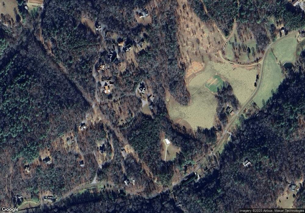
210 Brasstown Acres Brasstown, NC 28902
Brasstown NeighborhoodEstimated Value: $380,000 - $549,000
2
Beds
3
Baths
1,926
Sq Ft
$235/Sq Ft
Est. Value
About This Home
This home is located at 210 Brasstown Acres, Brasstown, NC 28902 and is currently estimated at $453,281, approximately $235 per square foot. 210 Brasstown Acres is a home located in Clay County with nearby schools including Hayesville Elementary School, Hayesville Middle School, and Hayesville High School.
Ownership History
Date
Name
Owned For
Owner Type
Purchase Details
Closed on
Mar 25, 2013
Sold by
Norris Edwin L and Norris Carrie C
Bought by
Goings Everett V and Goings Susan P
Current Estimated Value
Purchase Details
Closed on
Nov 1, 2010
Sold by
Norris Edwin L and Norris Carrie C
Bought by
Norris Edwin L and Norris Carrie C
Home Financials for this Owner
Home Financials are based on the most recent Mortgage that was taken out on this home.
Original Mortgage
$181,235
Interest Rate
4.38%
Mortgage Type
Stand Alone Second
Purchase Details
Closed on
Jul 14, 2008
Sold by
Payne William Kirk and Payne Sherry J
Bought by
Norris Edwin L and Norris Carrie C
Home Financials for this Owner
Home Financials are based on the most recent Mortgage that was taken out on this home.
Original Mortgage
$180,000
Interest Rate
6.27%
Mortgage Type
New Conventional
Create a Home Valuation Report for This Property
The Home Valuation Report is an in-depth analysis detailing your home's value as well as a comparison with similar homes in the area
Home Values in the Area
Average Home Value in this Area
Purchase History
| Date | Buyer | Sale Price | Title Company |
|---|---|---|---|
| Goings Everett V | $243,000 | None Available | |
| Norris Edwin L | -- | -- | |
| Norris Edwin L | $225,000 | -- |
Source: Public Records
Mortgage History
| Date | Status | Borrower | Loan Amount |
|---|---|---|---|
| Previous Owner | Norris Edwin L | $181,235 | |
| Previous Owner | Norris Edwin L | $180,000 |
Source: Public Records
Tax History Compared to Growth
Tax History
| Year | Tax Paid | Tax Assessment Tax Assessment Total Assessment is a certain percentage of the fair market value that is determined by local assessors to be the total taxable value of land and additions on the property. | Land | Improvement |
|---|---|---|---|---|
| 2025 | -- | $225,100 | $27,500 | $197,600 |
| 2024 | $1,058 | $225,100 | $27,500 | $197,600 |
| 2023 | $1,058 | $225,100 | $27,500 | $197,600 |
| 2022 | $0 | $225,100 | $27,500 | $197,600 |
| 2021 | $1,058 | $225,100 | $27,500 | $197,600 |
| 2020 | $1,058 | $225,100 | $27,500 | $197,600 |
| 2019 | $1,058 | $225,100 | $27,500 | $197,600 |
| 2018 | $1,058 | $225,100 | $27,500 | $197,600 |
| 2016 | -- | $260,899 | $75,000 | $185,899 |
| 2015 | -- | $260,899 | $75,000 | $185,899 |
| 2014 | -- | $260,899 | $75,000 | $185,899 |
Source: Public Records
Map
Nearby Homes
- 246 Brasstown Acres
- LOT 55 Brasstown Trail
- 722 Greasy Creek Rd
- 170 Anderson Rd
- 1AC Green Cove Rd
- 9341 Old Highway 64 W
- LOT 12 Preserve at Beach Mountain
- LOT 11 Preserve at Beach Mountain
- LOT 8 Preserve at Beach Mountain
- LOT 13 Preserve at Beach Mountain
- 0 Spotted Mule Run
- 88 Bruce Wike Ln
- 1AC Bruce Wike Ln
- 0 Mason Rd Unit 10539053
- Lot 50 Brasstown Trail
- Tract 2G Mason Ln
- Lot 37 Wildflower Ridge
- Lot 9 Wildflower Ridge
- 702 Wildflower Ridge
- LOT 28 Wildflower Ridge
- 236 Brasstown Acres
- 573 Greasy Creek Rd
- 573 Greasy Creek Rd
- 346 Brasstown Acres
- 313 Brasstown Acres
- 313 Brasstown Acres
- 38 Darnell Ln
- 530 Brasstown Acres
- 54 Darnell Ln
- 364 Brasstown Acres
- 671 Greasy Creek Rd
- 95 Brasstown Acres
- 60 Brasstown Acres
- 15 Acres Brasstown Rd
- 55 Darnell Ln
- 0 Darnell Ln
- 22 Brasstown Acres
- Lt 18 Brasstown Acres
- LT16A Brasstown Acres
- LT16B Brasstown Acres
