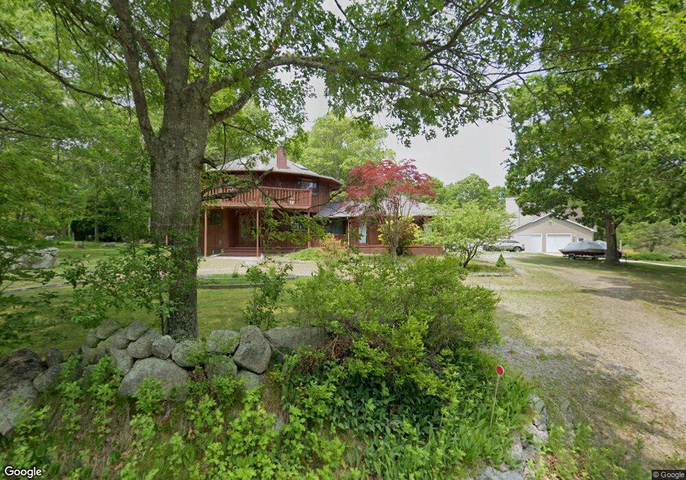
210 Buckeye Brook Rd Charlestown, RI 02813
Estimated Value: $640,000 - $760,000
3
Beds
2
Baths
1,900
Sq Ft
$369/Sq Ft
Est. Value
About This Home
This home is located at 210 Buckeye Brook Rd, Charlestown, RI 02813 and is currently estimated at $700,931, approximately $368 per square foot. 210 Buckeye Brook Rd is a home located in Washington County with nearby schools including Chariho Regional Middle School and Chariho High School.
Ownership History
Date
Name
Owned For
Owner Type
Purchase Details
Closed on
Oct 29, 2001
Sold by
D-Rose Erin M
Bought by
Macaione Gina M
Current Estimated Value
Home Financials for this Owner
Home Financials are based on the most recent Mortgage that was taken out on this home.
Original Mortgage
$165,000
Interest Rate
6.86%
Purchase Details
Closed on
Jun 5, 1998
Sold by
Rogers Joan M
Bought by
Deloghia-Rose Erin M
Create a Home Valuation Report for This Property
The Home Valuation Report is an in-depth analysis detailing your home's value as well as a comparison with similar homes in the area
Home Values in the Area
Average Home Value in this Area
Purchase History
| Date | Buyer | Sale Price | Title Company |
|---|---|---|---|
| Macaione Gina M | $215,000 | -- | |
| Deloghia-Rose Erin M | $158,000 | -- |
Source: Public Records
Mortgage History
| Date | Status | Borrower | Loan Amount |
|---|---|---|---|
| Closed | Deloghia-Rose Erin M | $106,400 | |
| Closed | Deloghia-Rose Erin M | $114,200 | |
| Closed | Deloghia-Rose Erin M | $156,400 | |
| Closed | Deloghia-Rose Erin M | $165,000 |
Source: Public Records
Tax History Compared to Growth
Tax History
| Year | Tax Paid | Tax Assessment Tax Assessment Total Assessment is a certain percentage of the fair market value that is determined by local assessors to be the total taxable value of land and additions on the property. | Land | Improvement |
|---|---|---|---|---|
| 2025 | $2,959 | $499,000 | $157,500 | $341,500 |
| 2024 | $2,884 | $499,000 | $157,500 | $341,500 |
| 2023 | $2,864 | $499,000 | $157,500 | $341,500 |
| 2022 | $2,534 | $310,100 | $97,200 | $212,900 |
| 2021 | $2,537 | $310,100 | $97,200 | $212,900 |
| 2020 | $2,552 | $310,100 | $97,200 | $212,900 |
| 2019 | $2,532 | $274,300 | $97,200 | $177,100 |
| 2018 | $2,644 | $274,300 | $97,200 | $177,100 |
| 2017 | $2,631 | $274,300 | $97,200 | $177,100 |
| 2016 | $2,656 | $260,100 | $88,300 | $171,800 |
| 2015 | $2,630 | $260,100 | $88,300 | $171,800 |
| 2014 | $2,575 | $260,100 | $88,300 | $171,800 |
Source: Public Records
Map
Nearby Homes
- 129 Peckham Hollow Rd
- 473 Klondike Rd
- 10 Laurel Rd
- 162 Church St Unit 164
- 134 Church St
- 61 Church St
- 194 Ross Hill Rd
- 0 Woody Hill Rd Unit 1334811
- 0 Woody Hill Rd Unit 73432704
- 23 Canterbury Dr
- 135 Ross Hill Rd
- 4 Village Rd
- 154 Kings Factory Rd
- 155 Kings Factory Rd
- 126 Alton Bradford Rd
- 5717 Post Rd
- 12 Fallon Trail
- 5259 Old Post Rd
- 0 Post Rd Unit 1398131
- 0 Post Rd Unit 1349033
- 214 Buckeye Brook Rd
- 200 Buckeye Brook Rd
- 194 Buckeye Brook Rd
- 230 Buckeye Brook Rd
- 222 Buckeye Brook Rd
- 11 Blue Ridge Dr
- 238 Buckeye Brook Rd
- 15 Blue Ridge Dr
- 19 Blue Ridge Dr
- 240 Buckeye Brook Rd
- 178 Buckeye Brook Rd
- 27 Blue Ridge Dr
- 0 Blue Ridge Dr
- 16 Blue Ridge Dr
- 246 Buckeye Brook Rd
- 20 Blue Ridge Dr
- 35 Blue Ridge Dr
- 170 Buckeye Brook Rd
- 45 Blue Ridge Dr
- 51 Blue Ridge Dr