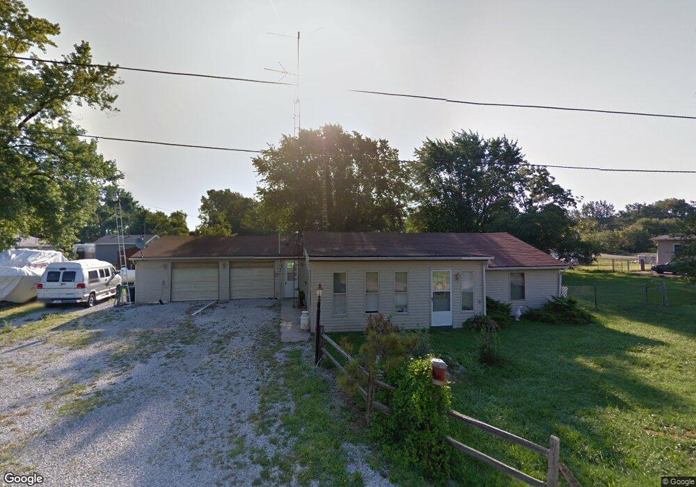
210 Burns Rd Curtice, OH 43412
Estimated Value: $123,000 - $156,000
2
Beds
2
Baths
1,168
Sq Ft
$124/Sq Ft
Est. Value
About This Home
This home is located at 210 Burns Rd, Curtice, OH 43412 and is currently estimated at $144,390, approximately $123 per square foot. 210 Burns Rd is a home located in Lucas County.
Ownership History
Date
Name
Owned For
Owner Type
Purchase Details
Closed on
Aug 7, 2023
Sold by
Wurster Kevin A and Malhoit Kimberly C
Bought by
Rickus Christopher
Current Estimated Value
Home Financials for this Owner
Home Financials are based on the most recent Mortgage that was taken out on this home.
Original Mortgage
$98,748
Outstanding Balance
$96,456
Interest Rate
6.71%
Mortgage Type
FHA
Estimated Equity
$47,934
Purchase Details
Closed on
Jul 30, 2019
Sold by
Wurster Virgil O
Bought by
Wurster Marilyn J
Purchase Details
Closed on
Apr 17, 1990
Sold by
Poolman Debbie E
Create a Home Valuation Report for This Property
The Home Valuation Report is an in-depth analysis detailing your home's value as well as a comparison with similar homes in the area
Home Values in the Area
Average Home Value in this Area
Purchase History
| Date | Buyer | Sale Price | Title Company |
|---|---|---|---|
| Rickus Christopher | $120,000 | None Listed On Document | |
| Wurster Marilyn J | -- | None Available | |
| -- | $33,500 | -- |
Source: Public Records
Mortgage History
| Date | Status | Borrower | Loan Amount |
|---|---|---|---|
| Open | Rickus Christopher | $98,748 |
Source: Public Records
Tax History Compared to Growth
Tax History
| Year | Tax Paid | Tax Assessment Tax Assessment Total Assessment is a certain percentage of the fair market value that is determined by local assessors to be the total taxable value of land and additions on the property. | Land | Improvement |
|---|---|---|---|---|
| 2024 | $1,138 | $36,750 | $10,325 | $26,425 |
| 2023 | $1,949 | $25,725 | $9,415 | $16,310 |
| 2022 | $1,400 | $25,725 | $9,415 | $16,310 |
| 2021 | $1,394 | $25,725 | $9,415 | $16,310 |
| 2020 | $1,090 | $21,280 | $7,805 | $13,475 |
| 2019 | $1,055 | $21,280 | $7,805 | $13,475 |
| 2018 | $898 | $21,280 | $7,805 | $13,475 |
| 2017 | $770 | $16,870 | $5,355 | $11,515 |
| 2016 | $765 | $48,200 | $15,300 | $32,900 |
| 2015 | $743 | $48,200 | $15,300 | $32,900 |
| 2014 | $539 | $16,880 | $5,360 | $11,520 |
| 2013 | $539 | $16,880 | $5,360 | $11,520 |
Source: Public Records
Map
Nearby Homes
- 11931 Rachel Rd
- 11965 Dyke Rd
- 12403 Lagoon Dr
- 12504 La Fontaine Dr
- 12643 Lagoon Dr
- 541 Temple Rd
- 11103 Dyke Rd
- 11661 Veler Rd
- 725 Donovan Rd
- 10208 Corduroy Rd
- 16047 W Krause Rd
- 9440 Seaman Rd
- 0 W Walbridge E Unit 6135427
- 13538 W Velliquette Rd
- 3784 N Stange Rd
- 7733 Brown Rd
- 0 W Walbridge Rd
- Track 1 W Walbridge Rd
- 19367 W Walbridge Rd
- 19395 W Walbridge Rd
- 222 Burns Rd
- 12186 Corduroy Rd
- 12107 Corduroy Rd
- 202 Burns Rd
- 207 Burns Rd
- 12166 Corduroy Rd
- 219 Burns Rd
- 203 Burns Rd
- 223 Burns Rd
- 12162 Corduroy Rd
- 239 Burns Rd
- 12201 Lafontaine Dr
- 12152 Corduroy Rd
- 252 Burns Rd
- 247 Burns Rd
- 244 Alzale Rd
- 251 Burns Rd
- 12144 Corduroy Rd
- 12205 Lagoon Dr
- 12201 Lagoon Dr