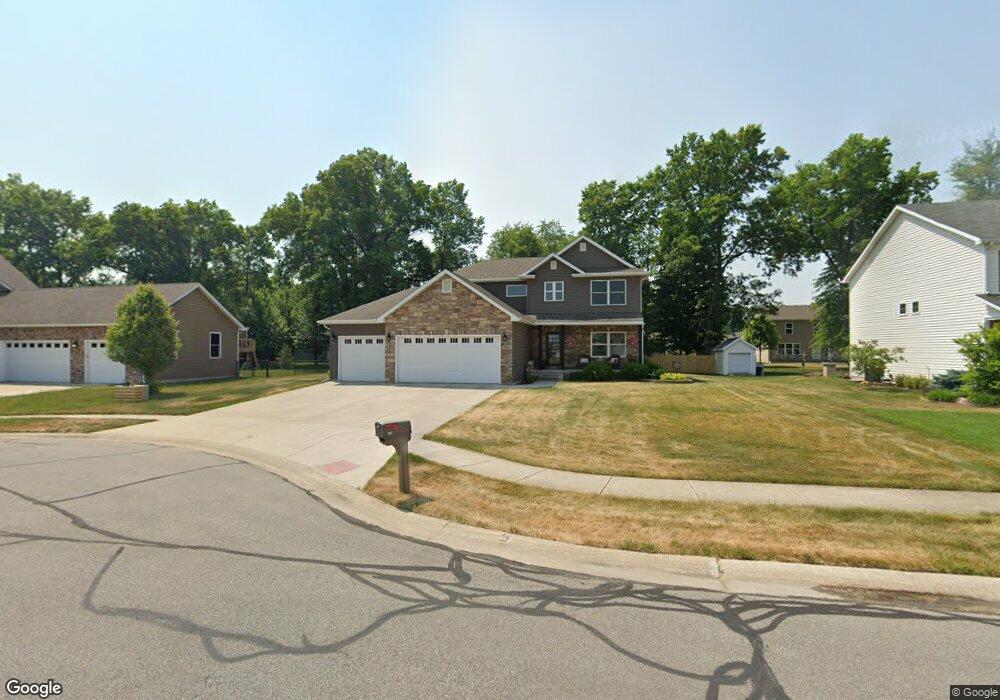
210 Cessna Dr Chesterton, IN 46304
Estimated Value: $415,000 - $429,468
3
Beds
3
Baths
2,147
Sq Ft
$197/Sq Ft
Est. Value
About This Home
This home is located at 210 Cessna Dr, Chesterton, IN 46304 and is currently estimated at $422,867, approximately $196 per square foot. 210 Cessna Dr is a home with nearby schools including Newton Yost Elementary School, Westchester Intermediate School, and Chesterton Middle School.
Ownership History
Date
Name
Owned For
Owner Type
Purchase Details
Closed on
Jun 10, 2024
Sold by
Kociara Kevin A
Bought by
Kociara Living Trust
Current Estimated Value
Purchase Details
Closed on
Aug 20, 2013
Sold by
Oak Tree Park Sales Inc
Bought by
Kociara Kevin A
Home Financials for this Owner
Home Financials are based on the most recent Mortgage that was taken out on this home.
Original Mortgage
$186,750
Interest Rate
4.33%
Mortgage Type
New Conventional
Create a Home Valuation Report for This Property
The Home Valuation Report is an in-depth analysis detailing your home's value as well as a comparison with similar homes in the area
Home Values in the Area
Average Home Value in this Area
Purchase History
| Date | Buyer | Sale Price | Title Company |
|---|---|---|---|
| Kociara Living Trust | -- | None Listed On Document | |
| Kociara Kevin A | -- | None Available | |
| Oak Tree Park Sales Inc | -- | Fidelity National Title Comp |
Source: Public Records
Mortgage History
| Date | Status | Borrower | Loan Amount |
|---|---|---|---|
| Previous Owner | Kociara Kevin A | $186,750 |
Source: Public Records
Tax History Compared to Growth
Tax History
| Year | Tax Paid | Tax Assessment Tax Assessment Total Assessment is a certain percentage of the fair market value that is determined by local assessors to be the total taxable value of land and additions on the property. | Land | Improvement |
|---|---|---|---|---|
| 2024 | $3,830 | $395,300 | $43,000 | $352,300 |
| 2023 | $3,663 | $375,600 | $39,800 | $335,800 |
| 2022 | $3,643 | $345,500 | $39,800 | $305,700 |
| 2021 | $2,937 | $301,500 | $39,800 | $261,700 |
| 2020 | $2,962 | $299,300 | $34,600 | $264,700 |
| 2019 | $2,814 | $273,700 | $34,600 | $239,100 |
| 2018 | $2,681 | $266,400 | $34,600 | $231,800 |
| 2017 | $2,529 | $262,300 | $34,600 | $227,700 |
| 2016 | $2,386 | $255,400 | $34,600 | $220,800 |
| 2014 | $2,396 | $245,100 | $33,100 | $212,000 |
| 2013 | -- | $500 | $500 | $0 |
Source: Public Records
Map
Nearby Homes
- 237 Cessna Dr
- 1198 N Babcock Rd
- 1440 Duffer Dr
- 210 Rainbow Dr
- 283 Melton Rd
- 1346 Essex Dr
- 696 Admiral Dr
- V/L U S 20
- 2131 Pepperbush Ave
- 1290 Old Porter Rd
- 1198 Old Porter Rd
- 4131 Abercrombie Dr
- 1177 Harbor Way
- 1521 Birdie Way
- 1181 Harbor Way
- 1178 Harbor Way
- 322 Sherman Ave
- 1183 Harbor Way
- 1162 Chesterfield Ave
- 1180 Harbor Way
- 212 Cessna Dr
- 1151 Skylark Dr
- 213 Trail Dr
- 213 Trailcreek Dr
- 214 Cessna Dr
- 211 Trailcreek Dr
- 215 Trailcreek Dr
- 1154 Skylark Dr
- 1153 Skylark Dr
- 209 Trailcreek Dr
- 217 Trailcreek Dr
- 216 Cessna Dr
- 14-Lot Trailcreek Dr
- 15-Lot Trailcreek Dr
- 11-Lot Trailcreek Dr
- (Lot 5) Trailcreek Dr
- 1155 Kinner Dr
- 1155 Skylark Dr
- 207 Trailcreek Dr
- 1158 Skylark Dr