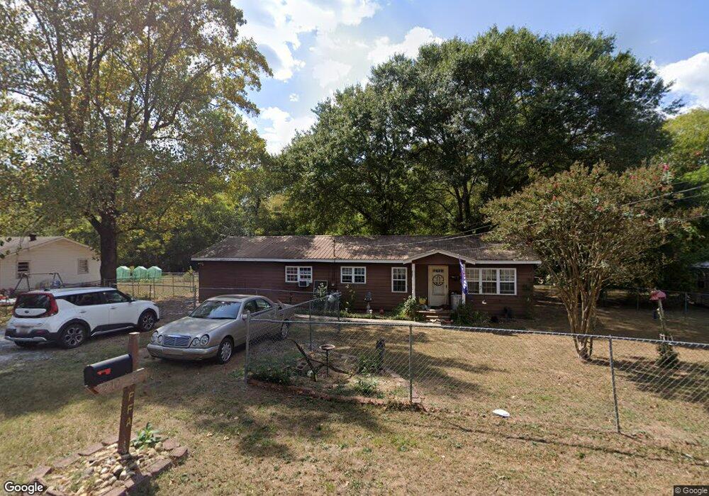
210 Cherokee Dr Calhoun, GA 30701
Estimated Value: $171,000 - $205,000
2
Beds
2
Baths
1,152
Sq Ft
$163/Sq Ft
Est. Value
About This Home
This home is located at 210 Cherokee Dr, Calhoun, GA 30701 and is currently estimated at $187,438, approximately $162 per square foot. 210 Cherokee Dr is a home located in Gordon County with nearby schools including Red Bud Elementary School, Red Bud Middle School, and Sonoraville High School.
Ownership History
Date
Name
Owned For
Owner Type
Purchase Details
Closed on
Oct 17, 2007
Sold by
Ratliff Connie
Bought by
Davis Sandra Laverne
Current Estimated Value
Purchase Details
Closed on
Jan 3, 2006
Sold by
Stanley Dorothy D
Bought by
Ratliff Connie Waits
Purchase Details
Closed on
Jan 3, 2005
Sold by
Stanley Dorothy
Bought by
Ratliff Connie
Purchase Details
Closed on
Jun 28, 2002
Sold by
Cornwell Evelyn J
Bought by
Stanley Dorothy D
Purchase Details
Closed on
Jun 7, 2001
Bought by
Cornwell Evelyn J
Create a Home Valuation Report for This Property
The Home Valuation Report is an in-depth analysis detailing your home's value as well as a comparison with similar homes in the area
Purchase History
| Date | Buyer | Sale Price | Title Company |
|---|---|---|---|
| Davis Sandra Laverne | $60,830 | -- | |
| Ratliff Connie Waits | -- | -- | |
| Ratliff Connie | -- | -- | |
| Stanley Dorothy D | $65,800 | -- | |
| Cornwell Evelyn J | -- | -- | |
| Cornwell Evelyn J | -- | -- |
Source: Public Records
Tax History
| Year | Tax Paid | Tax Assessment Tax Assessment Total Assessment is a certain percentage of the fair market value that is determined by local assessors to be the total taxable value of land and additions on the property. | Land | Improvement |
|---|---|---|---|---|
| 2025 | $1,425 | $57,808 | $9,240 | $48,568 |
| 2024 | $1,437 | $51,768 | $9,240 | $42,528 |
| 2023 | $1,297 | $46,768 | $8,800 | $37,968 |
| 2022 | $411 | $45,168 | $9,800 | $35,368 |
| 2021 | $1,122 | $38,328 | $9,800 | $28,528 |
| 2020 | $1,143 | $38,728 | $9,800 | $28,928 |
| 2019 | $1,141 | $38,728 | $9,800 | $28,928 |
| 2018 | $305 | $33,680 | $9,280 | $24,400 |
| 2017 | $298 | $32,320 | $9,280 | $23,040 |
| 2016 | $299 | $32,320 | $9,280 | $23,040 |
| 2015 | $283 | $30,360 | $9,280 | $21,080 |
| 2014 | $237 | $26,092 | $8,330 | $17,762 |
Source: Public Records
Map
Nearby Homes
- 1325 U S 41
- 187 Fire Tower Rd NE
- 308 Thor Ave
- 320 Chiefvan Terrace NE
- 105 Keisha Ln
- 219 Shire Loop
- 403 S Sequoyah Cir NE
- 103 Mcginnis Cir
- 201 Mcginnis Cir
- 108 Mcginnis Cir
- 104 Cornwell Way
- 000 Mauldin Rd
- 403 Mcginnis Cir
- 485 Mount Vernon Dr
- 389 Mount Vernon Dr
- 126 Windy Hill Dr
- 105 McEntyre Ct
- 257 Iracille Ln NE
- 198 Iracille Ln NE
- 367 Mount Vernon Dr
- 200 Cherokee Dr
- 220 Cherokee Dr
- 221 Cherokee Dr
- 113 Cherokee Dr
- 227 Cherokee Dr
- 231 Cherokee Dr
- 110 Cherokee Dr
- 126 Cherokee Dr
- 305 Cherokee Dr
- 1317 U S 41
- 319 Cherokee Dr
- 111 Creekside Dr NW
- 109 Creekside Dr NW
- 109 Creekside Dr NW Unit 3
- 109 Creekside Dr NW
- 1317 Us 41 N
- 108 Cherokee Dr
- 108 Freeman Rd NE
- 107 Creekside Dr NW
- 306 Cherokee Dr
Your Personal Tour Guide
Ask me questions while you tour the home.