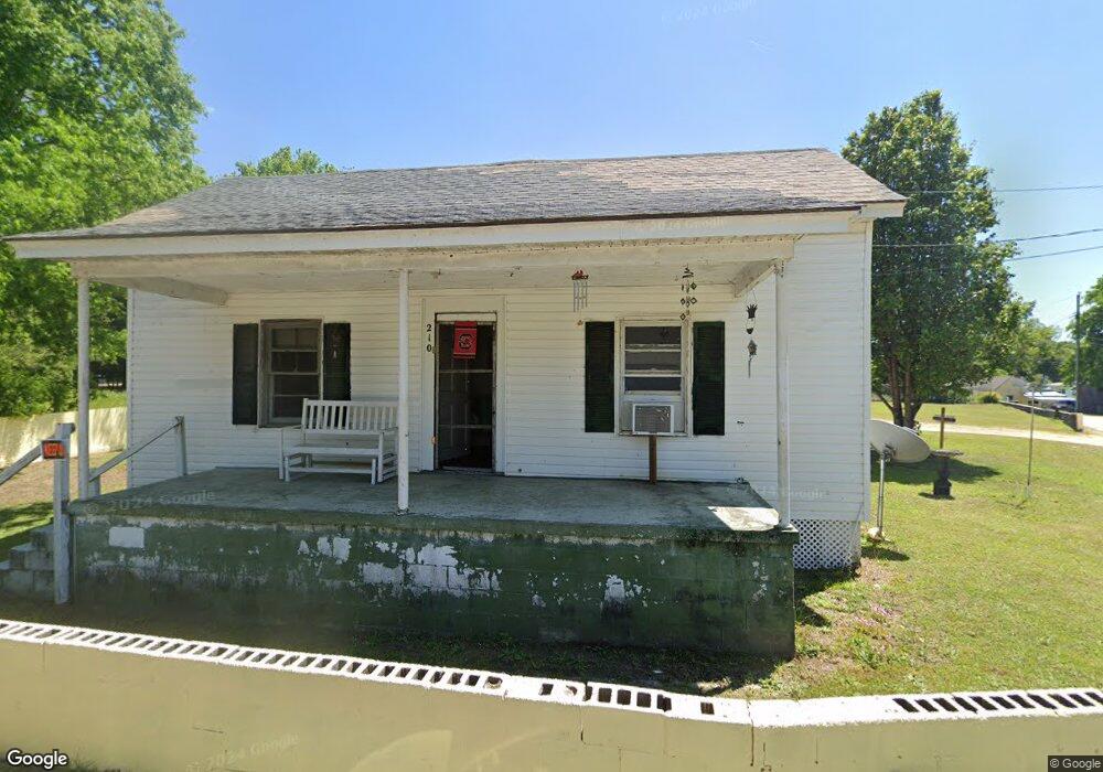
210 Churchill St Darlington, SC 29532
Estimated Value: $57,000 - $69,000
3
Beds
1
Bath
992
Sq Ft
$64/Sq Ft
Est. Value
About This Home
This home is located at 210 Churchill St, Darlington, SC 29532 and is currently estimated at $63,196, approximately $63 per square foot. 210 Churchill St is a home located in Darlington County with nearby schools including St. Johns Elementary School, Darlington Middle School, and Darlington High School.
Ownership History
Date
Name
Owned For
Owner Type
Purchase Details
Closed on
Jun 11, 2008
Sold by
Nucor Employees Cu
Bought by
Buff Homa and Buff Charles
Current Estimated Value
Home Financials for this Owner
Home Financials are based on the most recent Mortgage that was taken out on this home.
Original Mortgage
$17,651
Outstanding Balance
$11,280
Interest Rate
5.97%
Mortgage Type
Credit Line Revolving
Estimated Equity
$51,916
Purchase Details
Closed on
Sep 12, 2007
Sold by
Wiggins Joseph E
Bought by
Nucor Employees Cu
Purchase Details
Closed on
Sep 20, 2002
Sold by
Wiggins Joseph E
Bought by
Bowers Donald and Bowers Judith
Create a Home Valuation Report for This Property
The Home Valuation Report is an in-depth analysis detailing your home's value as well as a comparison with similar homes in the area
Home Values in the Area
Average Home Value in this Area
Purchase History
| Date | Buyer | Sale Price | Title Company |
|---|---|---|---|
| Buff Homa | $17,000 | -- | |
| Nucor Employees Cu | $21,810 | Attorney | |
| Bowers Donald | $31,000 | None Available |
Source: Public Records
Mortgage History
| Date | Status | Borrower | Loan Amount |
|---|---|---|---|
| Open | Buff Homa | $17,651 |
Source: Public Records
Tax History Compared to Growth
Tax History
| Year | Tax Paid | Tax Assessment Tax Assessment Total Assessment is a certain percentage of the fair market value that is determined by local assessors to be the total taxable value of land and additions on the property. | Land | Improvement |
|---|---|---|---|---|
| 2024 | $317 | $1,420 | $280 | $1,140 |
| 2023 | $329 | $1,320 | $280 | $1,040 |
| 2022 | $329 | $1,320 | $280 | $1,040 |
| 2021 | $329 | $1,320 | $280 | $1,040 |
| 2020 | $291 | $1,320 | $280 | $1,040 |
| 2019 | $298 | $1,320 | $280 | $1,040 |
| 2018 | $257 | $1,240 | $280 | $960 |
| 2017 | $239 | $1,240 | $280 | $960 |
| 2016 | $236 | $1,400 | $280 | $1,120 |
| 2014 | $281 | $1,400 | $280 | $1,120 |
| 2013 | $244 | $1,400 | $280 | $1,120 |
Source: Public Records
Map
Nearby Homes
- 1011 Pearl St
- 0 Harry Byrd Hwy
- 116 Cleveland St
- 113 Cleveland St
- 500 Alexander St
- 265 Syracuse St
- 2213 Highway 52
- 2225 Highway 52
- 527 Stanley Cir
- 1977 E Paces Trail
- 1983 E Paces Trail
- 1970 E Paces Trail
- 5183 Shallowford Rd
- 5189 Shallowford Rd
- 5177 Shallowford Rd
- TBD Lamar Hwy
- 0 Stanley Cir
- 208 Grove St
- 640 Stanley Cir
- 608 Wood Duck Dr
- 212 Churchill St
- 211 Churchill St
- 213 Churchill St
- 213 Churchhill St
- 108 Fleming St
- 119 Calhoun St
- 205 Churchill St
- 106 Fleming St
- 121 Calhoun St
- 104 Fleming St
- 117 Calhoun St
- 111 Calhoun St
- 125 Calhoun St
- 114 Fleming St
- 107 Fleming St
- 105 Fleming St
- 109 Fleming St
- 113 Fleming St
- 107 Calhoun St
- 115 Fleming St