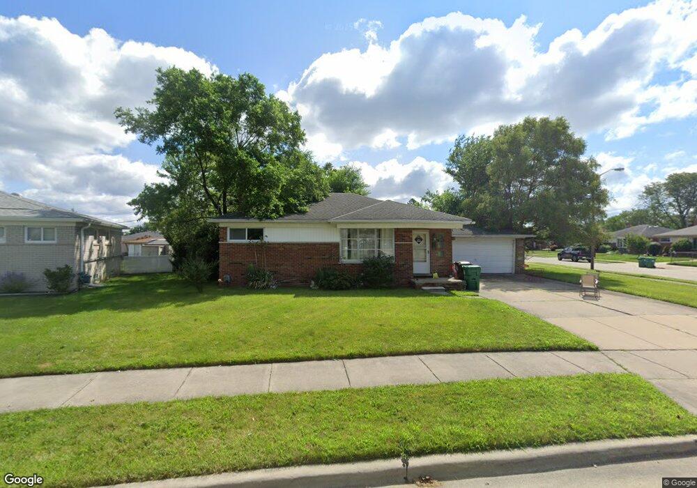
210 Clair St Garden City, MI 48135
Estimated Value: $193,000 - $220,000
3
Beds
2
Baths
1,001
Sq Ft
$208/Sq Ft
Est. Value
About This Home
This home is located at 210 Clair St, Garden City, MI 48135 and is currently estimated at $208,156, approximately $207 per square foot. 210 Clair St is a home located in Wayne County with nearby schools including Memorial Elementary 1-2 Campus, Douglas Elementary 3-4 Campus, and Farmington 5-6 Campus.
Ownership History
Date
Name
Owned For
Owner Type
Purchase Details
Closed on
Oct 12, 2011
Sold by
Federal Home Loan Mortgage Corporation
Bought by
Finch Betty
Current Estimated Value
Purchase Details
Closed on
Sep 15, 2010
Sold by
Williams Willie F and Williams Angelia
Bought by
Federal Home Loan Mortgage Corp
Purchase Details
Closed on
Aug 28, 2003
Sold by
Duff Danielle M
Bought by
Williams Willie F
Purchase Details
Closed on
May 18, 2001
Sold by
Duff Nancy M
Bought by
Duff Danielle M
Create a Home Valuation Report for This Property
The Home Valuation Report is an in-depth analysis detailing your home's value as well as a comparison with similar homes in the area
Home Values in the Area
Average Home Value in this Area
Purchase History
| Date | Buyer | Sale Price | Title Company |
|---|---|---|---|
| Finch Betty | $46,000 | E Title Agency Inc | |
| Federal Home Loan Mortgage Corp | $114,007 | None Available | |
| Williams Willie F | $132,000 | Wolverine State Title Inc | |
| Duff Danielle M | $110,000 | -- |
Source: Public Records
Tax History Compared to Growth
Tax History
| Year | Tax Paid | Tax Assessment Tax Assessment Total Assessment is a certain percentage of the fair market value that is determined by local assessors to be the total taxable value of land and additions on the property. | Land | Improvement |
|---|---|---|---|---|
| 2025 | $2,828 | $96,900 | $0 | $0 |
| 2024 | $2,828 | $87,500 | $0 | $0 |
| 2023 | $2,371 | $76,200 | $0 | $0 |
| 2022 | $2,657 | $70,500 | $0 | $0 |
| 2021 | $2,599 | $68,200 | $0 | $0 |
| 2020 | $2,609 | $63,700 | $0 | $0 |
| 2019 | $2,145 | $55,400 | $0 | $0 |
| 2018 | $1,909 | $46,300 | $0 | $0 |
| 2017 | $616 | $43,800 | $0 | $0 |
| 2016 | $2,169 | $43,300 | $0 | $0 |
| 2015 | $3,840 | $41,700 | $0 | $0 |
| 2013 | $3,940 | $40,000 | $0 | $0 |
| 2012 | $2,135 | $42,600 | $16,900 | $25,700 |
Source: Public Records
Map
Nearby Homes
- 577 Brandt St
- 30414 Cherry Hill Rd
- 489 Henry Ruff Rd
- 29487 Florence St
- 30639 Florence St
- 329 Shotka St
- 1125 Brandt St
- 29643 Steinhauer St
- 29760 Birchwood St
- 30806 Fernwood St
- 724 Clair St
- 30901 Cherry Hill Rd
- 29031 Rosslyn Ave
- 28999 Beechnut St
- 30915 Cherry Hill Rd
- 30808 Sheridan St
- 30931 Fernwood St
- 29578 Brown Ct
- 29522 Grandview St
- 30822 Steinhauer St