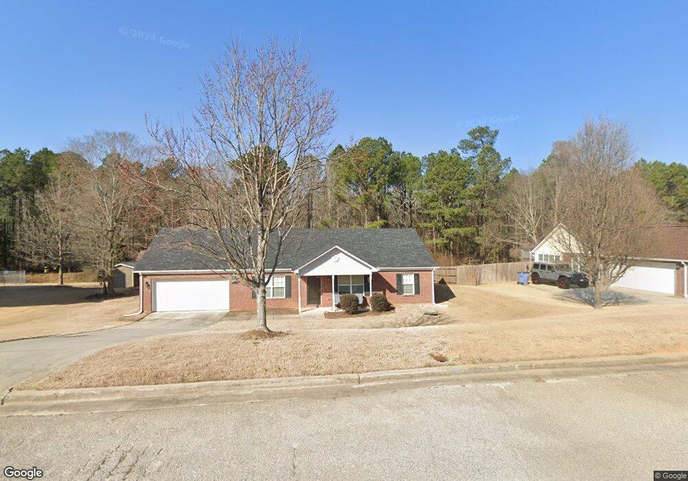
210 Corley Cir Grovetown, GA 30813
Estimated Value: $247,000 - $258,849
4
Beds
2
Baths
1,615
Sq Ft
$157/Sq Ft
Est. Value
About This Home
This home is located at 210 Corley Cir, Grovetown, GA 30813 and is currently estimated at $253,712, approximately $157 per square foot. 210 Corley Cir is a home located in Columbia County with nearby schools including Baker Place Elementary School and Grovetown High School.
Ownership History
Date
Name
Owned For
Owner Type
Purchase Details
Closed on
Jun 25, 2008
Sold by
Clay Robertson Inc
Bought by
Tate Racheal J
Current Estimated Value
Home Financials for this Owner
Home Financials are based on the most recent Mortgage that was taken out on this home.
Original Mortgage
$132,970
Outstanding Balance
$85,826
Interest Rate
6.08%
Mortgage Type
FHA
Estimated Equity
$167,886
Purchase Details
Closed on
Jul 22, 2005
Sold by
Lewiston Road Investment G
Bought by
Clay Robertson Inc
Create a Home Valuation Report for This Property
The Home Valuation Report is an in-depth analysis detailing your home's value as well as a comparison with similar homes in the area
Home Values in the Area
Average Home Value in this Area
Purchase History
| Date | Buyer | Sale Price | Title Company |
|---|---|---|---|
| Tate Racheal J | $137,900 | -- | |
| Clay Robertson Inc | $416,300 | -- |
Source: Public Records
Mortgage History
| Date | Status | Borrower | Loan Amount |
|---|---|---|---|
| Open | Tate Racheal J | $132,970 |
Source: Public Records
Tax History Compared to Growth
Tax History
| Year | Tax Paid | Tax Assessment Tax Assessment Total Assessment is a certain percentage of the fair market value that is determined by local assessors to be the total taxable value of land and additions on the property. | Land | Improvement |
|---|---|---|---|---|
| 2024 | $2,453 | $97,789 | $17,904 | $79,885 |
| 2023 | $2,453 | $85,188 | $16,004 | $69,184 |
| 2022 | $1,967 | $75,377 | $13,904 | $61,473 |
| 2021 | $1,877 | $68,827 | $14,104 | $54,723 |
| 2020 | $1,889 | $67,874 | $12,604 | $55,270 |
| 2019 | $1,786 | $64,158 | $12,104 | $52,054 |
| 2018 | $1,650 | $59,010 | $11,204 | $47,806 |
| 2017 | $1,768 | $63,052 | $11,504 | $51,548 |
| 2016 | $1,509 | $55,794 | $10,080 | $45,714 |
| 2015 | $1,478 | $54,514 | $10,580 | $43,934 |
| 2014 | $1,464 | $53,365 | $10,180 | $43,185 |
Source: Public Records
Map
Nearby Homes
- 321 Frick Ln
- 1446 Sawmill Trail
- 220 Havelock Dr
- 4061 Ellington Dr
- 4044 Ellington Dr
- 4010 Ellington Dr
- 1270 Cobblefield Dr
- 153 Brighton Landing Dr
- 1218 Absolon Ct
- 1214 Absolon Ct
- 1915 Butternut Dr Unit 17A
- 337 Brentford Ave
- 1246 Cobblefield Dr
- 1244 Cobblefield Dr
- 1863 Butternut Dr
- 118 Broadleaf Trail
- 1986 Kenlock Dr
- 4131 Chastain Dr
- 139 Broadleaf Trail
- 675 Red Cedar Ct
- 208 Corley Cir
- 212 Corley Cir
- 1100 Crosscut Ln
- 206 Corley Cir
- 213 Corley Cir
- 216 Corley Cir
- 204 Corley Cir
- 217 Corley Cir
- 207 Corley Cir
- 219 Corley Cir
- 1103 Crosscut Ln
- 202 Corley Cir
- 1104 Crosscut Ln
- 218 Corley Cir
- 1105 Crosscut Ln
- 221 Corley Cir
- 220 Corley Cir
- 1106 Crosscut Ln
- 1418 Sawmill Trail
- 222 Corley Cir