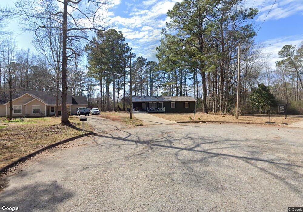
210 Custer Cir Griffin, GA 30223
Spalding County NeighborhoodEstimated Value: $129,000 - $160,366
--
Bed
2
Baths
1,147
Sq Ft
$130/Sq Ft
Est. Value
About This Home
This home is located at 210 Custer Cir, Griffin, GA 30223 and is currently estimated at $149,455, approximately $130 per square foot. 210 Custer Cir is a home located in Spalding County with nearby schools including Atkinson Elementary School, Cowan Road Middle School, and Spalding High School.
Ownership History
Date
Name
Owned For
Owner Type
Purchase Details
Closed on
Jun 28, 1989
Sold by
Phillips Wise Phillips Realty
Bought by
Spier H Vic
Current Estimated Value
Purchase Details
Closed on
Jan 12, 1988
Sold by
Commercial Bank & Trust Company
Bought by
Phillips Wise Phillips Realty Dev & Inve
Purchase Details
Closed on
Jan 6, 1987
Sold by
Phillips John
Bought by
Commercial Bank & Trust Company
Purchase Details
Closed on
Apr 29, 1985
Sold by
Commercial Bank & Trust Company
Bought by
Phillips John
Purchase Details
Closed on
Jun 10, 1982
Sold by
Smith Fred R and Fletcher
Bought by
Commercial Bank & Trust Company
Create a Home Valuation Report for This Property
The Home Valuation Report is an in-depth analysis detailing your home's value as well as a comparison with similar homes in the area
Home Values in the Area
Average Home Value in this Area
Purchase History
| Date | Buyer | Sale Price | Title Company |
|---|---|---|---|
| Spier H Vic | $3,500 | -- | |
| Phillips Wise Phillips Realty Dev & Inve | $14,400 | -- | |
| Commercial Bank & Trust Company | -- | -- | |
| Phillips John | $36,000 | -- | |
| Commercial Bank & Trust Company | $15,300 | -- |
Source: Public Records
Tax History Compared to Growth
Tax History
| Year | Tax Paid | Tax Assessment Tax Assessment Total Assessment is a certain percentage of the fair market value that is determined by local assessors to be the total taxable value of land and additions on the property. | Land | Improvement |
|---|---|---|---|---|
| 2024 | $1,414 | $39,538 | $7,260 | $32,278 |
| 2023 | $1,414 | $40,272 | $7,260 | $33,012 |
| 2022 | $1,247 | $34,284 | $6,600 | $27,684 |
| 2021 | $1,064 | $29,251 | $5,060 | $24,191 |
| 2020 | $920 | $25,219 | $5,060 | $20,159 |
| 2019 | $939 | $25,219 | $5,060 | $20,159 |
| 2018 | $889 | $23,269 | $5,060 | $18,209 |
| 2017 | $865 | $23,269 | $5,060 | $18,209 |
| 2016 | $881 | $23,269 | $5,060 | $18,209 |
| 2015 | $954 | $24,483 | $5,060 | $19,423 |
| 2014 | $973 | $24,483 | $5,060 | $19,423 |
Source: Public Records
Map
Nearby Homes
- 204 Custer Cir
- 1110 N 2nd St
- 1517 Cabin Creek Trail
- 126 Callie Rd
- 0 Short St Unit 10555372
- 0 Short St Unit 7572526
- 103 Cabin Creek Cir
- 1621 N Hill St
- 1416 Spellman Ave
- 1324 Spellman Ave
- 607 Lakewood Dr
- 127 Kennedy Rd
- 1307 Wildwood Dr
- 221 Lexington Ave
- 209 Kentucky Ave
- 32 UNIT MUTLIPL Multiple
- 1406 Canterbury Rd
- 101 Behan Place
- 0 Hamil Rd Unit 6.21 AC 10578337
- 583 Hamil Rd
- 208 Custer Cir Unit 3
- 207 Custer Cir Unit 56
- 206 Custer Cir
- 205 Custer Cir
- 203 Custer Cir
- 204 Custer Cir Unit 52
- 123 Big Horn Rd
- 122 Big Horn Rd
- 123 Little Big Horn Rd
- 119 Little Big Horn Rd
- 125 Little Big Horn Rd
- 121 Big Horn Rd
- 129 Little Big Horn Rd
- 117 Little Big Horn Rd
- 222 Hammerhawk Rd
- 224 Hammerhawk Rd
- 115 Little Big Horn Rd
- 120 Big Horn Rd
- 220 Hammerhawk Rd
- 2nd Little Big Horn Rd Unit 50.33 AC