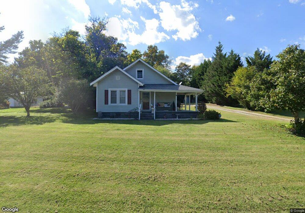
210 Deatherage Rd Mount Airy, NC 27030
Estimated Value: $124,000 - $171,000
3
Beds
1
Bath
1,152
Sq Ft
$129/Sq Ft
Est. Value
About This Home
This home is located at 210 Deatherage Rd, Mount Airy, NC 27030 and is currently estimated at $148,967, approximately $129 per square foot. 210 Deatherage Rd is a home located in Surry County with nearby schools including Flat Rock Elementary School, Meadowview Magnet Middle School, and North Surry High School.
Ownership History
Date
Name
Owned For
Owner Type
Purchase Details
Closed on
Mar 23, 2006
Sold by
Deprisco John Timothy
Bought by
Deprisco Patricia H
Current Estimated Value
Purchase Details
Closed on
Jun 1, 2002
Purchase Details
Closed on
May 1, 1978
Create a Home Valuation Report for This Property
The Home Valuation Report is an in-depth analysis detailing your home's value as well as a comparison with similar homes in the area
Home Values in the Area
Average Home Value in this Area
Purchase History
| Date | Buyer | Sale Price | Title Company |
|---|---|---|---|
| Deprisco Patricia H | -- | None Available | |
| -- | $47,000 | -- | |
| -- | -- | -- |
Source: Public Records
Tax History Compared to Growth
Tax History
| Year | Tax Paid | Tax Assessment Tax Assessment Total Assessment is a certain percentage of the fair market value that is determined by local assessors to be the total taxable value of land and additions on the property. | Land | Improvement |
|---|---|---|---|---|
| 2025 | $312 | $80,960 | $12,000 | $68,960 |
| 2024 | $290 | $68,950 | $10,000 | $58,950 |
| 2023 | $285 | $68,950 | $10,000 | $58,950 |
| 2022 | $277 | $68,950 | $10,000 | $58,950 |
| 2021 | $281 | $68,950 | $10,000 | $58,950 |
| 2020 | $277 | $64,850 | $10,000 | $54,850 |
| 2019 | $274 | $64,850 | $0 | $0 |
| 2018 | $267 | $64,850 | $0 | $0 |
| 2017 | $264 | $64,850 | $0 | $0 |
| 2016 | $261 | $64,850 | $0 | $0 |
| 2013 | -- | $58,200 | $0 | $0 |
Source: Public Records
Map
Nearby Homes
- 280 Burke Rd
- 00 Paynetown Rd
- 335 Badgett Ave
- 663 Mcbride Rd
- 845 Linville Rd
- 2384 Westfield Rd
- 0 NE Pine St
- 2326 Westfield Rd
- 200 Englewood Trail
- xx 44.93 Acres Stardust Trail
- 607 Riverside Dr
- 1769 Inglebrook Trail
- 1694 Woodbury Ln
- 0 Blue Hollow Rd Unit 33 1176021
- 0 Blue Hollow Rd Unit 23105199
- 000 Blue Hollow Rd Unit 27
- 2638 Riverside Dr
- 226 Hamburg St
- 00 Jackson Rd Unit 8.64 Ac
- 344 Linville Rd
- 194 Deatherage Rd
- 226 Deatherage Rd
- 123 Julie Ln
- 187 Deatherage Rd
- 135 Julie Ln
- 191 Deatherage Rd
- 215 Deatherage Rd
- 125 Bushwood Ln
- 227 Deatherage Rd
- 168 Deatherage Rd
- 137 Bushwood Ln
- 165 Deatherage Rd
- 152 Julie Ln
- 151 Deatherage Rd
- 144 Deatherage Rd
- 145 Deatherage Rd
- 1034 Deatherage Rd
- 142 Rocky Ln
- 135 Deatherage Rd
- 156 Cabin Ln