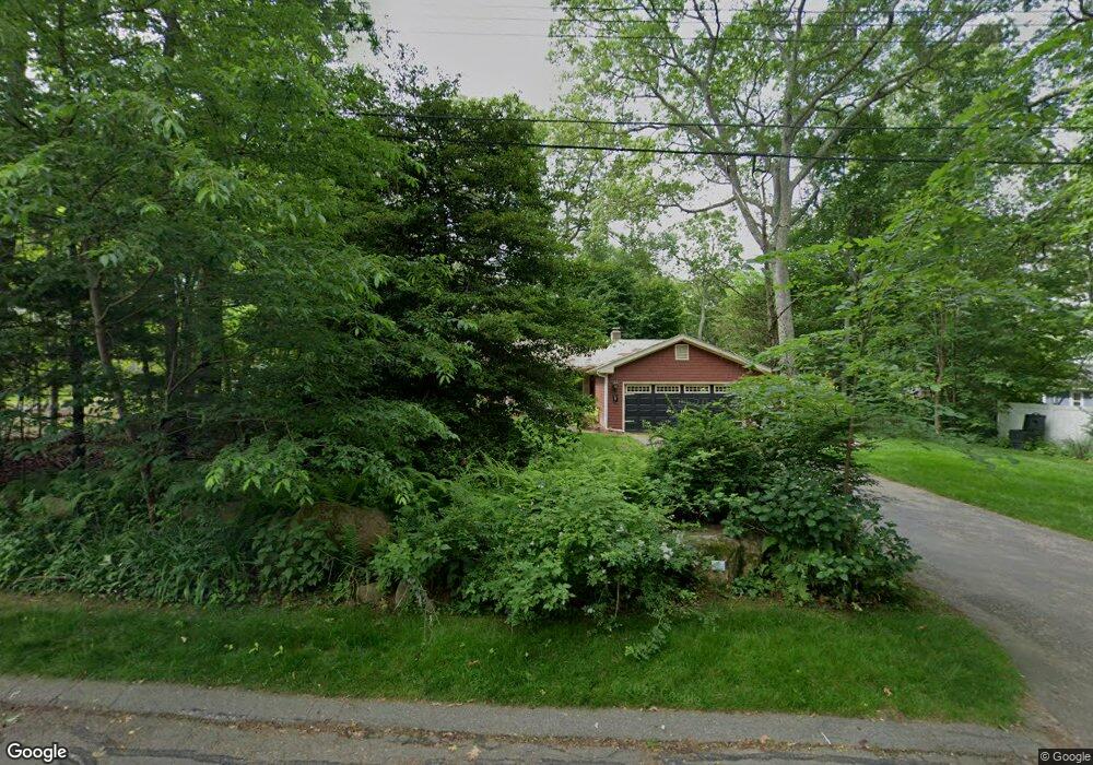
210 Dendron Rd Wakefield, RI 02879
Estimated Value: $573,675 - $708,000
3
Beds
2
Baths
1,248
Sq Ft
$509/Sq Ft
Est. Value
About This Home
This home is located at 210 Dendron Rd, Wakefield, RI 02879 and is currently estimated at $635,169, approximately $508 per square foot. 210 Dendron Rd is a home located in Washington County with nearby schools including South Kingstown High School, Monsignor Matthew Clarke Catholic Regional School, and Bradley School-South.
Ownership History
Date
Name
Owned For
Owner Type
Purchase Details
Closed on
Sep 11, 2007
Sold by
Stahle Richard M
Bought by
Sherman Stephen A and Sherman Vivian L
Current Estimated Value
Home Financials for this Owner
Home Financials are based on the most recent Mortgage that was taken out on this home.
Original Mortgage
$268,000
Interest Rate
6.74%
Mortgage Type
Purchase Money Mortgage
Purchase Details
Closed on
Sep 27, 2005
Sold by
Thunberg Mildred W
Bought by
Stahlf Richard M and Stahlf Gundi D
Home Financials for this Owner
Home Financials are based on the most recent Mortgage that was taken out on this home.
Original Mortgage
$130,000
Interest Rate
5.92%
Mortgage Type
Purchase Money Mortgage
Create a Home Valuation Report for This Property
The Home Valuation Report is an in-depth analysis detailing your home's value as well as a comparison with similar homes in the area
Home Values in the Area
Average Home Value in this Area
Purchase History
| Date | Buyer | Sale Price | Title Company |
|---|---|---|---|
| Sherman Stephen A | $335,000 | -- | |
| Stahlf Richard M | $350,000 | -- |
Source: Public Records
Mortgage History
| Date | Status | Borrower | Loan Amount |
|---|---|---|---|
| Open | Stahlf Richard M | $239,480 | |
| Closed | Stahlf Richard M | $268,000 | |
| Previous Owner | Stahlf Richard M | $130,000 |
Source: Public Records
Tax History
| Year | Tax Paid | Tax Assessment Tax Assessment Total Assessment is a certain percentage of the fair market value that is determined by local assessors to be the total taxable value of land and additions on the property. | Land | Improvement |
|---|---|---|---|---|
| 2025 | $4,272 | $477,800 | $230,400 | $247,400 |
| 2024 | $4,065 | $367,900 | $170,700 | $197,200 |
| 2023 | $4,065 | $367,900 | $170,700 | $197,200 |
| 2022 | $4,029 | $367,900 | $170,700 | $197,200 |
| 2021 | $3,971 | $274,800 | $131,400 | $143,400 |
| 2020 | $3,971 | $274,800 | $131,400 | $143,400 |
| 2019 | $3,971 | $274,800 | $131,400 | $143,400 |
| 2018 | $3,900 | $248,700 | $125,600 | $123,100 |
| 2017 | $3,808 | $248,700 | $125,600 | $123,100 |
| 2016 | $3,753 | $248,700 | $125,600 | $123,100 |
| 2015 | $3,540 | $228,100 | $114,200 | $113,900 |
| 2014 | $3,531 | $228,100 | $114,200 | $113,900 |
Source: Public Records
Map
Nearby Homes
- 22 Beech Tree Place
- 3 Larkin St
- 918 Saugatucket Rd
- 48 Stone Bridge Dr
- 53 Rocky Brook Way
- 37 Columbia St
- 128 Rodman St
- 45 Cherry Ln Unit C
- 39 Hazard Ave
- 917 Broad Rock Rd
- 1808 Kingstown Rd
- 0 Vespia Dr Unit 1317499
- 44 Vespia Ln
- 50 Vespia Ln
- 58 Vespia Ln
- 56 Vespia Ln
- 23 Rockland Dr
- 260 Sweet Allen Farm Rd Unit 3
- 170 Weathervane Rd
- 39 Secluded Dr