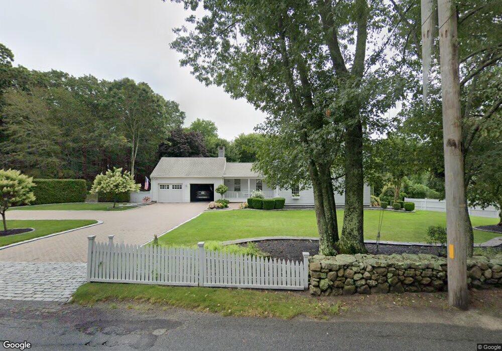
210 Drift Rd Westport, MA 02790
Head of Westport NeighborhoodEstimated Value: $762,781 - $955,000
3
Beds
--
Bath
2,502
Sq Ft
$352/Sq Ft
Est. Value
About This Home
This home is located at 210 Drift Rd, Westport, MA 02790 and is currently estimated at $880,945, approximately $352 per square foot. 210 Drift Rd is a home located in Bristol County with nearby schools including Alice A. Macomber Primary School, Westport Elementary School, and Westport Middle-High School.
Ownership History
Date
Name
Owned For
Owner Type
Purchase Details
Closed on
Nov 1, 2023
Sold by
Mcguigan Brooke B
Bought by
Brooke B Mcguigan 2021 T B and Brooke Mcguigan
Current Estimated Value
Purchase Details
Closed on
Jul 30, 1979
Bought by
Mcguigan Frank P and Mcguigan Brooke B
Create a Home Valuation Report for This Property
The Home Valuation Report is an in-depth analysis detailing your home's value as well as a comparison with similar homes in the area
Home Values in the Area
Average Home Value in this Area
Purchase History
| Date | Buyer | Sale Price | Title Company |
|---|---|---|---|
| Brooke B Mcguigan 2021 T B | -- | None Available | |
| Mcguigan Frank P | -- | -- |
Source: Public Records
Mortgage History
| Date | Status | Borrower | Loan Amount |
|---|---|---|---|
| Previous Owner | Mcguigan Frank P | $65,000 | |
| Previous Owner | Mcguigan Frank P | $98,000 |
Source: Public Records
Tax History Compared to Growth
Tax History
| Year | Tax Paid | Tax Assessment Tax Assessment Total Assessment is a certain percentage of the fair market value that is determined by local assessors to be the total taxable value of land and additions on the property. | Land | Improvement |
|---|---|---|---|---|
| 2025 | $5,017 | $673,400 | $211,200 | $462,200 |
| 2024 | $5,006 | $647,600 | $195,700 | $451,900 |
| 2023 | $5,074 | $621,800 | $186,400 | $435,400 |
| 2022 | $4,786 | $572,400 | $186,400 | $386,000 |
| 2021 | $4,786 | $555,200 | $169,500 | $385,700 |
| 2020 | $4,531 | $537,500 | $156,800 | $380,700 |
| 2019 | $4,349 | $525,900 | $144,700 | $381,200 |
| 2018 | $4,087 | $500,200 | $165,600 | $334,600 |
| 2017 | $0 | $505,800 | $165,600 | $340,200 |
| 2016 | $3,718 | $470,100 | $165,600 | $304,500 |
| 2015 | $3,583 | $451,800 | $169,300 | $282,500 |
Source: Public Records
Map
Nearby Homes
- 47 Fallon Dr
- Lot 0 Marcotte
- 0 Hidden Glen Ln
- 118 Charlotte White Rd Extension
- 4 Main Rd
- 118 Charlotte White Rd
- 8 Strawberry Ln
- 27 Dias Ave
- 73 White Oak Run
- 96 Forge Rd
- 3 Roller Coaster Way Unit Lot 1
- 29 Union Ave
- 461 Reed Rd
- 6 Angel Ct
- 7 Village Way
- 15 Village Way
- 8 Village Way
- 978 Sodom Rd
- 837 Main Rd
- 9 Kyle Jacob Rd