Estimated Value: $204,437 - $227,000
--
Bed
1
Bath
1,282
Sq Ft
$171/Sq Ft
Est. Value
About This Home
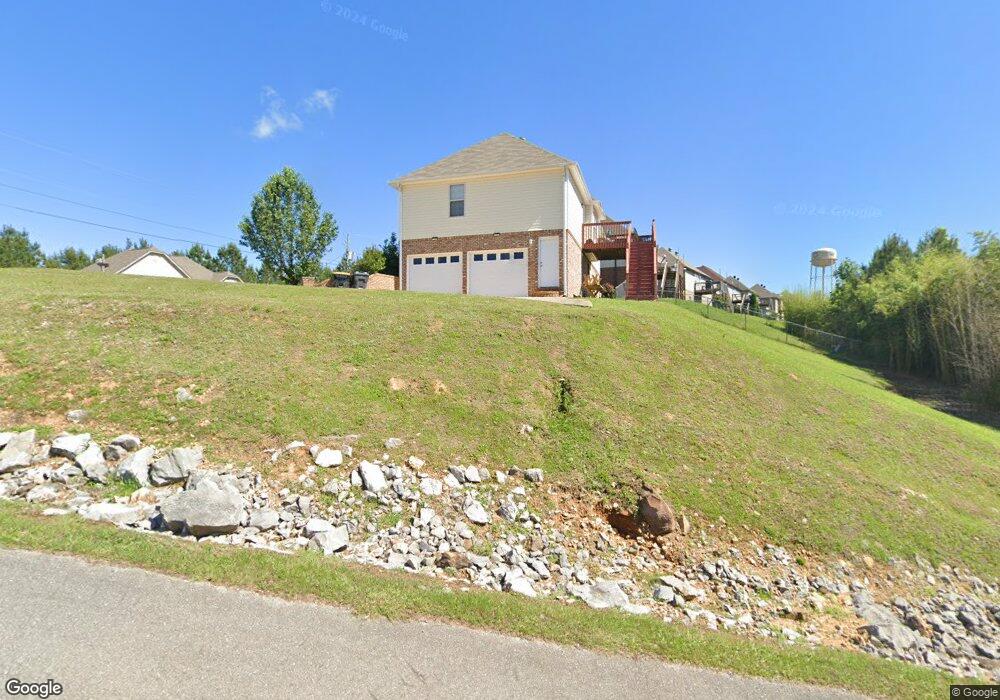
This home is located at 210 Dust Ridge Rd, Moody, AL 35004 and is currently estimated at $218,859, approximately $170 per square foot. 210 Dust Ridge Rd is a home located in St. Clair County with nearby schools including Moody Elementary School, Moody Middle School, and Moody High School.
Ownership History
Date
Name
Owned For
Owner Type
Purchase Details
Closed on
May 16, 2008
Sold by
Fourt Star Investments Inc
Bought by
Lopresti Pete A and Lopresti Kathryn
Current Estimated Value
Home Financials for this Owner
Home Financials are based on the most recent Mortgage that was taken out on this home.
Original Mortgage
$129,900
Interest Rate
5.86%
Mortgage Type
New Conventional
Create a Home Valuation Report for This Property
The Home Valuation Report is an in-depth analysis detailing your home's value as well as a comparison with similar homes in the area
Home Values in the Area
Average Home Value in this Area
Purchase History
| Date | Buyer | Sale Price | Title Company |
|---|---|---|---|
| Lopresti Pete A | $129,900 | None Available | |
| Kathryn Lopresti Pete A | $129,900 | None Available |
Source: Public Records
Mortgage History
| Date | Status | Borrower | Loan Amount |
|---|---|---|---|
| Closed | Kathryn Lopresti Pete A | $129,900 |
Source: Public Records
Tax History Compared to Growth
Tax History
| Year | Tax Paid | Tax Assessment Tax Assessment Total Assessment is a certain percentage of the fair market value that is determined by local assessors to be the total taxable value of land and additions on the property. | Land | Improvement |
|---|---|---|---|---|
| 2024 | $529 | $32,036 | $5,200 | $26,836 |
| 2023 | $529 | $32,036 | $5,200 | $26,836 |
| 2022 | $439 | $13,549 | $2,600 | $10,949 |
| 2021 | $440 | $13,549 | $2,600 | $10,949 |
| 2020 | $453 | $13,914 | $2,600 | $11,314 |
| 2019 | $453 | $13,914 | $2,600 | $11,314 |
| 2018 | $408 | $12,680 | $0 | $0 |
| 2017 | $421 | $12,680 | $0 | $0 |
| 2016 | $412 | $12,780 | $0 | $0 |
| 2015 | $421 | $12,780 | $0 | $0 |
| 2014 | $421 | $13,020 | $0 | $0 |
Source: Public Records
Map
Nearby Homes
- 5953 Old Acton Rd
- 5618 Old Acton Rd
- 15 Stevens Cove Dr
- The Redmont I 1 Plan at Steven's Cove
- The Benton 1 Plan at Steven's Cove
- The Florabelle II 1 Plan at Steven's Cove
- The Marlin 1 Plan at Steven's Cove
- 35 Stevens Cove Dr
- 45 Stevens Cove Dr
- 130 Stevens Cove Dr
- 220 Virginia Way Unit 69
- 230 Virginia Way Unit 68
- 260 Virginia Way Unit 65
- 270 Virginia Way Unit 64
- 280 Virginia Way Unit 63
- 1090 Brookhaven Dr
- 290 Virginia Way Unit 62
- 1150 Brookhaven Dr
- 1080 Brookhaven Dr
- 1115 Brookhaven Dr
- 001 Dust Ridge Rd
- 220 Dust Ridge Rd
- 5905 Old Acton Rd
- 230 Dust Ridge Rd
- 101 Bates Ln
- 215 Dust Ridge Rd
- 215 Dust Ridge Rd Unit LOT 74
- 205 Dust Ridge Rd
- 205 Dust Ridge Rd Unit 75
- 240 Dust Ridge Rd
- 14242 N Hidden Arroyo Pass
- 105 Bates Ln
- 915 Acton Loop Unit Lot 102
- 5915 Old Acton Rd
- 250 Dust Ridge Rd
- 250 Dust Ridge Rd Unit LOT 47
- 245 Dust Ridge Rd
- 245 Dust Ridge Rd Unit 71
- 111 Bates Ln
- 920 Acton Loop Unit Lot 103