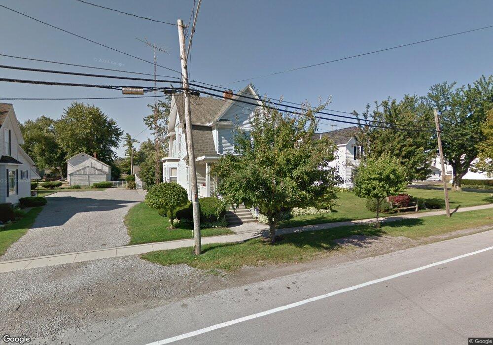
210 E 4th St Spencerville, OH 45887
Estimated Value: $164,000 - $221,000
3
Beds
2
Baths
2,045
Sq Ft
$90/Sq Ft
Est. Value
About This Home
This home is located at 210 E 4th St, Spencerville, OH 45887 and is currently estimated at $184,826, approximately $90 per square foot. 210 E 4th St is a home located in Allen County with nearby schools including Spencerville Elementary School, Spencerville Middle School, and Spencerville High School.
Ownership History
Date
Name
Owned For
Owner Type
Purchase Details
Closed on
Aug 4, 2019
Sold by
Stober William A
Bought by
Miller Curtis
Current Estimated Value
Home Financials for this Owner
Home Financials are based on the most recent Mortgage that was taken out on this home.
Original Mortgage
$114,400
Outstanding Balance
$100,193
Interest Rate
3.7%
Mortgage Type
Purchase Money Mortgage
Estimated Equity
$84,633
Purchase Details
Closed on
Jul 16, 2001
Sold by
Wurst Betty J
Bought by
Stober William and Stober Charlotte E
Home Financials for this Owner
Home Financials are based on the most recent Mortgage that was taken out on this home.
Original Mortgage
$66,000
Interest Rate
7.27%
Mortgage Type
New Conventional
Purchase Details
Closed on
Jun 1, 1980
Bought by
Wurst Joseph A
Create a Home Valuation Report for This Property
The Home Valuation Report is an in-depth analysis detailing your home's value as well as a comparison with similar homes in the area
Purchase History
| Date | Buyer | Sale Price | Title Company |
|---|---|---|---|
| Miller Curtis | $118,000 | None Available | |
| Stober William | $90,000 | -- | |
| Wurst Joseph A | $38,500 | -- |
Source: Public Records
Mortgage History
| Date | Status | Borrower | Loan Amount |
|---|---|---|---|
| Open | Miller Curtis | $114,400 | |
| Previous Owner | Stober William | $66,000 |
Source: Public Records
Tax History
| Year | Tax Paid | Tax Assessment Tax Assessment Total Assessment is a certain percentage of the fair market value that is determined by local assessors to be the total taxable value of land and additions on the property. | Land | Improvement |
|---|---|---|---|---|
| 2024 | $1,572 | $47,740 | $5,950 | $41,790 |
| 2023 | $1,378 | $39,140 | $4,870 | $34,270 |
| 2022 | $1,382 | $39,140 | $4,870 | $34,270 |
| 2021 | $1,374 | $39,140 | $4,870 | $34,270 |
| 2020 | $1,219 | $32,520 | $4,590 | $27,930 |
| 2019 | $1,219 | $32,520 | $4,590 | $27,930 |
| 2018 | $1,210 | $32,520 | $4,590 | $27,930 |
| 2017 | $1,002 | $27,380 | $4,590 | $22,790 |
| 2016 | $982 | $27,380 | $4,590 | $22,790 |
| 2015 | $987 | $27,380 | $4,590 | $22,790 |
| 2014 | $1,033 | $28,810 | $4,800 | $24,010 |
| 2013 | $1,045 | $28,810 | $4,800 | $24,010 |
Source: Public Records
Map
Nearby Homes
- 305 N Broadway St
- 303 N Canal St
- 313 S Broadway St
- 115 Oakland Ave
- 408 N Mulberry St
- 449 N Main St
- 522 S Broadway St
- 417 W 4th St
- 00 Kleinoeder Rd
- 21302 Masters Rd
- 3000 S Sunderland Rd
- 3000 Sunderland Rd
- 8240 Spencerville Rd
- 22284 Ohio 198
- 0 N Conant Rd
- 7630 Spencerville Rd
- 7570 Fort Amanda Rd
- 7551 Fort Amanda Rd
- 00 National Rd
- 17700 Moulton-Ft Amanda Rd
Your Personal Tour Guide
Ask me questions while you tour the home.