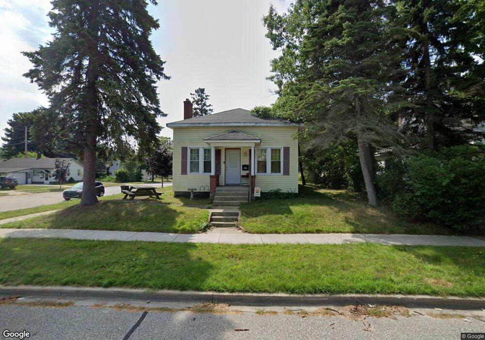
210 E Foster St Ludington, MI 49431
Estimated Value: $122,930 - $192,000
3
Beds
1
Bath
1,268
Sq Ft
$125/Sq Ft
Est. Value
About This Home
This home is located at 210 E Foster St, Ludington, MI 49431 and is currently estimated at $158,233, approximately $124 per square foot. 210 E Foster St is a home located in Mason County with nearby schools including Ludington Elementary School, Lakeview Elementary School, and O.J. DeJonge Middle School.
Ownership History
Date
Name
Owned For
Owner Type
Purchase Details
Closed on
Sep 24, 2024
Sold by
Mccabe John
Bought by
Stevens Whitney
Current Estimated Value
Purchase Details
Closed on
Jul 30, 2024
Sold by
Mccabe John
Bought by
Stevens Whitney
Purchase Details
Closed on
Oct 9, 2023
Sold by
Mccabe Brooke C
Bought by
Mccabe John C
Purchase Details
Closed on
Dec 2, 2002
Sold by
Manufacturers & Traders Trust Co
Bought by
Mccabe John
Purchase Details
Closed on
Jan 25, 2002
Sold by
Williams Ward C and Williams Amy K
Bought by
Manufacturers & Traders Trust Co
Purchase Details
Closed on
Dec 1, 1993
Create a Home Valuation Report for This Property
The Home Valuation Report is an in-depth analysis detailing your home's value as well as a comparison with similar homes in the area
Home Values in the Area
Average Home Value in this Area
Purchase History
| Date | Buyer | Sale Price | Title Company |
|---|---|---|---|
| Stevens Whitney | -- | None Listed On Document | |
| Stevens Whitney | -- | None Listed On Document | |
| Mccabe John C | -- | None Listed On Document | |
| Mccabe John | $48,900 | -- | |
| Manufacturers & Traders Trust Co | $51,800 | -- | |
| -- | $31,800 | -- |
Source: Public Records
Tax History Compared to Growth
Tax History
| Year | Tax Paid | Tax Assessment Tax Assessment Total Assessment is a certain percentage of the fair market value that is determined by local assessors to be the total taxable value of land and additions on the property. | Land | Improvement |
|---|---|---|---|---|
| 2025 | $1,018 | $42,500 | $42,500 | $0 |
| 2024 | -- | $42,200 | $42,200 | $0 |
| 2023 | -- | $34,900 | $34,900 | $0 |
| 2022 | -- | $30,200 | $0 | $0 |
| 2021 | $3,150 | $28,200 | $0 | $0 |
| 2020 | $3,150 | $28,300 | $0 | $0 |
| 2019 | -- | -- | $0 | $0 |
| 2018 | -- | -- | $0 | $0 |
| 2017 | -- | -- | $0 | $0 |
| 2016 | -- | -- | $0 | $0 |
| 2015 | -- | -- | $0 | $0 |
| 2013 | -- | -- | $0 | $0 |
Source: Public Records
Map
Nearby Homes
- 201 E Danaher St
- 409 E Filer St
- 105 W Danaher St Unit 201
- 105 W Danaher St Unit 309
- 105 W Danaher St Unit 401
- 302 S James St
- 403 S Emily St
- 3843 Highway 10 NW
- 106 W Danaher St
- 413 S Rath Ave Unit Site 2
- 300 S Rath Ave Unit 23
- 109 W Melendy St
- 508 E Ludington Ave
- 509 Lake St
- 115 N Emily St
- 0 Highway 10 NW
- 709 E Loomis St
- 210 N Lavinia St
- 713 E Loomis St
- 724 E Filer St
- 208 E Foster St
- 302 E Foster St
- 206 E Foster St
- 206 E Foster St Unit 5
- 403 S Rowe St
- 304 E Foster St
- 204 E Foster St
- 406 S Rowe St
- 207 E Danaher St
- 205 E Danaher St
- 205 E Foster St
- 301 E Danaher St
- 306 E Foster St
- 403 S Harrison St
- 307 S Rowe St
- 203 E Danaher St
- 407 S Harrison St
- 307 E Foster St
- 303 E Danaher St
- 304 S Rowe St