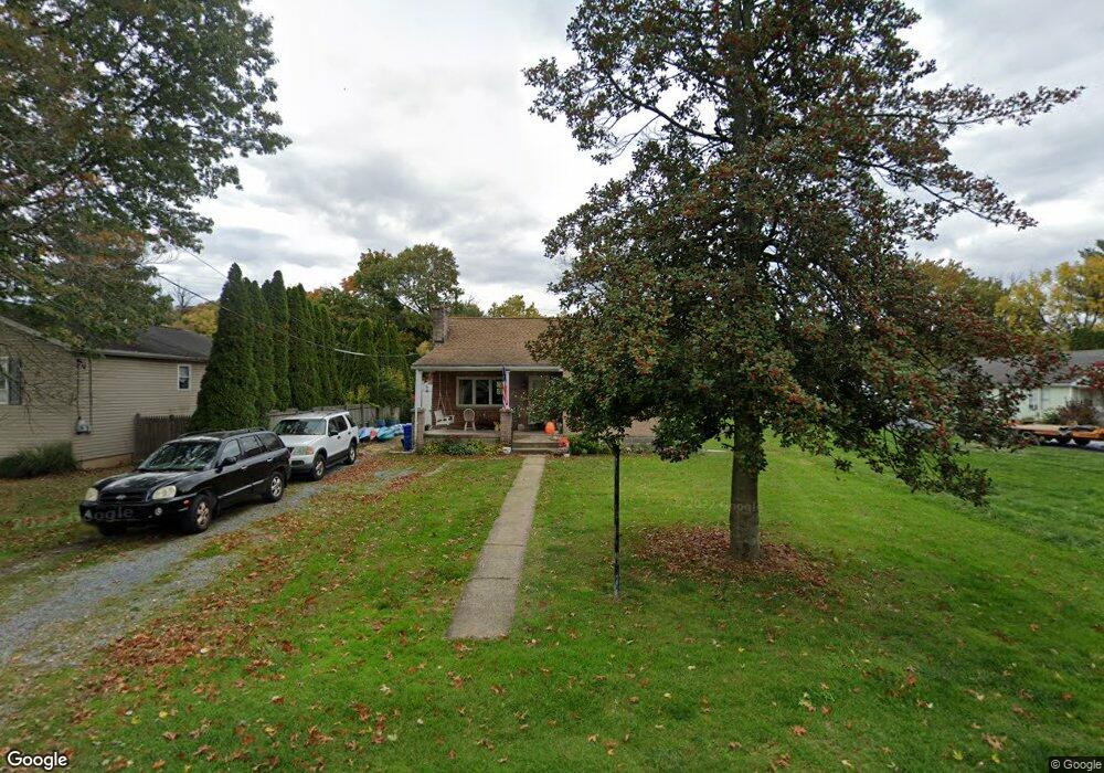
210 Fairview Rd New Cumberland, PA 17070
Estimated Value: $142,000 - $241,000
2
Beds
1
Bath
1,138
Sq Ft
$168/Sq Ft
Est. Value
About This Home
This home is located at 210 Fairview Rd, New Cumberland, PA 17070 and is currently estimated at $190,645, approximately $167 per square foot. 210 Fairview Rd is a home located in York County with nearby schools including Fairview Elementary School, New Cumberland Middle School, and Cedar Cliff High School.
Ownership History
Date
Name
Owned For
Owner Type
Purchase Details
Closed on
Jan 14, 2021
Sold by
Wickard Christy Ann
Bought by
Orris Amy Jo and Holland Beverly F
Current Estimated Value
Home Financials for this Owner
Home Financials are based on the most recent Mortgage that was taken out on this home.
Original Mortgage
$125,400
Outstanding Balance
$111,920
Interest Rate
2.71%
Mortgage Type
New Conventional
Estimated Equity
$78,725
Purchase Details
Closed on
Jul 9, 1999
Sold by
Shaffer Randall R and Shaffer Deborah K
Bought by
Wickard George L and Wickard Christy Ann
Home Financials for this Owner
Home Financials are based on the most recent Mortgage that was taken out on this home.
Original Mortgage
$71,327
Interest Rate
7.19%
Purchase Details
Closed on
Nov 17, 1992
Bought by
Shaffer Randall R and Shaffer Deborah K
Create a Home Valuation Report for This Property
The Home Valuation Report is an in-depth analysis detailing your home's value as well as a comparison with similar homes in the area
Home Values in the Area
Average Home Value in this Area
Purchase History
| Date | Buyer | Sale Price | Title Company |
|---|---|---|---|
| Orris Amy Jo | $132,000 | Homesale Settlement Services | |
| Wickard George L | $74,000 | -- | |
| Shaffer Randall R | -- | -- |
Source: Public Records
Mortgage History
| Date | Status | Borrower | Loan Amount |
|---|---|---|---|
| Open | Orris Amy Jo | $125,400 | |
| Previous Owner | Wickard George L | $71,327 | |
| Closed | Wickard George L | $3,100 |
Source: Public Records
Tax History Compared to Growth
Tax History
| Year | Tax Paid | Tax Assessment Tax Assessment Total Assessment is a certain percentage of the fair market value that is determined by local assessors to be the total taxable value of land and additions on the property. | Land | Improvement |
|---|---|---|---|---|
| 2025 | $2,576 | $98,390 | $35,540 | $62,850 |
| 2024 | $2,439 | $98,390 | $35,540 | $62,850 |
| 2023 | $2,372 | $98,390 | $35,540 | $62,850 |
| 2022 | $2,365 | $98,390 | $35,540 | $62,850 |
| 2021 | $2,225 | $98,390 | $35,540 | $62,850 |
| 2020 | $2,198 | $98,390 | $35,540 | $62,850 |
| 2019 | $2,160 | $98,390 | $35,540 | $62,850 |
| 2018 | $2,118 | $98,390 | $35,540 | $62,850 |
| 2017 | $2,047 | $98,390 | $35,540 | $62,850 |
| 2016 | $2,386 | $98,390 | $35,540 | $62,850 |
| 2015 | -- | $98,390 | $35,540 | $62,850 |
| 2014 | -- | $98,390 | $35,540 | $62,850 |
Source: Public Records
Map
Nearby Homes
- 118 Old York Rd Unit 1
- 0 Old York Rd Unit 253 PAYK2089868
- 82 Springers Ln
- 355 Weatherstone Dr
- 309 Stoneridge Ct Unit 80
- 280 Fieldstone Ct Unit 99
- 1240 Summitview Ct
- 1248 Summitview Ct
- 400 Woodland Ave
- 110 Ross Ave Unit 2
- 8 Umberto Ave
- 134 S Market St
- 211 Market St
- 414 5th St
- 1601 Cobble Ct
- 1740 Creek Vista Dr
- 409 1/2 Market St
- 1726 Josiah Chowning Way
- 1764 Peyton Randolph Ct
- 319 7th St