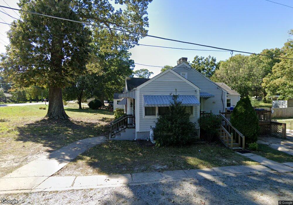
210 Gate St High Point, NC 27263
Greater High Point NeighborhoodEstimated Value: $84,000 - $181,000
3
Beds
1
Bath
1,052
Sq Ft
$118/Sq Ft
Est. Value
About This Home
This home is located at 210 Gate St, High Point, NC 27263 and is currently estimated at $123,699, approximately $117 per square foot. 210 Gate St is a home located in Guilford County with nearby schools including Allen Jay Elementary School, Southern Guilford Middle, and Southern Guilford High School.
Ownership History
Date
Name
Owned For
Owner Type
Purchase Details
Closed on
Apr 22, 2021
Sold by
Harper Richard D and Harper Wendy B
Bought by
Gilliland Terry and Gilliland Rebecca
Current Estimated Value
Purchase Details
Closed on
Apr 21, 2021
Sold by
Hill Kenneth Wayne and Hill Gillian D
Bought by
Alam Zeb
Purchase Details
Closed on
Jun 10, 2015
Bought by
Hill Kenneth Wayne
Purchase Details
Closed on
Aug 9, 1991
Bought by
Hill Patsy R
Create a Home Valuation Report for This Property
The Home Valuation Report is an in-depth analysis detailing your home's value as well as a comparison with similar homes in the area
Home Values in the Area
Average Home Value in this Area
Purchase History
| Date | Buyer | Sale Price | Title Company |
|---|---|---|---|
| Gilliland Terry | $38,000 | None Available | |
| Alam Zeb | $55,000 | None Available | |
| Hill Kenneth Wayne | -- | -- | |
| Hill Patsy R | $20,000 | -- |
Source: Public Records
Tax History Compared to Growth
Tax History
| Year | Tax Paid | Tax Assessment Tax Assessment Total Assessment is a certain percentage of the fair market value that is determined by local assessors to be the total taxable value of land and additions on the property. | Land | Improvement |
|---|---|---|---|---|
| 2025 | $506 | $57,700 | $20,000 | $37,700 |
| 2024 | $506 | $57,700 | $20,000 | $37,700 |
| 2023 | $506 | $57,700 | $20,000 | $37,700 |
| 2022 | $506 | $57,700 | $20,000 | $37,700 |
| 2021 | $497 | $56,700 | $20,000 | $36,700 |
| 2020 | $497 | $56,700 | $20,000 | $36,700 |
| 2019 | $497 | $56,700 | $0 | $0 |
| 2018 | $495 | $56,700 | $0 | $0 |
| 2017 | $480 | $56,700 | $0 | $0 |
| 2016 | $568 | $64,900 | $0 | $0 |
| 2015 | $571 | $64,900 | $0 | $0 |
| 2014 | $578 | $64,900 | $0 | $0 |
Source: Public Records
Map
Nearby Homes
- 1846 Sechrest Cir
- 1103 Pegram Ave
- 706 E Fairfield Rd
- 2716 Allen Jay Rd
- 10844 N Main St
- 10812, 10822, 10828 N Main St
- 2708 Ernest St
- 600 E Fairfield Rd
- 2616 Ingram Rd
- 302 Brittany Way
- 914 Nance Ave
- 510 Aldridge Rd
- 3813 Salisbury St
- 512 Dale St
- 926 Norton St
- 921 Norton St
- 209 Rivermeade Dr
- 327 Wynnewood Dr
- 1020 Westbrook Ct
- 3820 David St
- 523 Liberty Rd
- 521 Liberty Rd
- 600 Liberty Rd
- 519 Liberty Rd
- 607 Liberty Rd
- 606 Liberty Rd
- 515 Liberty Rd
- 610 Liberty Rd
- 518 Liberty Rd
- 612 Liberty Rd
- 204 Gate St
- 511 Liberty Rd
- 203 Gate St
- 507 Chesapeake Ln
- 505 Chesapeake Ln
- 619 Liberty Rd
- 503 Chesapeake Ln
- 605 Chesapeake Ln
- 509 Liberty Rd
- 501 Chesapeake Ln