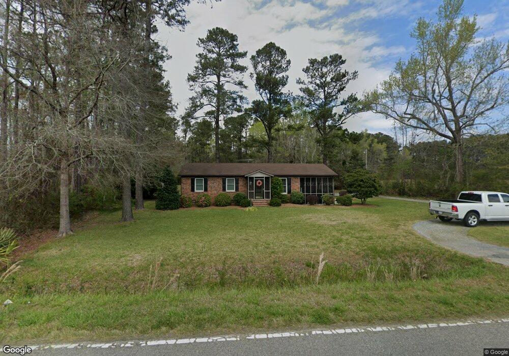
210 Highway 548 Conway, SC 29527
Estimated Value: $189,000 - $287,000
3
Beds
1
Bath
1,066
Sq Ft
$205/Sq Ft
Est. Value
About This Home
This home is located at 210 Highway 548, Conway, SC 29527 and is currently estimated at $218,397, approximately $204 per square foot. 210 Highway 548 is a home located in Horry County with nearby schools including Conway Elementary School, Conway Middle School, and Conway High School.
Ownership History
Date
Name
Owned For
Owner Type
Purchase Details
Closed on
Jun 24, 2002
Sold by
Thomas Gary W and Thomas Veronica L
Bought by
Mancini Ronald W and Mancini Jeanna M
Current Estimated Value
Home Financials for this Owner
Home Financials are based on the most recent Mortgage that was taken out on this home.
Original Mortgage
$87,550
Outstanding Balance
$37,515
Interest Rate
7%
Mortgage Type
VA
Estimated Equity
$180,882
Create a Home Valuation Report for This Property
The Home Valuation Report is an in-depth analysis detailing your home's value as well as a comparison with similar homes in the area
Home Values in the Area
Average Home Value in this Area
Purchase History
| Date | Buyer | Sale Price | Title Company |
|---|---|---|---|
| Mancini Ronald W | $85,000 | -- |
Source: Public Records
Mortgage History
| Date | Status | Borrower | Loan Amount |
|---|---|---|---|
| Open | Mancini Ronald W | $87,550 |
Source: Public Records
Tax History Compared to Growth
Tax History
| Year | Tax Paid | Tax Assessment Tax Assessment Total Assessment is a certain percentage of the fair market value that is determined by local assessors to be the total taxable value of land and additions on the property. | Land | Improvement |
|---|---|---|---|---|
| 2024 | $407 | $6,790 | $4,500 | $2,290 |
| 2023 | $407 | $3,012 | $1,200 | $1,812 |
| 2021 | $374 | $4,518 | $1,800 | $2,718 |
| 2020 | $306 | $4,518 | $1,800 | $2,718 |
| 2019 | $306 | $4,518 | $1,800 | $2,718 |
| 2018 | $325 | $4,692 | $1,560 | $3,132 |
| 2017 | $310 | $3,128 | $1,040 | $2,088 |
| 2016 | -- | $3,128 | $1,040 | $2,088 |
| 2015 | $310 | $3,128 | $1,040 | $2,088 |
| 2014 | $287 | $3,128 | $1,040 | $2,088 |
Source: Public Records
Map
Nearby Homes
- 631 State Highway 548
- 635 State Highway 548
- 158 Hamilton Way
- 156 Hamilton Way
- TBD Hamilton Way
- 197 Springtide Dr
- 600 Shallow Cove Dr Unit Lot 154
- 594 Shallow Cove Dr Unit Lot 151
- 598 Shallow Cove Dr Unit Lot 153
- 596 Shallow Cove Dr Unit Lot 152
- 933 Woodside Dr Unit Lot 402 Sullivan
- 947 Woodside Dr Unit Lot 405 Sewee
- 951 Woodside Dr Unit Lot 406 Abaco
- 1000 Woodside Dr Unit Lot 157 Oak II
- 1004 Woodside Dr Unit Lot 158 Sullivan
- 601 Lightwood Dr Unit Lot 385 Oak II
- 1008 Woodside Dr Unit Lot 159 Sewee
- 1012 Woodside Dr Unit Lot 160 Kokomo
- 1016 Woodside Dr Unit Lot 161 Sewee
- 602 Lightwood Dr Unit Lot 357 Key Largo
- 84.7 Acres Highway 548
- 3525 W Highway 501
- 3470 W Highway 501
- TBD1 State Highway 548
- 1acre State Highway 548
- Tract 1 State Highway 548
- SC 548 State Highway 548
- SC Hwy 548 State Highway 548
- TBD State Highway 548
- Parcel A State Highway 548 Unit Behind Tractor Suppl
- Lot 1 State Highway 548
- 1 Four Mile Rd
- 0 Highway 501 Unit 1717613
- 0 Not Specified Unit 2201913
- 0 Not Specified Unit 2116223
- 0 Not Specified Unit 2112247
- 0 Highway 501 Unit 827806
- 0 Highway 501 Unit 1514076
- 0 Not Specified Unit 1610930
- 0 Not Specified Unit 1722221