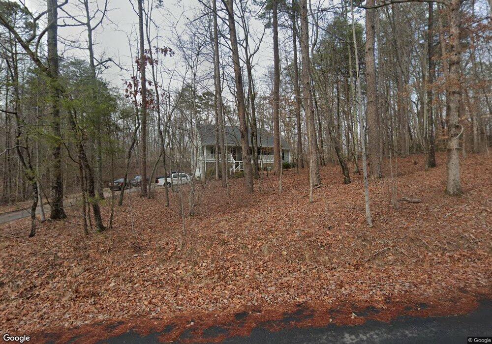
210 Joseph Ln Dawsonville, GA 30534
Dawson County NeighborhoodEstimated Value: $366,584 - $435,000
3
Beds
3
Baths
1,564
Sq Ft
$256/Sq Ft
Est. Value
About This Home
This home is located at 210 Joseph Ln, Dawsonville, GA 30534 and is currently estimated at $400,896, approximately $256 per square foot. 210 Joseph Ln is a home located in Dawson County with nearby schools including Robinson Elementary School, Dawson County Junior High School, and Dawson County Middle School.
Ownership History
Date
Name
Owned For
Owner Type
Purchase Details
Closed on
Nov 22, 1994
Sold by
Brown Gary L and Brown Jonni
Bought by
Goswick Ricky L and Goswick Di
Current Estimated Value
Purchase Details
Closed on
Feb 1, 1994
Sold by
Martin Bryan K
Bought by
Brown Gary L and Brown Jonni
Purchase Details
Closed on
Feb 16, 1989
Sold by
Bryson Jimmy
Bought by
Martin Bryan K
Purchase Details
Closed on
Mar 22, 1988
Bought by
Bryson Jimmy
Create a Home Valuation Report for This Property
The Home Valuation Report is an in-depth analysis detailing your home's value as well as a comparison with similar homes in the area
Home Values in the Area
Average Home Value in this Area
Purchase History
| Date | Buyer | Sale Price | Title Company |
|---|---|---|---|
| Goswick Ricky L | $122,200 | -- | |
| Goswick Ricky L | -- | -- | |
| Brown Gary L | $11,900 | -- | |
| Martin Bryan K | $11,900 | -- | |
| Bryson Jimmy | -- | -- |
Source: Public Records
Tax History Compared to Growth
Tax History
| Year | Tax Paid | Tax Assessment Tax Assessment Total Assessment is a certain percentage of the fair market value that is determined by local assessors to be the total taxable value of land and additions on the property. | Land | Improvement |
|---|---|---|---|---|
| 2024 | $1,422 | $133,840 | $17,360 | $116,480 |
| 2023 | $2,144 | $140,680 | $17,360 | $123,320 |
| 2022 | $2,348 | $111,600 | $17,360 | $94,240 |
| 2021 | $2,198 | $99,144 | $17,360 | $81,784 |
| 2020 | $2,258 | $97,424 | $17,360 | $80,064 |
| 2019 | $2,052 | $87,984 | $17,360 | $70,624 |
| 2018 | $2,137 | $91,344 | $20,720 | $70,624 |
| 2017 | $1,612 | $69,407 | $14,720 | $54,687 |
| 2016 | $1,539 | $66,351 | $14,336 | $52,015 |
| 2015 | $1,588 | $66,351 | $14,336 | $52,015 |
| 2014 | $1,341 | $54,610 | $12,186 | $42,425 |
| 2013 | -- | $45,258 | $10,035 | $35,223 |
Source: Public Records
Map
Nearby Homes
- 8 Swanson St
- 282 Red Hawk Dr
- 42 Vickie Dr E
- 555 Perimeter Rd
- 198 Red Hawk Dr
- 87 Thorndale Ln
- 66 Red Hawk Dr
- 356 Orange Cir
- 57 Fausett Ln
- 53 Fausett Ln
- 378 Shoal Creek Rd
- 19 Fausett Ln
- 8 Gold Dust Dr
- 10 Gold Dust Dr
- 8 Gold Dust Dr Unit 23-B
- 10 Gold Dust Dr Unit 23-A
- 29 Gold Dust Dr
- 23 Gold Dust Dr
- 21 Gold Dust Dr Unit 1-A