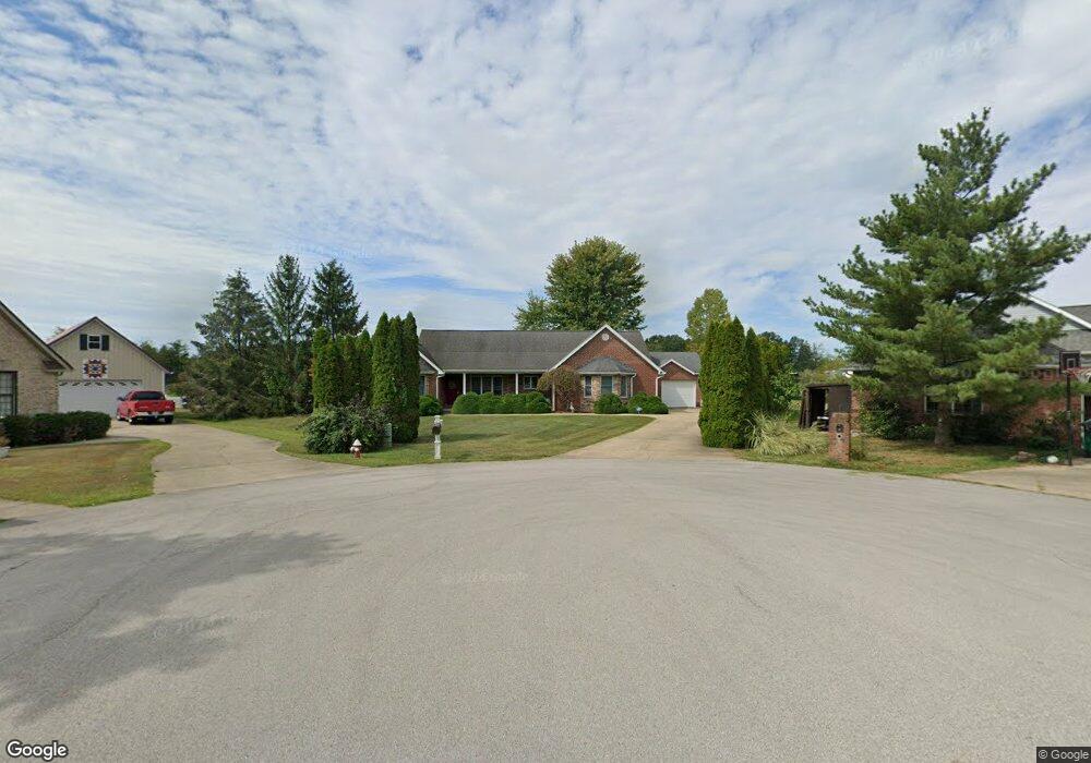
210 Lakewood Ln Georgetown, OH 45121
Estimated Value: $366,000 - $615,000
3
Beds
2
Baths
2,602
Sq Ft
$178/Sq Ft
Est. Value
About This Home
This home is located at 210 Lakewood Ln, Georgetown, OH 45121 and is currently estimated at $464,127, approximately $178 per square foot. 210 Lakewood Ln is a home located in Brown County with nearby schools including Georgetown Elementary School and Georgetown Jr/Sr High School.
Ownership History
Date
Name
Owned For
Owner Type
Purchase Details
Closed on
Feb 26, 2016
Sold by
Rjeily Charbel Abou and Tawk Diala Amir
Bought by
Slade Russell M and Slade Lona
Current Estimated Value
Purchase Details
Closed on
Oct 15, 2001
Sold by
Perkins James D
Bought by
Fragassi Michael C and Fragassi Peggy
Purchase Details
Closed on
Aug 5, 1998
Sold by
Forrest W Wahl Family Tr
Bought by
Perkins James D
Home Financials for this Owner
Home Financials are based on the most recent Mortgage that was taken out on this home.
Original Mortgage
$18,500
Interest Rate
7.05%
Mortgage Type
New Conventional
Create a Home Valuation Report for This Property
The Home Valuation Report is an in-depth analysis detailing your home's value as well as a comparison with similar homes in the area
Home Values in the Area
Average Home Value in this Area
Purchase History
| Date | Buyer | Sale Price | Title Company |
|---|---|---|---|
| Slade Russell M | $1,550,000 | None Available | |
| Fragassi Michael C | $18,000 | -- | |
| Perkins James D | $23,000 | -- |
Source: Public Records
Mortgage History
| Date | Status | Borrower | Loan Amount |
|---|---|---|---|
| Previous Owner | Perkins James D | $18,500 |
Source: Public Records
Tax History Compared to Growth
Tax History
| Year | Tax Paid | Tax Assessment Tax Assessment Total Assessment is a certain percentage of the fair market value that is determined by local assessors to be the total taxable value of land and additions on the property. | Land | Improvement |
|---|---|---|---|---|
| 2024 | $3,876 | $119,220 | $10,880 | $108,340 |
| 2023 | $3,876 | $90,360 | $9,240 | $81,120 |
| 2022 | $3,147 | $90,360 | $9,240 | $81,120 |
| 2021 | $3,118 | $90,360 | $9,240 | $81,120 |
| 2020 | $2,700 | $75,300 | $7,700 | $67,600 |
| 2019 | $1,341 | $75,300 | $7,700 | $67,600 |
| 2018 | $2,662 | $75,300 | $7,700 | $67,600 |
| 2017 | $2,004 | $68,200 | $8,470 | $59,730 |
| 2016 | $2,003 | $68,200 | $8,470 | $59,730 |
| 2015 | $2,028 | $68,200 | $8,470 | $59,730 |
| 2014 | $2,087 | $67,430 | $7,700 | $59,730 |
| 2013 | $2,080 | $67,430 | $7,700 | $59,730 |
Source: Public Records
Map
Nearby Homes
- 30 Straight Dr
- 143 Hamer Rd
- 83 Hamer Rd
- 9705 W Fork Rd
- 427 Kenwood Ave
- 874 Mount Orab Pike
- 331 Spring Grove Dr
- 5781 Camp Run Rd
- 60 New St
- 508 Mount Orab Pike
- 403 Elmwood Ct
- 401 Elmwood Ct
- 414 N Water St
- 406 E North St
- 107 N Elm St
- 102 N Elm St
- 409 N Main St
- 405 N Main St
- 708 E State St
- 120 N Apple St
- 208 Lakewood Ln
- 208 Lakewood Ln
- 208 Lakewood Ln
- 211 Lakewood Ln
- 206 Lakewood Ln
- 209 Lakewood Ln
- 204 Lakewood Ln
- 207 Lakewood Ln
- 205 Lakewood Ln
- 202 Lakewood Ln
- 203 Lakewood Ln
- 201 Lakewood Ln
- Lot Lakewood Ln
- 6 Lakewood Ln
- 101 Lakewood Ln
- 102 Lakewood Ln
- 0 Straight Dr
- 9215 W Fork Rd
- 10 Straight Dr
- 9801 Airport Rd