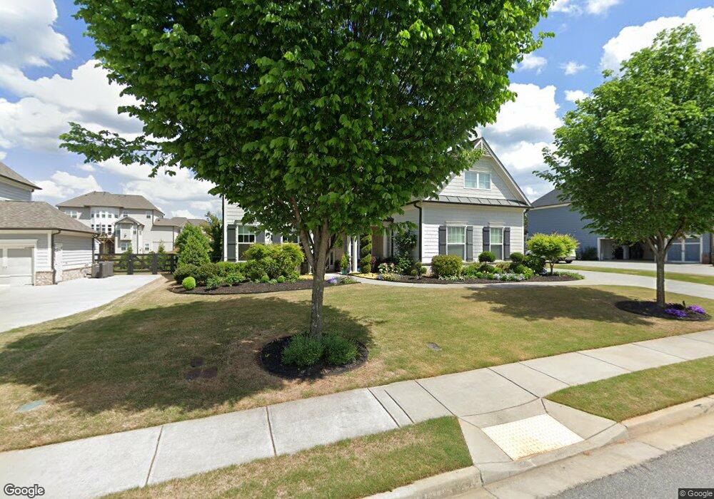
210 Leland Way Woodstock, GA 30188
Estimated Value: $868,871 - $928,000
5
Beds
4
Baths
4,102
Sq Ft
$219/Sq Ft
Est. Value
About This Home
This home is located at 210 Leland Way, Woodstock, GA 30188 and is currently estimated at $898,436, approximately $219 per square foot. 210 Leland Way is a home with nearby schools including Little River Elementary, Mill Creek Middle School, and River Ridge High School.
Ownership History
Date
Name
Owned For
Owner Type
Purchase Details
Closed on
Apr 13, 2016
Sold by
Crp Eah Jm Ii Llc Ii
Bought by
Johnson Robert D and Johnson Shelby A
Current Estimated Value
Home Financials for this Owner
Home Financials are based on the most recent Mortgage that was taken out on this home.
Original Mortgage
$478,500
Outstanding Balance
$379,735
Interest Rate
3.73%
Mortgage Type
VA
Estimated Equity
$518,701
Purchase Details
Closed on
Dec 15, 2015
Sold by
Crp Eah Jm Llc
Bought by
Crp Eah Jm Ii Llc
Create a Home Valuation Report for This Property
The Home Valuation Report is an in-depth analysis detailing your home's value as well as a comparison with similar homes in the area
Home Values in the Area
Average Home Value in this Area
Purchase History
| Date | Buyer | Sale Price | Title Company |
|---|---|---|---|
| Johnson Robert D | $485,319 | -- | |
| Crp Eah Jm Ii Llc | -- | -- |
Source: Public Records
Mortgage History
| Date | Status | Borrower | Loan Amount |
|---|---|---|---|
| Open | Johnson Robert D | $478,500 |
Source: Public Records
Tax History Compared to Growth
Tax History
| Year | Tax Paid | Tax Assessment Tax Assessment Total Assessment is a certain percentage of the fair market value that is determined by local assessors to be the total taxable value of land and additions on the property. | Land | Improvement |
|---|---|---|---|---|
| 2025 | $8,139 | $341,600 | $73,200 | $268,400 |
| 2024 | $7,695 | $320,720 | $65,600 | $255,120 |
| 2023 | $7,277 | $321,520 | $65,600 | $255,920 |
| 2022 | $6,810 | $274,920 | $53,600 | $221,320 |
| 2021 | $5,862 | $209,880 | $38,000 | $171,880 |
| 2020 | $5,778 | $203,360 | $38,000 | $165,360 |
| 2019 | $5,876 | $206,800 | $38,000 | $168,800 |
| 2018 | $5,961 | $208,520 | $38,000 | $170,520 |
| 2017 | $1,106 | $491,300 | $38,000 | $158,520 |
| 2016 | $1,106 | $95,000 | $38,000 | $0 |
Source: Public Records
Map
Nearby Homes
- 205 Leland Way
- 134 Sierra Cir
- 5100 Ravenwood Dr
- 202 Wild Ginger Bend
- 452 Maypop Ln
- Bramwell Plan at Havencroft
- Hendricks Plan at Havencroft
- Wynstone Plan at Havencroft
- Buckhorn Plan at Havencroft
- Worthdale Plan at Havencroft
- Ransdall Plan at Havencroft
- Kinton Plan at Havencroft
- 3415 Trickum Rd
- 416 Maypop Ln
- 223 Wild Ginger Bend
- 205 Trickum Hills Ln
- 235 Wild Ginger Bend
- 314 Trickum Hills Way
- 157 Trickum Hills Dr
- 212 Leland Way Unit 69
- 212 Leland Way Unit 63
- 212 Leland Way
- 208 Leland Way
- 308 Aurora Ave
- 214 Leland Way Unit 68
- 215 Leland Way
- 206 Leland Way
- 0 Leland Way
- 209 Leland Way
- 411 Amber Way Unit 63
- 411 Amber Way
- 413 Amber Way
- 409 Amber Way
- 217 Leland Way
- 216 Leland Way
- 207 Leland Way
- 415 Amber Way
- 204 Leland Way
- 407 Amber Way