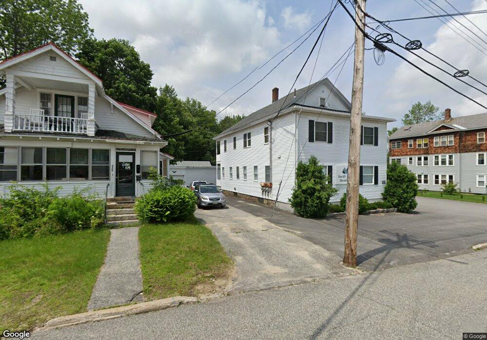
210 Lincoln Ave Unit Suite 2 Rumford, ME 04276
Estimated Value: $222,643 - $245,000
--
Bed
--
Bath
1,885
Sq Ft
$124/Sq Ft
Est. Value
About This Home
This home is located at 210 Lincoln Ave Unit Suite 2, Rumford, ME 04276 and is currently estimated at $233,822, approximately $124 per square foot. 210 Lincoln Ave Unit Suite 2 is a home located in Oxford County with nearby schools including Rumford Elementary School, Meroby Elementary School, and Mountain Valley Middle School.
Ownership History
Date
Name
Owned For
Owner Type
Purchase Details
Closed on
Apr 5, 2023
Sold by
Bretz Philip J and Newman Michael J
Bought by
Dlb Holdings Llc
Current Estimated Value
Home Financials for this Owner
Home Financials are based on the most recent Mortgage that was taken out on this home.
Original Mortgage
$140,000
Outstanding Balance
$136,037
Interest Rate
6.5%
Mortgage Type
Purchase Money Mortgage
Estimated Equity
$97,785
Create a Home Valuation Report for This Property
The Home Valuation Report is an in-depth analysis detailing your home's value as well as a comparison with similar homes in the area
Home Values in the Area
Average Home Value in this Area
Purchase History
| Date | Buyer | Sale Price | Title Company |
|---|---|---|---|
| Dlb Holdings Llc | $175,000 | None Available | |
| Dlb Holdings Llc | $175,000 | None Available |
Source: Public Records
Mortgage History
| Date | Status | Borrower | Loan Amount |
|---|---|---|---|
| Open | Dlb Holdings Llc | $140,000 | |
| Closed | Dlb Holdings Llc | $140,000 |
Source: Public Records
Tax History Compared to Growth
Tax History
| Year | Tax Paid | Tax Assessment Tax Assessment Total Assessment is a certain percentage of the fair market value that is determined by local assessors to be the total taxable value of land and additions on the property. | Land | Improvement |
|---|---|---|---|---|
| 2024 | $3,392 | $204,100 | $21,000 | $183,100 |
| 2023 | $3,234 | $145,800 | $15,000 | $130,800 |
| 2022 | $3,234 | $145,800 | $15,000 | $130,800 |
| 2021 | $3,273 | $145,800 | $15,000 | $130,800 |
| 2020 | $3,295 | $145,800 | $15,000 | $130,800 |
| 2019 | $3,603 | $118,129 | $5,500 | $112,629 |
| 2018 | $3,514 | $118,129 | $5,500 | $112,629 |
| 2017 | $3,408 | $118,129 | $5,500 | $112,629 |
| 2016 | $3,308 | $118,129 | $5,500 | $112,629 |
| 2015 | $3,243 | $118,129 | $5,500 | $112,629 |
| 2014 | $3,184 | $118,129 | $5,500 | $112,629 |
Source: Public Records
Map
Nearby Homes
- 501 Knox St
- 615 Washington St
- 630 Franklin St
- 429 Penobscot St
- 154 Essex Ave
- 335 Franklin St
- 134 Lincoln Ave
- 407 Maple St
- 529 Kennebec St
- 321 Penobscot St
- 512 Kennebec St
- 321 & 325 Pine St
- 312 Pine St
- 307 Penobscot St
- 236 Knox St
- 239 Penobscot St
- 0 Swain Rd
- 507 Waldo St
- 156 Strathglass Park
- 36 Erchles St
- 210 Lincoln Ave
- 0 Sagadahoc St Unit 1242283
- 0 Sagadahoc St Unit 1242785
- 206 Lincoln Ave
- 218 Lincoln Ave
- 512 Franklin St
- 200 Lincoln Ave
- 506 Franklin St
- 518 Franklin St
- 503 Piscataquis St
- 507 Franklin St
- 522 Franklin St
- 513 Franklin St
- 437 Franklin St
- 505 Piscataquis St
- 435 Franklin St
- 523 Franklin St
- 180 Lincoln Ave
- 502 Piscataquis St
- 526 Franklin St