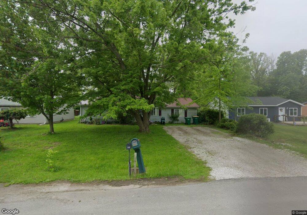
210 Linden St Jefferson, OH 44047
Estimated Value: $122,000 - $212,000
4
Beds
1
Bath
1,512
Sq Ft
$109/Sq Ft
Est. Value
About This Home
This home is located at 210 Linden St, Jefferson, OH 44047 and is currently estimated at $165,141, approximately $109 per square foot. 210 Linden St is a home located in Ashtabula County with nearby schools including Jefferson Elementary School, Jefferson Area Junior High School, and Jefferson Area Senior High School.
Ownership History
Date
Name
Owned For
Owner Type
Purchase Details
Closed on
Sep 15, 2004
Sold by
Beneficial Ohio Inc
Bought by
Kaziska Michael R and Kaziska Carrie L
Current Estimated Value
Home Financials for this Owner
Home Financials are based on the most recent Mortgage that was taken out on this home.
Original Mortgage
$78,000
Outstanding Balance
$38,772
Interest Rate
5.93%
Mortgage Type
Unknown
Estimated Equity
$126,369
Purchase Details
Closed on
Aug 25, 2004
Sold by
Collins Gale and Howell Katherine M
Bought by
Beneficial Ohio Inc and Beneficial Mortgage Co Of Ohio
Home Financials for this Owner
Home Financials are based on the most recent Mortgage that was taken out on this home.
Original Mortgage
$78,000
Outstanding Balance
$38,772
Interest Rate
5.93%
Mortgage Type
Unknown
Estimated Equity
$126,369
Purchase Details
Closed on
Feb 16, 1995
Sold by
Roach Jacqueline L
Bought by
Gale and Collins Katherine M
Home Financials for this Owner
Home Financials are based on the most recent Mortgage that was taken out on this home.
Original Mortgage
$45,000
Interest Rate
9.26%
Mortgage Type
New Conventional
Create a Home Valuation Report for This Property
The Home Valuation Report is an in-depth analysis detailing your home's value as well as a comparison with similar homes in the area
Home Values in the Area
Average Home Value in this Area
Purchase History
| Date | Buyer | Sale Price | Title Company |
|---|---|---|---|
| Kaziska Michael R | $73,000 | Chicago Title Agency | |
| Beneficial Ohio Inc | $75,000 | Chicago Title | |
| Gale | $45,000 | -- |
Source: Public Records
Mortgage History
| Date | Status | Borrower | Loan Amount |
|---|---|---|---|
| Open | Kaziska Michael R | $78,000 | |
| Previous Owner | Gale | $45,000 |
Source: Public Records
Tax History
| Year | Tax Paid | Tax Assessment Tax Assessment Total Assessment is a certain percentage of the fair market value that is determined by local assessors to be the total taxable value of land and additions on the property. | Land | Improvement |
|---|---|---|---|---|
| 2024 | $3,184 | $36,580 | $6,440 | $30,140 |
| 2023 | $1,701 | $36,580 | $6,440 | $30,140 |
| 2022 | $1,350 | $26,470 | $4,940 | $21,530 |
| 2021 | $1,291 | $26,470 | $4,940 | $21,530 |
| 2020 | $1,295 | $26,470 | $4,940 | $21,530 |
| 2019 | $1,164 | $23,070 | $4,730 | $18,340 |
| 2018 | $1,130 | $23,070 | $4,730 | $18,340 |
| 2017 | $1,123 | $23,070 | $4,730 | $18,340 |
| 2016 | $1,144 | $22,860 | $4,690 | $18,170 |
| 2015 | $1,117 | $22,860 | $4,690 | $18,170 |
| 2014 | $1,088 | $22,860 | $4,690 | $18,170 |
| 2013 | $1,302 | $27,520 | $4,310 | $23,210 |
Source: Public Records
Map
Nearby Homes
- 243 Jackson St
- 187 Garfield Ln
- 0 Vl St Rt 307
- 97 W Jefferson St
- 304 Woodland Way
- 309 Woodland Way Unit A
- 391 Kathleen Dr
- 303 S Market St
- 138 E Cedar St
- 1163 State Route 307 W
- 800 Lenox New Lyme Rd
- 1589 State Route 46 N
- 425 Woodside Ave
- 0 State Route 307 Unit 5168871
- 0 State Route 307 Unit LotWP001
- 1790 Dadeyville Rd
- 0 Forman Rd Unit 226011156
- 2254 Chapel Rd
- 2631 State Route 46 N
- 1592 Brown Rd
Your Personal Tour Guide
Ask me questions while you tour the home.