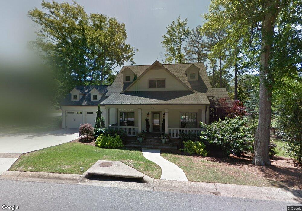
210 Lullwater Rd Athens, GA 30606
Five Points NeighborhoodEstimated Value: $1,056,000 - $1,126,932
--
Bed
1
Bath
3,230
Sq Ft
$336/Sq Ft
Est. Value
About This Home
This home is located at 210 Lullwater Rd, Athens, GA 30606 and is currently estimated at $1,083,983, approximately $335 per square foot. 210 Lullwater Rd is a home with nearby schools including Barrow Elementary School, Clarke Middle School, and Clarke Central High School.
Ownership History
Date
Name
Owned For
Owner Type
Purchase Details
Closed on
Feb 11, 2015
Sold by
Mc2 Holdings Llc
Bought by
Mccrary Leslie J
Current Estimated Value
Home Financials for this Owner
Home Financials are based on the most recent Mortgage that was taken out on this home.
Original Mortgage
$417,000
Outstanding Balance
$320,359
Interest Rate
4%
Mortgage Type
New Conventional
Estimated Equity
$763,624
Purchase Details
Closed on
Apr 8, 2014
Sold by
Mccrary Royce
Bought by
Mc2 Holdings Llc
Purchase Details
Closed on
Dec 12, 2013
Sold by
Keller Alex P
Bought by
Mccrary Royce
Purchase Details
Closed on
Nov 22, 2013
Sold by
Keller Alex P
Bought by
Mccrary Royce
Create a Home Valuation Report for This Property
The Home Valuation Report is an in-depth analysis detailing your home's value as well as a comparison with similar homes in the area
Home Values in the Area
Average Home Value in this Area
Purchase History
| Date | Buyer | Sale Price | Title Company |
|---|---|---|---|
| Mccrary Leslie J | -- | -- | |
| Mc2 Holdings Llc | -- | -- | |
| Mccrary Royce | $425,000 | -- | |
| Mccrary Royce | -- | -- |
Source: Public Records
Mortgage History
| Date | Status | Borrower | Loan Amount |
|---|---|---|---|
| Open | Mccrary Leslie J | $417,000 |
Source: Public Records
Tax History Compared to Growth
Tax History
| Year | Tax Paid | Tax Assessment Tax Assessment Total Assessment is a certain percentage of the fair market value that is determined by local assessors to be the total taxable value of land and additions on the property. | Land | Improvement |
|---|---|---|---|---|
| 2025 | $13,679 | $470,294 | $63,888 | $406,406 |
| 2024 | $13,101 | $435,213 | $51,110 | $384,103 |
| 2023 | $13,101 | $387,107 | $51,110 | $335,996 |
| 2022 | $11,005 | $354,975 | $51,110 | $303,865 |
| 2021 | $9,407 | $289,127 | $46,851 | $242,276 |
| 2020 | $9,407 | $289,127 | $46,851 | $242,276 |
| 2019 | $9,476 | $305,835 | $58,564 | $247,271 |
| 2018 | $8,302 | $254,549 | $58,564 | $195,985 |
| 2017 | $8,085 | $248,138 | $58,564 | $189,574 |
| 2016 | $7,712 | $237,148 | $58,564 | $178,584 |
| 2015 | $4,935 | $145,154 | $53,240 | $91,914 |
| 2014 | $334 | $9,800 | $9,800 | $0 |
Source: Public Records
Map
Nearby Homes
- 2019 S Lumpkin St
- 275 Westview Dr
- 104 W Lake Ct
- 253 Sleepy Creek Dr
- 185 Eaglewood Way
- 105 Princeton Mill Rd
- 164 Plum Nelly Rd
- 262 Rhodes Dr
- 204 Gran Ellen Dr
- 275 Davis Estates Rd
- 589 W Lake Dr
- 299 Kennington Dr
- 265 Annes Ct
- 183 Parkway Dr
- 145 Heatherwood Ln
- 213 Highpointe Ln
- 128 Habersham Dr
- 115 Annes Ct
- 1697 S Milledge Ave
- 120 120 Witherspoon Rd
- 220 Lullwater Rd
- 225 Lullwater Rd
- 201 Woodward Way
- 109 Witherspoon Rd
- 105 Witherspoon Rd
- 265 Lullwater Rd
- 260 Lullwater Rd
- 115 Witherspoon Rd
- 125 Terrell Dr
- 136 Witherspoon Rd
- 125 Witherspoon Rd
- 620 Riverview Rd
- 640 Riverview Rd
- 145 Terrell Dr
- 175 Lullwater Rd
- 660 Riverview Rd
- 142 Witherspoon Rd
- 280 Lullwater Rd
- 145 Witherspoon Rd