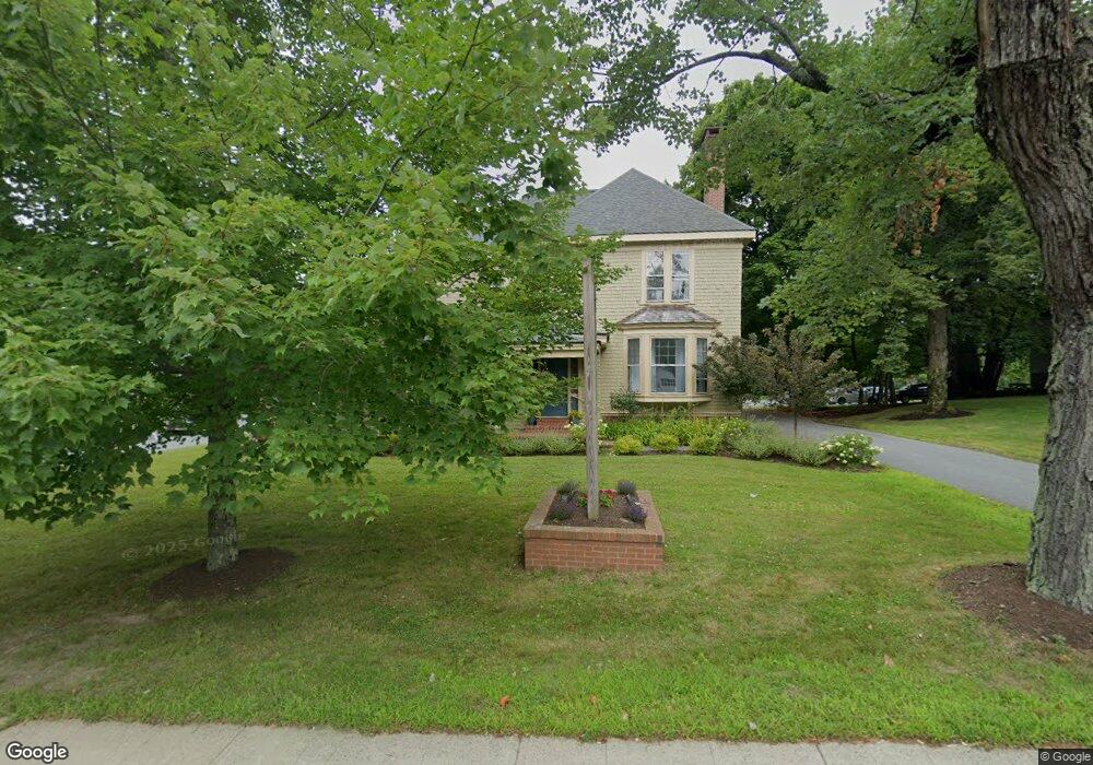
210 Main St Ellsworth, ME 04605
Estimated Value: $4,625,245
--
Bed
--
Bath
3,246
Sq Ft
$1,425/Sq Ft
Est. Value
About This Home
This home is located at 210 Main St, Ellsworth, ME 04605 and is currently priced at $4,625,245, approximately $1,424 per square foot. 210 Main St is a home located in Hancock County with nearby schools including Sumner Memorial High School, Kidspeace National Centers of New England, and Graham Lake School.
Ownership History
Date
Name
Owned For
Owner Type
Purchase Details
Closed on
Oct 17, 2018
Sold by
Braniff William V and Braniff Margaret E
Bought by
Carpenter Debra
Current Estimated Value
Home Financials for this Owner
Home Financials are based on the most recent Mortgage that was taken out on this home.
Original Mortgage
$165,527
Interest Rate
4.7%
Mortgage Type
Unknown
Create a Home Valuation Report for This Property
The Home Valuation Report is an in-depth analysis detailing your home's value as well as a comparison with similar homes in the area
Home Values in the Area
Average Home Value in this Area
Purchase History
| Date | Buyer | Sale Price | Title Company |
|---|---|---|---|
| Carpenter Debra | -- | -- |
Source: Public Records
Mortgage History
| Date | Status | Borrower | Loan Amount |
|---|---|---|---|
| Open | Opus One Llc | $231,000 | |
| Closed | Carpenter Debra | $165,527 | |
| Previous Owner | Petra Llc | $217,500 | |
| Previous Owner | Penobscot Harbor Trad | $255,000 |
Source: Public Records
Tax History Compared to Growth
Tax History
| Year | Tax Paid | Tax Assessment Tax Assessment Total Assessment is a certain percentage of the fair market value that is determined by local assessors to be the total taxable value of land and additions on the property. | Land | Improvement |
|---|---|---|---|---|
| 2024 | $15,083 | $864,370 | $102,960 | $761,410 |
| 2023 | $7,588 | $438,585 | $110,145 | $328,440 |
| 2022 | $6,886 | $438,585 | $110,145 | $328,440 |
| 2021 | $7,531 | $417,700 | $104,900 | $312,800 |
| 2020 | $7,840 | $417,700 | $104,900 | $312,800 |
| 2019 | $7,857 | $417,700 | $104,900 | $312,800 |
| 2018 | $7,619 | $417,700 | $104,900 | $312,800 |
| 2017 | $7,452 | $414,700 | $104,900 | $309,800 |
| 2016 | $7,332 | $414,700 | $104,900 | $309,800 |
| 2015 | $7,112 | $401,800 | $104,900 | $296,900 |
| 2014 | $6,610 | $401,800 | $104,900 | $296,900 |
| 2012 | $6,208 | $401,800 | $104,900 | $296,900 |
Source: Public Records
Map
Nearby Homes
- 35 Church St
- 4 Union St
- 25 Lincoln St
- 30 Water St
- 89 & 93 State St
- 80 State St
- 8 Sterling St
- 28 Central St
- 58 Laurel St
- 23 Chapel St
- 14 Chapel St
- 14 Jude Ln
- 35 Maple St
- 162 Maddocks Ave
- 44 Tinker Meadow Way Unit 40
- 43 Tinker Meadow Way Unit 19
- 42 Tinker Meadow Way Unit 38
- 41 Tinker Meadow Way Unit 17
- 14 Westwood Dr
- Lot #13-1 Shore Rd
- 200 Main St
- LOT 6 Oakhill Subdivision Black Bear Dr
- 6 Oak St
- 45 Church St
- 209 Main St
- 49 Church St
- LOT 4 N of Oak Hill Division Rd
- 203 Main St
- 0 Main & Oak Streets
- 41 Church St
- 5 School St
- 5 School St
- 1 High St
- 9 School St
- 215 Main St
- 5 School St
- 17 School St
- 56A/ Church St
- 230 Main St
- 3 High St Unit 958459