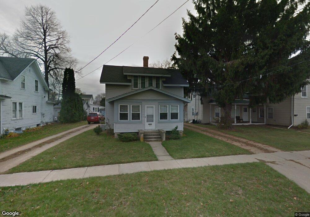
210 Maine St Mauston, WI 53948
Estimated Value: $164,000 - $215,000
--
Bed
--
Bath
--
Sq Ft
10,454
Sq Ft Lot
About This Home
This home is located at 210 Maine St, Mauston, WI 53948 and is currently estimated at $189,805. 210 Maine St is a home located in Juneau County with nearby schools including West Side Elementary School, Lyndon Station Elementary School, and Grayside Elementary School.
Ownership History
Date
Name
Owned For
Owner Type
Purchase Details
Closed on
Sep 14, 2022
Sold by
Baker Barbara J
Bought by
Boardman Robert B
Current Estimated Value
Purchase Details
Closed on
Jul 17, 2017
Sold by
Freng Randy A and Freng Richelle M
Bought by
Baker Barbara J
Purchase Details
Closed on
Jul 14, 2015
Sold by
Martingello Joseph W
Bought by
Freng Randy A
Purchase Details
Closed on
Mar 31, 2011
Sold by
Bank Of Mauston
Bought by
Martingello Joseph W
Purchase Details
Closed on
May 25, 2007
Sold by
Estate Of Williaim J Fox
Bought by
Luehman Real Estate Investments Llc
Create a Home Valuation Report for This Property
The Home Valuation Report is an in-depth analysis detailing your home's value as well as a comparison with similar homes in the area
Home Values in the Area
Average Home Value in this Area
Purchase History
| Date | Buyer | Sale Price | Title Company |
|---|---|---|---|
| Boardman Robert B | $8 | Barbara J Baker | |
| Baker Barbara J | $87,000 | -- | |
| Freng Randy A | $76,000 | -- | |
| Martingello Joseph W | $35,000 | -- | |
| Luehman Real Estate Investments Llc | $67,000 | -- |
Source: Public Records
Tax History Compared to Growth
Tax History
| Year | Tax Paid | Tax Assessment Tax Assessment Total Assessment is a certain percentage of the fair market value that is determined by local assessors to be the total taxable value of land and additions on the property. | Land | Improvement |
|---|---|---|---|---|
| 2024 | $2,489 | $111,500 | $14,300 | $97,200 |
| 2023 | $2,184 | $111,500 | $14,300 | $97,200 |
| 2022 | $2,411 | $111,500 | $14,300 | $97,200 |
| 2021 | $2,212 | $74,200 | $11,900 | $62,300 |
| 2020 | $2,168 | $74,200 | $11,900 | $62,300 |
| 2019 | $2,143 | $74,200 | $11,900 | $62,300 |
| 2018 | $2,073 | $74,200 | $11,900 | $62,300 |
| 2017 | $2,055 | $74,200 | $11,900 | $62,300 |
| 2016 | $1,946 | $69,800 | $11,900 | $57,900 |
| 2015 | $2,125 | $69,800 | $11,900 | $57,900 |
| 2014 | $1,860 | $69,800 | $11,900 | $57,900 |
| 2013 | $1,513 | $56,200 | $11,900 | $44,300 |
Source: Public Records
Map
Nearby Homes
- 108 Hanover St
- 0 Fleet St Unit 1978417
- 234 Tremont St
- 318 Tremont St
- 415 West Ave
- 12.35 AC Highway 58 Trunk
- 202 Wisconsin St
- 506 W State St
- 120 W Milwaukee St
- L5 Buttner Ct
- 207 Highview Ave
- 420 E Monroe St
- 722 E State St
- 810 S Hickory St
- 813 S Hickory St
- 914 Marshall Dr
- 0.3 acres Lincoln St
- Lot 47 Turner Dr
- 1.6 acres Prospect and Lincoln St
- L31 Heath Ct