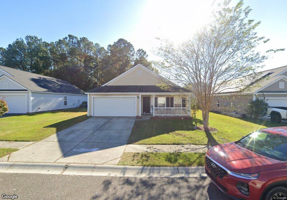
210 Maypop Dr Goose Creek, SC 29445
Estimated Value: $304,675 - $319,000
3
Beds
2
Baths
1,376
Sq Ft
$226/Sq Ft
Est. Value
About This Home
This home is located at 210 Maypop Dr, Goose Creek, SC 29445 and is currently estimated at $310,419, approximately $225 per square foot. 210 Maypop Dr is a home located in Berkeley County with nearby schools including Mount Holly Elementary, Sedgefield Middle School, and Goose Creek High School.
Ownership History
Date
Name
Owned For
Owner Type
Purchase Details
Closed on
Jul 12, 2011
Sold by
Cobrand Phillip C
Bought by
Alge Richard C and Alge Carol D
Current Estimated Value
Purchase Details
Closed on
Jul 17, 2006
Sold by
Beazer Homes Corp
Bought by
Cobrand Phillip C
Home Financials for this Owner
Home Financials are based on the most recent Mortgage that was taken out on this home.
Original Mortgage
$164,955
Interest Rate
6.6%
Mortgage Type
Future Advance Clause Open End Mortgage
Purchase Details
Closed on
Jun 28, 2006
Sold by
Addco Llc
Bought by
Beazer Homes Corp
Home Financials for this Owner
Home Financials are based on the most recent Mortgage that was taken out on this home.
Original Mortgage
$164,955
Interest Rate
6.6%
Mortgage Type
Future Advance Clause Open End Mortgage
Create a Home Valuation Report for This Property
The Home Valuation Report is an in-depth analysis detailing your home's value as well as a comparison with similar homes in the area
Home Values in the Area
Average Home Value in this Area
Purchase History
| Date | Buyer | Sale Price | Title Company |
|---|---|---|---|
| Alge Richard C | $112,000 | -- | |
| Cobrand Phillip C | $164,955 | None Available | |
| Beazer Homes Corp | $477,550 | None Available |
Source: Public Records
Mortgage History
| Date | Status | Borrower | Loan Amount |
|---|---|---|---|
| Previous Owner | Cobrand Phillip C | $164,955 |
Source: Public Records
Tax History Compared to Growth
Tax History
| Year | Tax Paid | Tax Assessment Tax Assessment Total Assessment is a certain percentage of the fair market value that is determined by local assessors to be the total taxable value of land and additions on the property. | Land | Improvement |
|---|---|---|---|---|
| 2025 | $2,937 | $163,951 | $37,288 | $126,663 |
| 2024 | $2,913 | $9,837 | $2,237 | $7,600 |
| 2023 | $2,913 | $9,837 | $2,237 | $7,600 |
| 2022 | $2,752 | $8,554 | $1,992 | $6,562 |
| 2021 | $2,822 | $8,550 | $1,992 | $6,562 |
| 2020 | $2,762 | $8,554 | $1,992 | $6,562 |
| 2019 | $2,716 | $8,554 | $1,992 | $6,562 |
| 2018 | $2,516 | $7,438 | $2,135 | $5,303 |
| 2017 | $2,510 | $7,438 | $2,135 | $5,303 |
| 2016 | $2,508 | $7,440 | $2,140 | $5,300 |
| 2015 | $2,408 | $7,440 | $2,140 | $5,300 |
| 2014 | $2,218 | $7,440 | $2,140 | $5,300 |
| 2013 | -- | $7,440 | $2,140 | $5,300 |
Source: Public Records
Map
Nearby Homes
- 141 Woodward Rd
- 126 Woodward Rd
- 338 Flyway Rd
- 380 Flyway Rd
- 192 Woodward Rd
- 315 Flyway Rd
- 339 Briarbend Rd
- 00 Liberty Hall Rd
- 000 Liberty Hall Rd
- 30 Bonnie Burn Rd
- 20 Bonnie Burn Rd
- 300 Greens Ct
- 25 Delaware Rd
- 105 Lovette Ct
- 300 Burton Ct
- 30 Oak Grove Rd
- 9 Pequannock Rd
- 58 Princeton Rd
- 407 Green Park Ln
- 116 Slow Mill Dr