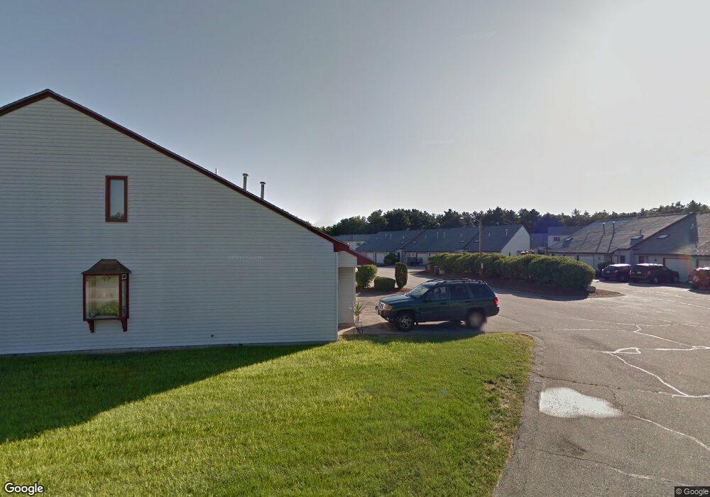
210 Millwright Dr Nashua, NH 03063
Northwest Nashua NeighborhoodEstimated Value: $275,000 - $343,000
2
Beds
1
Bath
1,340
Sq Ft
$227/Sq Ft
Est. Value
About This Home
This home is located at 210 Millwright Dr, Nashua, NH 03063 and is currently estimated at $304,594, approximately $227 per square foot. 210 Millwright Dr is a home located in Hillsborough County with nearby schools including Birch Hill Elementary School, Pennichuck Middle School, and Nashua High School North.
Ownership History
Date
Name
Owned For
Owner Type
Purchase Details
Closed on
May 16, 2006
Sold by
Rancourt Bianca L
Bought by
Antilus Vasty
Current Estimated Value
Home Financials for this Owner
Home Financials are based on the most recent Mortgage that was taken out on this home.
Original Mortgage
$117,000
Interest Rate
6.4%
Purchase Details
Closed on
Nov 24, 1999
Sold by
Dorney Stephen E and Dorney Lucille D
Bought by
Rancourt Bianca L
Create a Home Valuation Report for This Property
The Home Valuation Report is an in-depth analysis detailing your home's value as well as a comparison with similar homes in the area
Home Values in the Area
Average Home Value in this Area
Purchase History
| Date | Buyer | Sale Price | Title Company |
|---|---|---|---|
| Antilus Vasty | $130,000 | -- | |
| Rancourt Bianca L | $38,000 | -- |
Source: Public Records
Mortgage History
| Date | Status | Borrower | Loan Amount |
|---|---|---|---|
| Open | Rancourt Bianca L | $108,000 | |
| Closed | Rancourt Bianca L | $13,500 | |
| Closed | Rancourt Bianca L | $117,000 |
Source: Public Records
Tax History
| Year | Tax Paid | Tax Assessment Tax Assessment Total Assessment is a certain percentage of the fair market value that is determined by local assessors to be the total taxable value of land and additions on the property. | Land | Improvement |
|---|---|---|---|---|
| 2025 | $4,250 | $252,500 | $0 | $252,500 |
| 2024 | $4,015 | $252,500 | $0 | $252,500 |
| 2023 | $3,230 | $177,200 | $0 | $177,200 |
| 2022 | $3,202 | $177,200 | $0 | $177,200 |
| 2021 | $2,831 | $121,900 | $0 | $121,900 |
| 2020 | $2,795 | $123,600 | $0 | $123,600 |
| 2019 | $2,690 | $123,600 | $0 | $123,600 |
| 2018 | $2,622 | $123,600 | $0 | $123,600 |
| 2017 | $1,955 | $75,800 | $0 | $75,800 |
| 2016 | $1,900 | $75,800 | $0 | $75,800 |
| 2015 | $1,859 | $75,800 | $0 | $75,800 |
| 2014 | $1,823 | $75,800 | $0 | $75,800 |
Source: Public Records
Map
Nearby Homes
- 1133 Blackstone Dr Unit 33
- 262 Stonebridge Dr
- 254 Stonebridge Dr
- 3 Knights Bridge Dr Unit UL302
- 4 Knights Bridge Dr Unit UI206
- 5 Dumaine Ave Unit N
- 7 Dumaine Ave Unit H
- 7 Bradford St
- 6 Duckford Cir Unit U19
- 35 Albury Stone Cir Unit U201
- 47 Lamson Dr
- 1 Cambridge Dr
- 63 Cannongate III Unit 3
- 4 Wasserman Heights
- 189 Coburn Woods
- 5 Ivy Ln Unit U131
- 21 Todd Rd
- 206 S Merrimack Rd
- 111 Coburn Ave Unit 187
- 9 Rugby Rd
- 210 Millwright Dr
- 209 Millwright Dr
- 209 Millwright Dr
- 211 Millwright Dr
- 211 Millwright Dr
- 211 Millwright Dr Unit 211
- 212 Millwright Dr
- 212 Millwright Dr
- 208 Millwright Dr
- 208 Millwright Dr
- 208 Millwright Dr Unit 208
- 213 Millwright Dr
- 213 Millwright Dr
- 207 Millwright Dr
- 207 Millwright Dr
- 19 Stonebridge Dr Unit 292
- 214 Millwright Dr
- 214 Millwright Dr
- 214 Millwright Dr Unit 214
- 206 Millwright Dr
Your Personal Tour Guide
Ask me questions while you tour the home.