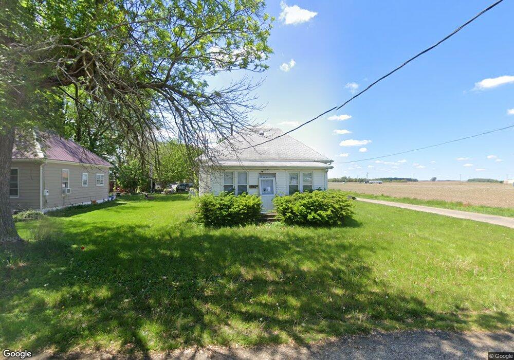
210 N 2nd St Easton, IL 62633
Estimated Value: $51,049 - $87,000
--
Bed
--
Bath
--
Sq Ft
9,409
Sq Ft Lot
About This Home
This home is located at 210 N 2nd St, Easton, IL 62633 and is currently estimated at $73,350. 210 N 2nd St is a home with nearby schools including Illini Central Grade School, Illini Central Middle School, and Illini Central High School.
Ownership History
Date
Name
Owned For
Owner Type
Purchase Details
Closed on
Sep 8, 2025
Sold by
Sheriff Of Mason County
Bought by
Secretary Of Veterans Affairs
Current Estimated Value
Purchase Details
Closed on
Aug 23, 2019
Sold by
Broker Patrick E
Bought by
Boston Richard
Home Financials for this Owner
Home Financials are based on the most recent Mortgage that was taken out on this home.
Original Mortgage
$51,075
Interest Rate
4%
Mortgage Type
New Conventional
Purchase Details
Closed on
Mar 22, 2017
Sold by
Hoff Kenneth R
Bought by
Boker Patricia
Purchase Details
Closed on
Jul 9, 2014
Sold by
Thompson Deb and Wills Shirley
Bought by
Hoff Calvin
Purchase Details
Closed on
Jul 3, 2008
Sold by
Thomas Olivene
Bought by
Thompson Deb and Staltz Shirley
Create a Home Valuation Report for This Property
The Home Valuation Report is an in-depth analysis detailing your home's value as well as a comparison with similar homes in the area
Home Values in the Area
Average Home Value in this Area
Purchase History
| Date | Buyer | Sale Price | Title Company |
|---|---|---|---|
| Secretary Of Veterans Affairs | -- | None Listed On Document | |
| Boston Richard | $5,000 | None Available | |
| Boker Patricia | $38,500 | None Available | |
| Hoff Calvin | $35,000 | None Available | |
| Thompson Deb | -- | None Available |
Source: Public Records
Mortgage History
| Date | Status | Borrower | Loan Amount |
|---|---|---|---|
| Previous Owner | Boston Richard | $51,075 |
Source: Public Records
Tax History Compared to Growth
Tax History
| Year | Tax Paid | Tax Assessment Tax Assessment Total Assessment is a certain percentage of the fair market value that is determined by local assessors to be the total taxable value of land and additions on the property. | Land | Improvement |
|---|---|---|---|---|
| 2024 | $1,360 | $14,856 | $1,906 | $12,950 |
| 2023 | $1,360 | $13,724 | $1,761 | $11,963 |
| 2022 | $700 | $12,478 | $1,601 | $10,877 |
| 2021 | $644 | $11,565 | $1,484 | $10,081 |
| 2020 | $639 | $11,565 | $1,484 | $10,081 |
| 2019 | $1,305 | $11,565 | $1,484 | $10,081 |
| 2018 | $64 | $11,565 | $1,484 | $10,081 |
| 2017 | $42 | $11,565 | $1,484 | $10,081 |
| 2016 | $35 | $11,565 | $1,484 | $10,081 |
| 2015 | -- | $11,565 | $1,484 | $10,081 |
| 2012 | -- | $15,605 | $1,451 | $14,154 |
Source: Public Records
Map
Nearby Homes
- 406 E Mason St
- 10844 CR 2950 Rd E
- 15319 N County Road 2600 Rd E
- 15319 N Co Rd 2600e
- 26266 E Co Road 700 N
- 22106 E 1200 Rd N
- 20215 E County Road 1500 N
- 428 W Walnut St
- 519 W Chestnut St
- 19430 E Co Road 1200 N
- 320 N Morgan St
- 202 S Logan St
- 408 N Main St
- 104 E Myrtle St
- 421 N Rutledge St
- 609 E High St
- 819 E Chestnut St
- 1535 E Pine St
- 100 S Main St
- 204 Chestnut