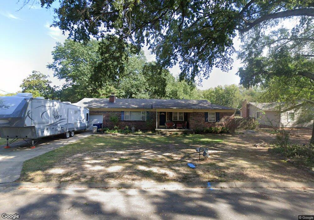
210 N 57th St Fort Smith, AR 72903
Estimated Value: $181,677 - $253,000
--
Bed
3
Baths
1,881
Sq Ft
$118/Sq Ft
Est. Value
About This Home
This home is located at 210 N 57th St, Fort Smith, AR 72903 and is currently estimated at $221,919, approximately $117 per square foot. 210 N 57th St is a home located in Sebastian County with nearby schools including Euper Lane Elementary School, L.A. Chaffin Junior High School, and Northside High School.
Ownership History
Date
Name
Owned For
Owner Type
Purchase Details
Closed on
Sep 1, 1994
Bought by
Price John I and Price Donna
Current Estimated Value
Purchase Details
Closed on
Jun 26, 1989
Bought by
Cole Ii Clemond H
Purchase Details
Closed on
Dec 23, 1986
Bought by
Cole Ii Clemond H and Linda Dia
Purchase Details
Closed on
Jun 25, 1981
Bought by
Carson Randall L and Carson Doris D
Purchase Details
Closed on
Mar 10, 1981
Bought by
Rothrock Lois Pope and Rothrock Nichols
Create a Home Valuation Report for This Property
The Home Valuation Report is an in-depth analysis detailing your home's value as well as a comparison with similar homes in the area
Home Values in the Area
Average Home Value in this Area
Purchase History
| Date | Buyer | Sale Price | Title Company |
|---|---|---|---|
| Price John I | $69,000 | -- | |
| Cole Ii Clemond H | -- | -- | |
| Cole Ii Clemond H | $60,000 | -- | |
| Carson Randall L | $48,000 | -- | |
| Rothrock Lois Pope | -- | -- |
Source: Public Records
Tax History Compared to Growth
Tax History
| Year | Tax Paid | Tax Assessment Tax Assessment Total Assessment is a certain percentage of the fair market value that is determined by local assessors to be the total taxable value of land and additions on the property. | Land | Improvement |
|---|---|---|---|---|
| 2024 | $1,272 | $24,220 | $5,000 | $19,220 |
| 2023 | $1,406 | $24,220 | $5,000 | $19,220 |
| 2022 | $1,406 | $24,220 | $5,000 | $19,220 |
| 2021 | $1,406 | $24,220 | $5,000 | $19,220 |
| 2020 | $1,406 | $24,220 | $5,000 | $19,220 |
| 2019 | $1,302 | $22,430 | $5,000 | $17,430 |
| 2018 | $1,302 | $22,430 | $5,000 | $17,430 |
| 2017 | $1,178 | $22,430 | $5,000 | $17,430 |
| 2016 | $1,178 | $22,430 | $5,000 | $17,430 |
| 2015 | $1,178 | $22,430 | $5,000 | $17,430 |
| 2014 | $1,199 | $22,625 | $4,000 | $18,625 |
Source: Public Records
Map
Nearby Homes
- 5421 Free Ferry Rd
- 5701 Free Ferry Rd Unit 34
- 5701 Free Ferry Rd Unit 1
- 5701 Free Ferry Rd Unit 29
- 5701 Free Ferry Rd Unit 12
- 6104 Park Ave
- 5325 Free Ferry Rd
- 1103 S Waldron Rd
- 5216 Free Ferry Rd
- 6212 Free Ferry Rd
- 6001 Bolton Rd
- 60 Jeffrey Way
- 4620 Free Ferry Rd
- 1004 S 67th Ln
- 4615 Free Ferry Rd
- 26 Jeffrey Way
- 1112 Autumn Oaks Ln
- 521 N 47th St
- 38 Jeffrey Way
- 1021 N 60th Terrace