Estimated Value: $316,000 - $334,000
3
Beds
1
Bath
1,931
Sq Ft
$168/Sq Ft
Est. Value
About This Home
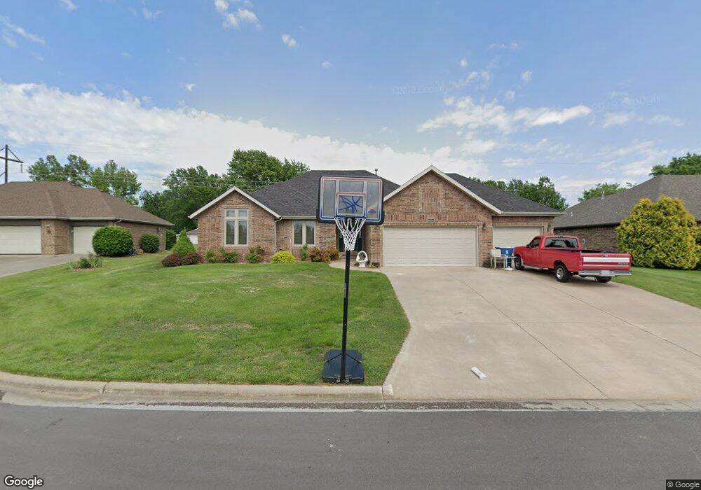
This home is located at 210 N Bluebird Ln, Nixa, MO 65714 and is currently estimated at $324,782, approximately $168 per square foot. 210 N Bluebird Ln is a home with nearby schools including P.S. 40 Samuel Huntington, Espy Elementary School, and Queens Gateway to Health Sciences Secondary School.
Ownership History
Date
Name
Owned For
Owner Type
Purchase Details
Closed on
Sep 24, 2018
Sold by
Lewis Diane L
Bought by
Dillon Marc E and Dillon Erin E
Current Estimated Value
Home Financials for this Owner
Home Financials are based on the most recent Mortgage that was taken out on this home.
Original Mortgage
$143,000
Outstanding Balance
$106,701
Interest Rate
4.5%
Mortgage Type
New Conventional
Estimated Equity
$218,081
Purchase Details
Closed on
Jun 9, 2006
Sold by
Stenberg Richard Carl and Stenberg Cora Ann
Bought by
Lewis Diane L
Create a Home Valuation Report for This Property
The Home Valuation Report is an in-depth analysis detailing your home's value as well as a comparison with similar homes in the area
Home Values in the Area
Average Home Value in this Area
Purchase History
| Date | Buyer | Sale Price | Title Company |
|---|---|---|---|
| Dillon Marc E | -- | Great American Title | |
| Lewis Diane L | -- | None Available |
Source: Public Records
Mortgage History
| Date | Status | Borrower | Loan Amount |
|---|---|---|---|
| Open | Dillon Marc E | $143,000 |
Source: Public Records
Tax History Compared to Growth
Tax History
| Year | Tax Paid | Tax Assessment Tax Assessment Total Assessment is a certain percentage of the fair market value that is determined by local assessors to be the total taxable value of land and additions on the property. | Land | Improvement |
|---|---|---|---|---|
| 2024 | $2,040 | $32,740 | -- | -- |
| 2023 | $2,040 | $32,740 | $0 | $0 |
| 2022 | $1,913 | $30,650 | $0 | $0 |
| 2021 | $1,914 | $30,650 | $0 | $0 |
| 2020 | $1,608 | $24,590 | $0 | $0 |
| 2019 | $1,608 | $24,590 | $0 | $0 |
| 2018 | $1,498 | $24,590 | $0 | $0 |
| 2017 | $1,498 | $24,590 | $0 | $0 |
| 2016 | $1,475 | $24,590 | $0 | $0 |
| 2015 | $1,477 | $24,590 | $24,590 | $0 |
| 2014 | $1,444 | $24,640 | $0 | $0 |
| 2013 | $14 | $24,640 | $0 | $0 |
| 2011 | $14 | $49,280 | $0 | $0 |
Source: Public Records
Map
Nearby Homes
- 502 Osage Dr
- 806 Honeysuckle Ln
- 613 N Baywood Dr
- 703 N Baywood Dr
- 705 N Baywood Dr
- 609 N Elderberry Ln
- 711 N Baywood Dr
- 707 N Baywood Dr
- 000 (Tbd) Highway 160 (14 8 Acres) St
- 1001 W Bryce Ln
- 907 Denali Dr
- 848 S Somerset Dr
- 000 West St
- 709 N Milton Dr
- 403 S Bryant St
- 1334 W Mount Vernon St
- 717 N Milton Dr
- 305 Meadow St
- 412 S Bryant St
- 106 S Delaware St
- 208 N Bluebird Ln
- 212 N Bluebird Ln
- 701 W Robinwood Ln
- 207 N Bluebird Ln
- 206 Bluebird Ln
- 205 Bluebird Ln
- 205 N Bluebird Ln
- 207 N Ellen St
- 703 Robinwood Ln
- 203 N Bluebird Ln
- 205 N Ellen St
- 204 Bluebird Ln
- 309 N Ellen St
- 705 Robinwood Ln
- 706 Robinwood Ln
- 702 Wasson Dr
- 201 N Bluebird Ln
- 203 N Ellen St
- 702 W Wasson St
- 704 W Wasson Dr