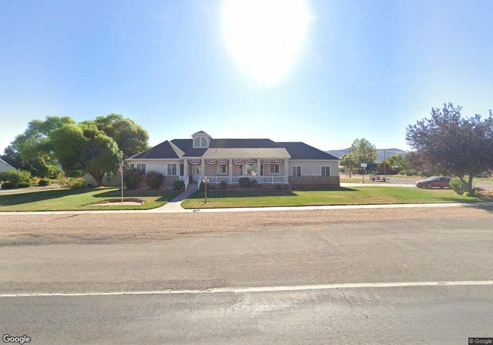
210 N Main St Kanosh, UT 84637
Estimated Value: $539,000 - $927,000
--
Bed
--
Bath
--
Sq Ft
0.82
Acres
About This Home
This home is located at 210 N Main St, Kanosh, UT 84637 and is currently estimated at $687,169. 210 N Main St is a home.
Ownership History
Date
Name
Owned For
Owner Type
Purchase Details
Closed on
May 29, 2020
Sold by
Black Ryan R
Bought by
Black Kerry James
Current Estimated Value
Home Financials for this Owner
Home Financials are based on the most recent Mortgage that was taken out on this home.
Original Mortgage
$225,000
Outstanding Balance
$198,562
Interest Rate
3.2%
Mortgage Type
New Conventional
Estimated Equity
$488,607
Purchase Details
Closed on
Apr 22, 2015
Sold by
Richard K Richard K
Bought by
Black Richard K and The Richard & Shirlene Black Family Tru
Purchase Details
Closed on
May 31, 2005
Sold by
Paxton Gail E and Paxton Carolyn
Bought by
Black Richard and Black Shirlene
Create a Home Valuation Report for This Property
The Home Valuation Report is an in-depth analysis detailing your home's value as well as a comparison with similar homes in the area
Home Values in the Area
Average Home Value in this Area
Purchase History
| Date | Buyer | Sale Price | Title Company |
|---|---|---|---|
| Black Kerry James | -- | None Available | |
| Coray Benjamin Qe | -- | First American Title | |
| Black Richard K | -- | Titan Title | |
| Black Richard K | -- | Titan Title | |
| Black Richard | -- | -- |
Source: Public Records
Mortgage History
| Date | Status | Borrower | Loan Amount |
|---|---|---|---|
| Open | Coray Benjamin Qe | $225,000 |
Source: Public Records
Tax History Compared to Growth
Tax History
| Year | Tax Paid | Tax Assessment Tax Assessment Total Assessment is a certain percentage of the fair market value that is determined by local assessors to be the total taxable value of land and additions on the property. | Land | Improvement |
|---|---|---|---|---|
| 2025 | $2,764 | $362,102 | $35,815 | $326,287 |
| 2024 | $2,764 | $383,038 | $25,653 | $357,385 |
| 2023 | $3,359 | $383,038 | $25,653 | $357,385 |
| 2022 | $2,523 | $237,033 | $20,522 | $216,511 |
| 2021 | $2,388 | $216,314 | $17,845 | $198,469 |
| 2020 | $2,120 | $193,962 | $27,458 | $166,504 |
| 2019 | $1,912 | $175,872 | $25,190 | $150,682 |
| 2018 | $1,857 | $174,978 | $22,900 | $152,078 |
| 2017 | $1,941 | $174,978 | $22,900 | $152,078 |
| 2016 | $1,758 | $165,329 | $17,175 | $148,154 |
| 2015 | $1,759 | $165,329 | $17,175 | $148,154 |
| 2014 | -- | $165,329 | $17,175 | $148,154 |
| 2013 | -- | $165,329 | $17,175 | $148,154 |
Source: Public Records
Map
Nearby Homes
- 135 E 200 N
- 115 W 200 S
- 58 E 300 South St
- 8610 S Highway 91
- 5098 W Hatton Rd
- Parcel # 8816
- 60 W Center St
- 50 N 100 Rd E
- 145 N 200 E
- 1565 W Sunflower Ln Unit 3
- 1615 W Sunflower Ln
- 1615 W Sunflower Ln Unit 4
- 1565 W Sunflower Ln
- 2000 N West Frontage I-15
- 0 Tbd Black Rock Rd Unit LotWP001
- 1100 S 725 Rd W
- 310 S 500 West Rd
- 190 W 400 St S
- 760 E 700 St S
- 155 E 500 St S