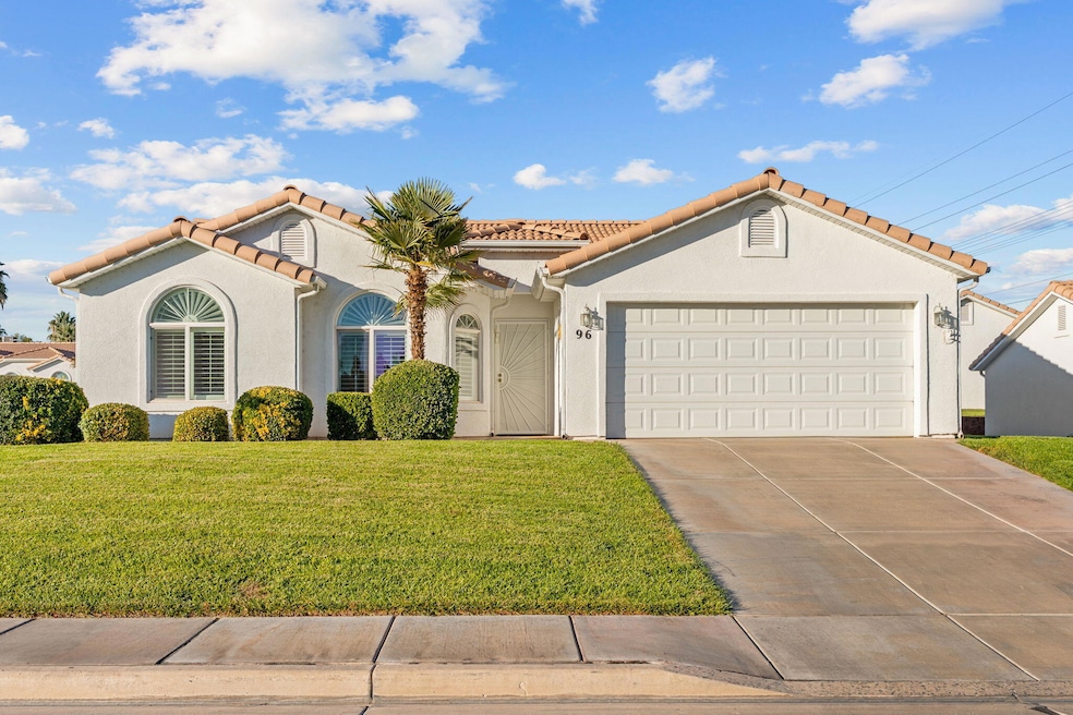
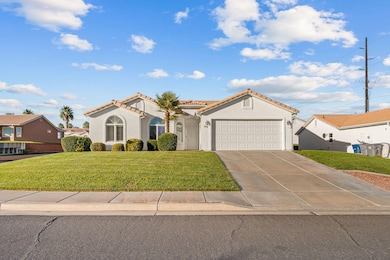
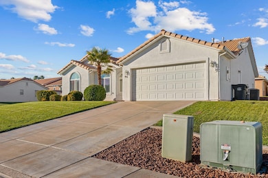
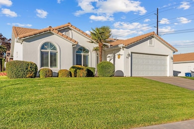
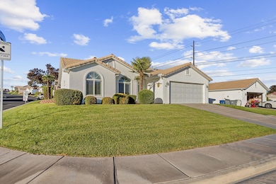
210 N Mall Dr Unit 96 Saint George, UT 84790
Estimated payment $2,090/month
Highlights
- Popular Property
- Vaulted Ceiling
- Covered Patio or Porch
- Active Adult
- Community Indoor Pool
- Attached Garage
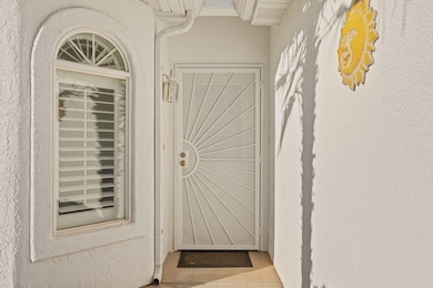
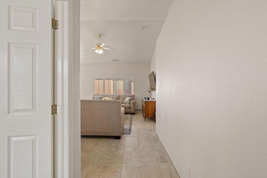
About This Home
Beautiful 3‑bedroom, 2‑bathroom home in the 55+ community of Santa Fe at Red Cliffs in St. George. Bright and welcoming, this residence features an open layout that feels spacious yet comfortable. The kitchen includes newer Bosch appliances, every window is fitted with shutters, tile flooring runs throughout, and outside you'll enjoy a charming patio with a gas line ready for BBQs — perfect for relaxed outdoor meals and entertaining. One of the bedrooms comes with a built‑in wall bed (Murphy‑style) — ideal for flexible use as a guest room or hobby/office space. Located just minutes from shopping, restaurants, entertainment and emergency care & hospitals, it's ideal for active adults who prefer convenience and a laid‑back lifestyle. *Informati information, including utilities, rental restrictions, and HOA details if applicable.*

Home Details
Home Type
- Single Family
Est. Annual Taxes
- $1,187
Year Built
- Built in 1999
Lot Details
- 2,614 Sq Ft Lot
- Landscaped
- Sprinkler System
HOA Fees
- $210 Monthly HOA Fees
Parking
- Attached Garage
- Garage Door Opener
Home Design
- Tile Roof
- Stucco Exterior
Interior Spaces
- 1,312 Sq Ft Home
- 1-Story Property
- Central Vacuum
- Vaulted Ceiling
- Ceiling Fan
- Double Pane Windows
Kitchen
- Free-Standing Range
- Microwave
- Bosch Dishwasher
- Dishwasher
- Disposal
Bedrooms and Bathrooms
- 3 Bedrooms
- Walk-In Closet
- 2 Bathrooms
Laundry
- Dryer
- Washer
Outdoor Features
- Covered Patio or Porch
- Exterior Lighting
Schools
- Panorama Elementary School
- Pine View Middle School
- Pine View High School
Utilities
- No Cooling
- Central Air
- Heating System Uses Natural Gas
Listing and Financial Details
- Assessor Parcel Number SG-SFRC-5-96
Community Details
Overview
- Active Adult
- Santa Fe At Red Cliffs Subdivision
Recreation
- Community Indoor Pool
- Community Spa
Map
Home Values in the Area
Average Home Value in this Area
Tax History
| Year | Tax Paid | Tax Assessment Tax Assessment Total Assessment is a certain percentage of the fair market value that is determined by local assessors to be the total taxable value of land and additions on the property. | Land | Improvement |
|---|---|---|---|---|
| 2025 | $1,215 | $180,290 | $44,000 | $136,290 |
| 2023 | $1,235 | $184,470 | $38,500 | $145,970 |
| 2022 | $1,329 | $186,725 | $38,500 | $148,225 |
| 2021 | $1,195 | $250,300 | $50,000 | $200,300 |
| 2020 | $1,942 | $210,800 | $50,000 | $160,800 |
| 2019 | $1,994 | $211,400 | $50,000 | $161,400 |
| 2018 | $1,866 | $180,300 | $0 | $0 |
| 2017 | $1,726 | $166,800 | $0 | $0 |
| 2016 | $1,767 | $157,900 | $0 | $0 |
| 2015 | $1,812 | $155,400 | $0 | $0 |
| 2014 | $1,705 | $147,100 | $0 | $0 |
Property History
| Date | Event | Price | List to Sale | Price per Sq Ft |
|---|---|---|---|---|
| 11/06/2025 11/06/25 | For Sale | $337,900 | -- | $258 / Sq Ft |
Purchase History
| Date | Type | Sale Price | Title Company |
|---|---|---|---|
| Interfamily Deed Transfer | -- | None Available | |
| Warranty Deed | -- | Southern Utah Title Co | |
| Warranty Deed | -- | Mountain View Ttl St George | |
| Interfamily Deed Transfer | -- | None Available | |
| Individual Deed | -- | None Available | |
| Interfamily Deed Transfer | -- | None Available | |
| Interfamily Deed Transfer | -- | None Available |
Source: Washington County Board of REALTORS®
MLS Number: 25-266561
APN: 0523772
Disclaimer: Certain information contained herein is derived from information provided by parties other than Homes.com. All information provided is deemed reliable, but is not guaranteed to be accurate and should be independently verified.
![]() All information should be verified by the recipient and none is guaranteed as accurate by ARMLS
All information should be verified by the recipient and none is guaranteed as accurate by ARMLS
Listing Information presented by local MLS brokerage: Ten-X, local REALTOR®- Arlene Richardson - (888)-952-6393
- 210 N Mall Dr Unit 46
- 210 N Mall Dr Unit 56
- 210 N Mall Dr Unit 86
- 9 S 2060 E
- 145 N Mall Dr Unit 57
- 145 N Mall Dr Unit 33
- 145 N Mall Dr Unit 59
- 2294 E 170 N
- 345 N 2450 E Unit 239
- 345 N 2450 E Unit 120
- 2144 E 220 Cir S
- 232 S Acantilado Cir
- 236 S 2020 Cir E
- 5664 S Carnelian Pkwy
- 2911 E Snowberry Dr Unit 56
- 2911 E Snowberry Dr
- 345 N 2450 E Unit 120
- 3 2450 St E Unit 3
- 84 N Eastridge Dr
- 2129 E 550 N
- 344 S 1990 E
- 368 S Mall Dr
- 2695 E 370 N
- 514 S 1990 E
- 1555 E Mead Ln
- 1551 E Mead Ln
- 2409 E Dinosaur Crossing Dr
- 2271 E Dinosaur Crossing Dr
- 277 S 1000 E
- 770 S 2780 E
- 997 Willow Breeze Ln
- 605 E Tabernacle St
- 1843 E 1220 S St
- 2349 S 240 W
- 175 S 400 E
- 325 S 200 E Unit 3
- 220 E 600 S
- 60 N 100th St W
- 543 S Main St
- 444 Sunland Dr