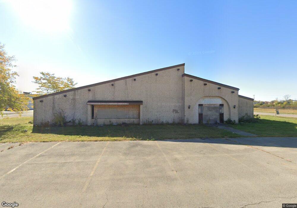
210 N Perkins St Appleton, WI 54914
Estimated Value: $671,300
--
Bed
--
Bath
30,918
Sq Ft
$22/Sq Ft
Est. Value
About This Home
This home is located at 210 N Perkins St, Appleton, WI 54914 and is currently priced at $671,300, approximately $21 per square foot. 210 N Perkins St is a home located in Outagamie County with nearby schools including Ronald C. Dunlap Elementary School, Wilson Middle School, and Appleton West High School.
Ownership History
Date
Name
Owned For
Owner Type
Purchase Details
Closed on
Apr 9, 2024
Sold by
Northern Hotel Motel Llc
Bought by
Northern Motel Hotel Llc
Current Estimated Value
Home Financials for this Owner
Home Financials are based on the most recent Mortgage that was taken out on this home.
Original Mortgage
$1,000,878
Interest Rate
6.87%
Mortgage Type
Construction
Purchase Details
Closed on
Jul 9, 2013
Sold by
Oum Santi Llc
Bought by
Northern Hotel Motel Llc
Purchase Details
Closed on
Aug 20, 2007
Sold by
Parvati Llc
Bought by
Oum Santi
Purchase Details
Closed on
Aug 18, 2007
Sold by
Santoshi Group Ltd
Bought by
Parvati Llc
Create a Home Valuation Report for This Property
The Home Valuation Report is an in-depth analysis detailing your home's value as well as a comparison with similar homes in the area
Home Values in the Area
Average Home Value in this Area
Purchase History
| Date | Buyer | Sale Price | Title Company |
|---|---|---|---|
| Northern Motel Hotel Llc | $1,259,100 | None Listed On Document | |
| Northern Hotel Motel Llc | $800,000 | -- | |
| Oum Santi | $750,000 | -- | |
| Parvati Llc | $1,350,000 | -- |
Source: Public Records
Mortgage History
| Date | Status | Borrower | Loan Amount |
|---|---|---|---|
| Closed | Northern Motel Hotel Llc | $1,000,878 |
Source: Public Records
Tax History Compared to Growth
Tax History
| Year | Tax Paid | Tax Assessment Tax Assessment Total Assessment is a certain percentage of the fair market value that is determined by local assessors to be the total taxable value of land and additions on the property. | Land | Improvement |
|---|---|---|---|---|
| 2024 | $4,850 | $158,400 | $122,400 | $36,000 |
| 2023 | $3,730 | $158,400 | $122,400 | $36,000 |
| 2022 | $2,851 | $144,900 | $108,900 | $36,000 |
| 2021 | $18,418 | $1,097,700 | $296,400 | $801,300 |
| 2020 | $18,865 | $1,097,700 | $296,400 | $801,300 |
| 2019 | $19,750 | $947,300 | $251,700 | $695,600 |
| 2018 | $18,432 | $947,300 | $251,700 | $695,600 |
| 2017 | $17,946 | $947,300 | $251,700 | $695,600 |
| 2016 | $17,543 | $947,300 | $251,700 | $695,600 |
| 2015 | $17,921 | $947,300 | $251,700 | $695,600 |
| 2014 | $17,867 | $948,500 | $243,600 | $704,900 |
| 2013 | $18,087 | $948,500 | $243,600 | $704,900 |
Source: Public Records
Map
Nearby Homes
- 20 Spencer Village Ct
- 83 Spencer Village Ct
- 62 Spencer Village Ct
- 65 Spencer Village Ct Unit 14
- 38 Spencer Village Ct Unit 1
- 1343 W Franklin St
- 825 S Olson Ave Unit F
- 1326 W Spencer St
- 1357 W Spring St
- 1119 W Lawrence St
- 1508 N Nicholas St
- 1223 W Summer St
- 511 S Mueller St
- 1400 W Prospect Ave
- 1017 W Lawrence St
- 1517 W Rogers Ave
- 1811 N Whitney Dr
- 1011 W Oklahoma St
- 1218 W Brewster St
- 912 W Winnebago St
- 2310 W College Ave
- 498 N Perkins St
- 1843 W Packard St
- 1835 W Packard St
- 1821 W Packard St
- 219 N Linwood Ave
- 227 N Linwood Ave
- 213 N Linwood Ave
- 1812 W Packard St
- 1806 W Packard St
- 529 N Linwood Ave
- 533 N Linwood Ave
- 523 N Linwood Ave
- 2118 W Spencer St
- 539 N Linwood Ave
- 504 N Linwood Ave
- 543 N Linwood Ave
- 2601 W College Ave
- 520 N Linwood Ave
- 549 N Linwood Ave