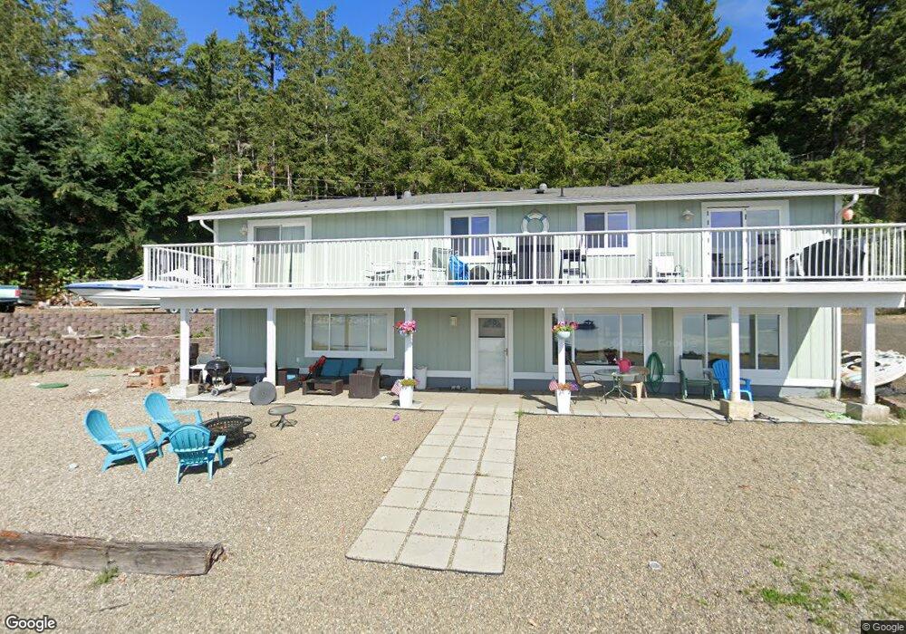
210 NE Sundstrom Rd Belfair, WA 98528
Estimated Value: $751,000 - $1,272,000
3
Beds
2
Baths
1,440
Sq Ft
$746/Sq Ft
Est. Value
About This Home
This home is located at 210 NE Sundstrom Rd, Belfair, WA 98528 and is currently estimated at $1,073,623, approximately $745 per square foot. 210 NE Sundstrom Rd is a home located in Mason County with nearby schools including North Mason Senior High School and Country Montessori School.
Ownership History
Date
Name
Owned For
Owner Type
Purchase Details
Closed on
Oct 6, 2024
Sold by
Pinyosri Patcharida
Bought by
Cummings Kent
Current Estimated Value
Purchase Details
Closed on
Jul 6, 2018
Sold by
Peterson Curtis D and Peterson Diane L
Bought by
Cummings Kent B and Pinyosri Patcharida
Home Financials for this Owner
Home Financials are based on the most recent Mortgage that was taken out on this home.
Original Mortgage
$520,000
Interest Rate
4.6%
Mortgage Type
New Conventional
Create a Home Valuation Report for This Property
The Home Valuation Report is an in-depth analysis detailing your home's value as well as a comparison with similar homes in the area
Home Values in the Area
Average Home Value in this Area
Purchase History
| Date | Buyer | Sale Price | Title Company |
|---|---|---|---|
| Cummings Kent | -- | None Listed On Document | |
| Cummings Kent B | $650,281 | Land Title Co |
Source: Public Records
Mortgage History
| Date | Status | Borrower | Loan Amount |
|---|---|---|---|
| Previous Owner | Cummings Kent B | $520,000 |
Source: Public Records
Tax History Compared to Growth
Tax History
| Year | Tax Paid | Tax Assessment Tax Assessment Total Assessment is a certain percentage of the fair market value that is determined by local assessors to be the total taxable value of land and additions on the property. | Land | Improvement |
|---|---|---|---|---|
| 2025 | $7,463 | $1,087,210 | $482,525 | $604,685 |
| 2023 | $7,463 | $1,166,865 | $813,625 | $353,240 |
| 2022 | $5,450 | $594,055 | $322,235 | $271,820 |
| 2021 | $5,217 | $594,055 | $322,235 | $271,820 |
| 2020 | $5,908 | $580,775 | $310,615 | $270,160 |
| 2018 | $2,042 | $494,820 | $277,280 | $217,540 |
| 2017 | $2,163 | $494,820 | $277,280 | $217,540 |
| 2016 | $2,148 | $470,405 | $261,585 | $208,820 |
| 2015 | $2,218 | $459,350 | $261,585 | $197,765 |
| 2014 | -- | $593,405 | $292,995 | $300,410 |
| 2013 | -- | $593,405 | $292,995 | $300,410 |
Source: Public Records
Map
Nearby Homes
- 4090 NE North Shore Rd
- 140 NE Rainier Place S
- 280 NE Beck Rd
- 17871 E State Route 106
- 80 E Rose Point Ln
- 190 NE Angove Place
- 591 NE Matthew Dr
- 0 E Ellinor Peak Place
- 0 E Katydid Ct
- 70 NE Wanda Ln
- 0 NE North Shore Rd Unit NWM2375952
- 0 NE North Shore Rd Unit NWM2347029
- 61 NE Wanda Ct
- 323 NE Barbara Blvd
- 191 NE Bryan Ln
- 321 NE Barbara Blvd
- 15931 E State Route 106
- 90 NE Burt Ct
- 323 E Alderwood Rd
- 0 E Greenberg Ln
- 151 NE Sundstrom Rd
- 0 NE Sundstrom Rd
- 0 L9&10 NE Sundstrom Rd
- 0 L9,10 NE Sundstrom Rd
- 121 NE Sundstrom Rd
- 4651 NE North Shore Rd
- 101 NE Sundstrom Rd
- 4670 NE North Shore Rd
- 71 NE Sundstrom Rd
- 4680 NE North Shore Rd
- 45 NE Sundstrom Rd
- 43 NE Sundstrom Rd
- 4710 NE North Shore Rd
- 47 NE Sundstrom Rd
- 41 NE Sundstrom Rd
- 4731 NE North Shore Rd
- 4730 NE North Shore Rd
- 4740 NE North Shore Rd
- 4750 NE North Shore Rd
- 4223 NE North Shore Rd