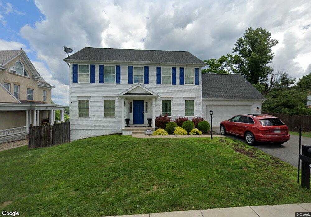
210 Newton Ave Bridgeport, WV 26330
Estimated Value: $367,000 - $506,000
4
Beds
3
Baths
3,995
Sq Ft
$115/Sq Ft
Est. Value
About This Home
This home is located at 210 Newton Ave, Bridgeport, WV 26330 and is currently estimated at $459,372, approximately $114 per square foot. 210 Newton Ave is a home with nearby schools including Heritage Christian School and Dollie Hilll Christian Academy.
Ownership History
Date
Name
Owned For
Owner Type
Purchase Details
Closed on
Feb 15, 2019
Sold by
Coburn Robert M and Coburn Patricia A
Bought by
Coburn Robert M and Coburn Amy M
Current Estimated Value
Home Financials for this Owner
Home Financials are based on the most recent Mortgage that was taken out on this home.
Original Mortgage
$210,700
Outstanding Balance
$184,488
Interest Rate
4.4%
Mortgage Type
Adjustable Rate Mortgage/ARM
Estimated Equity
$274,884
Purchase Details
Closed on
Jun 6, 2012
Sold by
Williamsburne Llc
Bought by
Coburn Robert M and Coburn Patricia A
Create a Home Valuation Report for This Property
The Home Valuation Report is an in-depth analysis detailing your home's value as well as a comparison with similar homes in the area
Home Values in the Area
Average Home Value in this Area
Purchase History
| Date | Buyer | Sale Price | Title Company |
|---|---|---|---|
| Coburn Robert M | $266,250 | None Available | |
| Coburn Robert M | -- | None Available |
Source: Public Records
Mortgage History
| Date | Status | Borrower | Loan Amount |
|---|---|---|---|
| Open | Coburn Robert M | $210,700 |
Source: Public Records
Tax History Compared to Growth
Tax History
| Year | Tax Paid | Tax Assessment Tax Assessment Total Assessment is a certain percentage of the fair market value that is determined by local assessors to be the total taxable value of land and additions on the property. | Land | Improvement |
|---|---|---|---|---|
| 2025 | $3,857 | $253,200 | $23,220 | $229,980 |
| 2024 | $3,857 | $235,680 | $23,220 | $212,460 |
| 2023 | $3,548 | $184,260 | $23,220 | $161,040 |
| 2022 | $2,810 | $182,820 | $23,220 | $159,600 |
| 2021 | $2,750 | $180,600 | $23,220 | $157,380 |
| 2020 | $2,697 | $178,440 | $23,220 | $155,220 |
| 2019 | $4,364 | $144,300 | $23,220 | $121,080 |
| 2018 | $4,297 | $142,620 | $23,220 | $119,400 |
| 2017 | $4,215 | $140,340 | $23,220 | $117,120 |
| 2016 | $4,109 | $138,120 | $23,220 | $114,900 |
| 2015 | $3,854 | $127,560 | $19,500 | $108,060 |
| 2014 | $3,745 | $124,080 | $17,640 | $106,440 |
Source: Public Records
Map
Nearby Homes
- 117 Newton Ave
- 119 Hill St
- 308 S Virginia Ave
- 420 Water St
- 216 Davisson St
- 220 Davisson St
- 102 W Philadelphia Ave
- 230 Grand Ave
- 422 Worthington Dr
- 303 Lexington Cir
- 428 James St
- 20 Meadow Ln
- 307 Pennsylvania Ave
- 224 Frisco Ln
- 210 Frisco Ln
- 113 Frisco Ln
- 111 Frisco Ln
- TBD Hinkle Lake Rd
- 406 Willis Ave
- 221 Broadway Ave