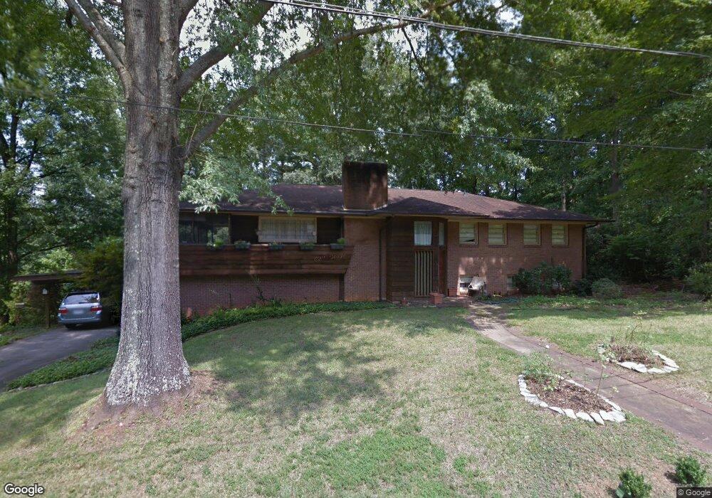
210 Northwestern Dr Morganton, NC 28655
Estimated Value: $328,000 - $429,000
5
Beds
3
Baths
2,829
Sq Ft
$134/Sq Ft
Est. Value
About This Home
This home is located at 210 Northwestern Dr, Morganton, NC 28655 and is currently estimated at $378,757, approximately $133 per square foot. 210 Northwestern Dr is a home located in Burke County with nearby schools including Hillcrest Elementary School, Walter R. Johnson Middle School, and Freedom High School.
Ownership History
Date
Name
Owned For
Owner Type
Purchase Details
Closed on
Jul 26, 2018
Sold by
Bevans Neal R
Bought by
Bevans Neal R and Bevans Nilsa
Current Estimated Value
Purchase Details
Closed on
May 19, 2008
Sold by
Fretz Ricci W and Fretz Susan H
Bought by
Bevans Neal R
Home Financials for this Owner
Home Financials are based on the most recent Mortgage that was taken out on this home.
Original Mortgage
$190,000
Outstanding Balance
$113,039
Interest Rate
4.75%
Mortgage Type
Purchase Money Mortgage
Estimated Equity
$265,718
Create a Home Valuation Report for This Property
The Home Valuation Report is an in-depth analysis detailing your home's value as well as a comparison with similar homes in the area
Home Values in the Area
Average Home Value in this Area
Purchase History
| Date | Buyer | Sale Price | Title Company |
|---|---|---|---|
| Bevans Neal R | -- | None Available | |
| Bevans Neal R | $190,000 | None Available |
Source: Public Records
Mortgage History
| Date | Status | Borrower | Loan Amount |
|---|---|---|---|
| Open | Bevans Neal R | $190,000 |
Source: Public Records
Tax History Compared to Growth
Tax History
| Year | Tax Paid | Tax Assessment Tax Assessment Total Assessment is a certain percentage of the fair market value that is determined by local assessors to be the total taxable value of land and additions on the property. | Land | Improvement |
|---|---|---|---|---|
| 2025 | $1,405 | $235,751 | $30,604 | $205,147 |
| 2024 | $1,413 | $235,751 | $30,604 | $205,147 |
| 2023 | $1,408 | $235,751 | $30,604 | $205,147 |
| 2022 | $1,545 | $210,441 | $30,604 | $179,837 |
| 2021 | $1,539 | $210,441 | $30,604 | $179,837 |
| 2020 | $1,535 | $210,441 | $30,604 | $179,837 |
| 2019 | $1,535 | $210,441 | $30,604 | $179,837 |
| 2018 | $1,417 | $193,490 | $30,604 | $162,886 |
| 2017 | $1,415 | $193,490 | $30,604 | $162,886 |
| 2016 | $1,381 | $193,490 | $30,604 | $162,886 |
| 2015 | $1,378 | $193,490 | $30,604 | $162,886 |
| 2014 | $1,376 | $193,490 | $30,604 | $162,886 |
| 2013 | $1,376 | $193,490 | $30,604 | $162,886 |
Source: Public Records
Map
Nearby Homes
- 105 Newland St
- 112A Wesley Dr Unit B
- 406 Lenoir St
- 209 Park St
- 710 Bouchelle St
- 718 E Union St
- 214 Howard St
- 404 Huffman St
- 0 N Green St
- 609 E Concord St
- 0 Setzer Dr
- 104 Belvedere Dr
- VL E Concord St
- 244 N Anderson St
- 118 W Union St Unit A
- 903 Independence Trail
- 231 Davis Dr
- 203 Beacon Ave
- 302 White St
- 218 Davis Dr
- 212 Northwestern Dr
- 211 Northwestern Dr
- 209 Northwestern Dr
- 206 Northwestern Dr
- 215 Northwest Dr
- 215 Northwestern Dr
- 207 Northwestern Dr
- 204 Northwestern Dr
- 204 Northwestern Dr Unit 17
- Vacant Lot Northwestern Dr
- 203 Northwestern Dr
- 211 Sherwood Place
- 0 Northwestern Dr
- 215 Sherwood Place
- 209 Sherwood Place
- 207 Sherwood Place
- 105 Furnifold St
- 417 Tate St
- 100 Furnifold St
- 216 Sherwood Place