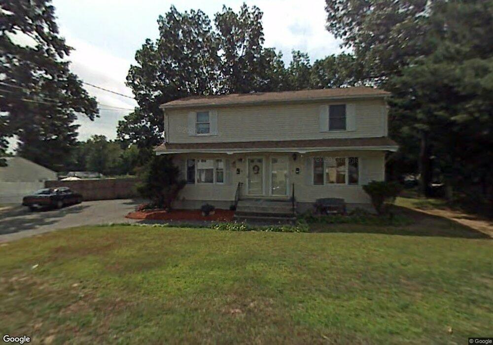
210 Nottingham St Unit 212 Springfield, MA 01104
Liberty Heights NeighborhoodEstimated Value: $329,752 - $391,000
4
Beds
2
Baths
1,728
Sq Ft
$215/Sq Ft
Est. Value
About This Home
This home is located at 210 Nottingham St Unit 212, Springfield, MA 01104 and is currently estimated at $371,438, approximately $214 per square foot. 210 Nottingham St Unit 212 is a home located in Hampden County with nearby schools including Mary O. Pottenger Elementary School, Van Sickle Academy, and Springfield Central High School.
Ownership History
Date
Name
Owned For
Owner Type
Purchase Details
Closed on
Jul 29, 2024
Sold by
Agyapong Yaw
Bought by
Achjrem Llc
Current Estimated Value
Purchase Details
Closed on
Jun 27, 1986
Bought by
Agyapong Yaw
Create a Home Valuation Report for This Property
The Home Valuation Report is an in-depth analysis detailing your home's value as well as a comparison with similar homes in the area
Home Values in the Area
Average Home Value in this Area
Purchase History
| Date | Buyer | Sale Price | Title Company |
|---|---|---|---|
| Achjrem Llc | -- | None Available | |
| Achjrem Llc | -- | None Available | |
| Agyapong Yaw | $112,000 | -- |
Source: Public Records
Mortgage History
| Date | Status | Borrower | Loan Amount |
|---|---|---|---|
| Previous Owner | Agyapong Yaw | $84,600 | |
| Previous Owner | Agyapong Yaw | $86,000 |
Source: Public Records
Tax History
| Year | Tax Paid | Tax Assessment Tax Assessment Total Assessment is a certain percentage of the fair market value that is determined by local assessors to be the total taxable value of land and additions on the property. | Land | Improvement |
|---|---|---|---|---|
| 2025 | $4,920 | $313,800 | $42,800 | $271,000 |
| 2024 | $4,468 | $278,200 | $42,800 | $235,400 |
| 2023 | $3,993 | $234,200 | $37,900 | $196,300 |
| 2022 | $3,676 | $195,300 | $35,300 | $160,000 |
| 2021 | $3,682 | $194,800 | $32,200 | $162,600 |
| 2020 | $3,560 | $182,300 | $32,200 | $150,100 |
| 2019 | $3,202 | $162,700 | $26,600 | $136,100 |
| 2018 | $2,580 | $131,100 | $26,600 | $104,500 |
| 2017 | $2,532 | $128,800 | $28,300 | $100,500 |
| 2016 | $2,432 | $123,700 | $28,300 | $95,400 |
| 2015 | $2,372 | $120,600 | $28,300 | $92,300 |
Source: Public Records
Map
Nearby Homes
- 52 Vadnais St
- 33 Drexel St
- 34 Savoy Ave Unit 36
- 9 Utica St
- 119 Littleton St
- 35 Merrimac Ave
- 27 Parallel St
- 28 Porter St
- 116 Stockman St
- 73 Melville
- 393 Saint James Ave
- 49 Upland St
- 148 Yale St
- 106 Amherst St
- 17 Stuyvesant St
- 491-493 Newbury St
- 59 Piedmont St
- 774-776 Liberty St
- 744-746 Carew St
- 107 Dartmouth St
- 200 Nottingham St
- 220 Nottingham St
- 205 Nottingham St Unit 207
- 211 Nottingham St
- 14 Pembroke Cir
- 219 Nottingham St
- 20 Pembroke Cir
- 197 Nottingham St Unit 199
- 197-199 Nottingham St
- 228 Nottingham St
- 194 Nottingham St
- 225 Nottingham St
- 57 Ellen St
- 5-7 Ellen St
- 6 Ellen St
- 20 Vadnais St
- 193 Nottingham St Unit 195
- 210 Middle St Unit 212
- 6 Pembroke Cir
- 198 Middle St Unit 200
Your Personal Tour Guide
Ask me questions while you tour the home.