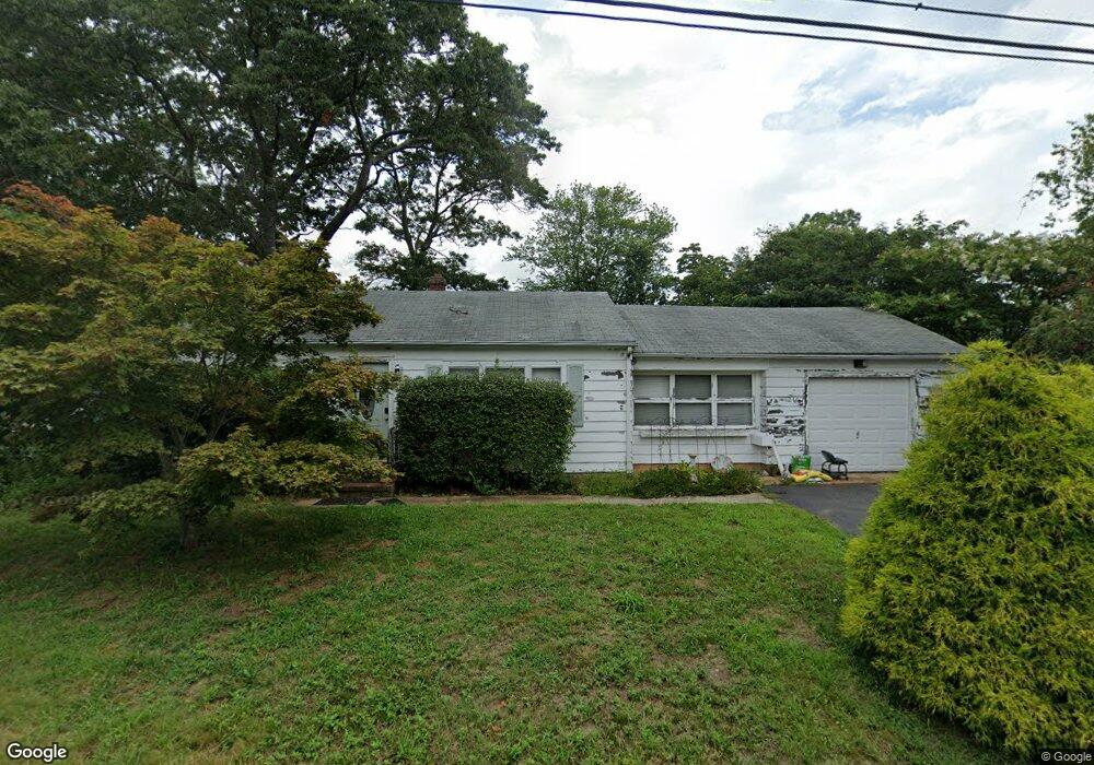
210 Ocean Ave Beachwood, NJ 08722
Estimated Value: $342,053 - $394,000
2
Beds
1
Bath
968
Sq Ft
$388/Sq Ft
Est. Value
About This Home
This home is located at 210 Ocean Ave, Beachwood, NJ 08722 and is currently estimated at $375,513, approximately $387 per square foot. 210 Ocean Ave is a home located in Ocean County with nearby schools including Ocean Academy and Ambassador Christian Academy.
Ownership History
Date
Name
Owned For
Owner Type
Purchase Details
Closed on
Sep 2, 2008
Sold by
Malvossi Vincent and Malvossi Eleanor
Bought by
Ellam Thomas
Current Estimated Value
Home Financials for this Owner
Home Financials are based on the most recent Mortgage that was taken out on this home.
Original Mortgage
$220,539
Outstanding Balance
$146,829
Interest Rate
6.54%
Mortgage Type
FHA
Estimated Equity
$228,684
Purchase Details
Closed on
Jun 17, 2005
Sold by
Liotti Denise and Lowery Ingrid H
Bought by
Malvossi Vincent
Home Financials for this Owner
Home Financials are based on the most recent Mortgage that was taken out on this home.
Original Mortgage
$177,625
Interest Rate
5.82%
Mortgage Type
FHA
Create a Home Valuation Report for This Property
The Home Valuation Report is an in-depth analysis detailing your home's value as well as a comparison with similar homes in the area
Home Values in the Area
Average Home Value in this Area
Purchase History
| Date | Buyer | Sale Price | Title Company |
|---|---|---|---|
| Ellam Thomas | $224,000 | First American Title Ins Co | |
| Malvossi Vincent | $234,000 | Old Republic National Title |
Source: Public Records
Mortgage History
| Date | Status | Borrower | Loan Amount |
|---|---|---|---|
| Open | Ellam Thomas | $220,539 | |
| Previous Owner | Malvossi Vincent | $177,625 |
Source: Public Records
Tax History Compared to Growth
Tax History
| Year | Tax Paid | Tax Assessment Tax Assessment Total Assessment is a certain percentage of the fair market value that is determined by local assessors to be the total taxable value of land and additions on the property. | Land | Improvement |
|---|---|---|---|---|
| 2025 | $4,617 | $159,000 | $82,000 | $77,000 |
| 2024 | $4,358 | $159,000 | $82,000 | $77,000 |
| 2023 | $4,207 | $159,000 | $82,000 | $77,000 |
| 2022 | $4,207 | $159,000 | $82,000 | $77,000 |
| 2021 | $4,080 | $159,000 | $82,000 | $77,000 |
| 2020 | $4,024 | $159,000 | $82,000 | $77,000 |
| 2019 | $3,840 | $159,000 | $82,000 | $77,000 |
| 2018 | $3,808 | $159,000 | $82,000 | $77,000 |
| 2017 | $3,738 | $159,000 | $82,000 | $77,000 |
| 2016 | $3,708 | $159,000 | $82,000 | $77,000 |
| 2015 | $3,971 | $216,900 | $138,000 | $78,900 |
| 2014 | $3,867 | $216,900 | $138,000 | $78,900 |
Source: Public Records
Map
Nearby Homes
- 226 Pennant Ave
- 63 Railroad Ave
- 236 Longboat Ave
- 200 Pacific Ave
- 240 Beachwood Blvd
- 400 Anchor Ave
- 301 Compass Ave
- 224 Tiller Ave
- 453 Cable Ave
- 637 Compass Ave
- 352 Halliard Ave
- 553 Mermaid Ave
- 55 Lakeview Dr
- 553 Ship Ave
- 352 Surf Ave
- 400 Surf Ave
- 501 Monument Rd
- 539 Mizzen Ave
- 645 Beachwood Blvd
- 453 Leeward Ave