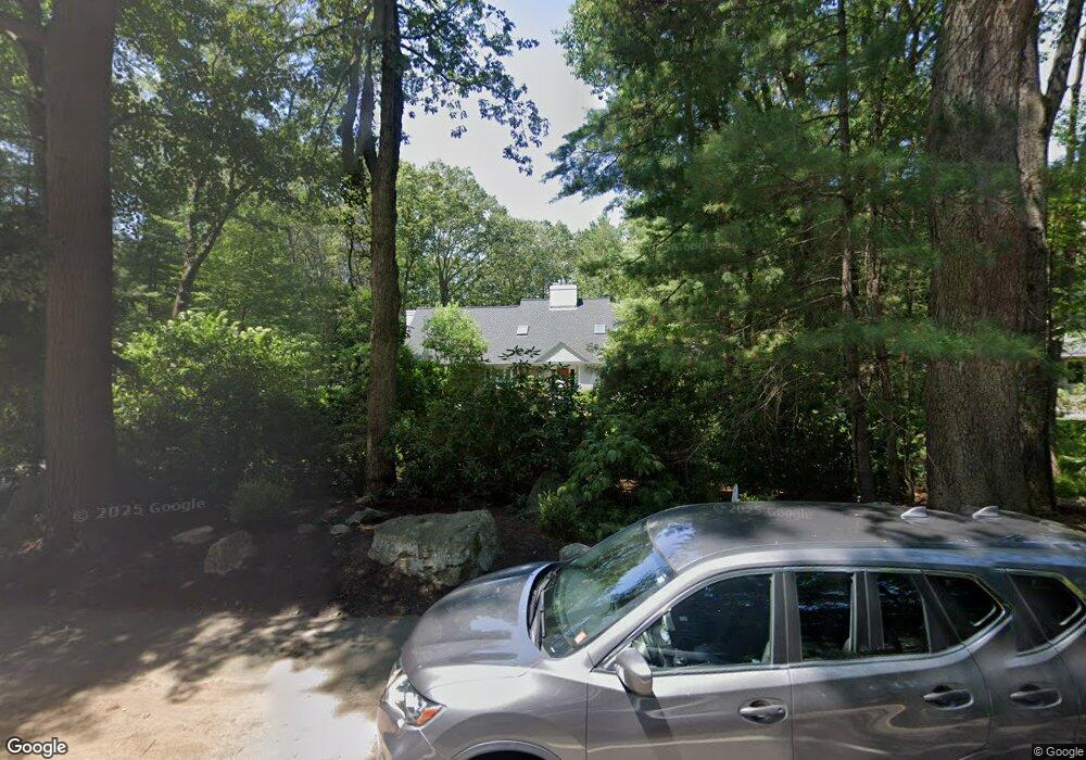
210 Old Pickard Rd Concord, MA 01742
Estimated Value: $1,625,000 - $2,189,000
3
Beds
3
Baths
3,516
Sq Ft
$505/Sq Ft
Est. Value
About This Home
This home is located at 210 Old Pickard Rd, Concord, MA 01742 and is currently estimated at $1,774,860, approximately $504 per square foot. 210 Old Pickard Rd is a home located in Middlesex County with nearby schools including Willard School, Concord Middle School, and Concord Carlisle High School.
Ownership History
Date
Name
Owned For
Owner Type
Purchase Details
Closed on
Aug 22, 1991
Sold by
Stonehenge Rt
Bought by
Adelman Burt A
Current Estimated Value
Create a Home Valuation Report for This Property
The Home Valuation Report is an in-depth analysis detailing your home's value as well as a comparison with similar homes in the area
Home Values in the Area
Average Home Value in this Area
Purchase History
| Date | Buyer | Sale Price | Title Company |
|---|---|---|---|
| Adelman Burt A | $403,000 | -- | |
| Adelman Burt A | $403,000 | -- |
Source: Public Records
Mortgage History
| Date | Status | Borrower | Loan Amount |
|---|---|---|---|
| Closed | Adelman Burt A | $115,000 | |
| Closed | Adelman Burt A | $199,400 | |
| Closed | Adelman Burt A | $201,000 |
Source: Public Records
Tax History
| Year | Tax Paid | Tax Assessment Tax Assessment Total Assessment is a certain percentage of the fair market value that is determined by local assessors to be the total taxable value of land and additions on the property. | Land | Improvement |
|---|---|---|---|---|
| 2025 | $204 | $1,536,000 | $637,700 | $898,300 |
| 2024 | $19,677 | $1,498,600 | $637,700 | $860,900 |
| 2023 | $18,626 | $1,437,200 | $599,700 | $837,500 |
| 2022 | $17,589 | $1,191,700 | $479,600 | $712,100 |
| 2021 | $15,711 | $1,067,300 | $410,400 | $656,900 |
| 2020 | $15,926 | $1,119,200 | $410,400 | $708,800 |
| 2019 | $14,626 | $1,030,700 | $398,500 | $632,200 |
| 2018 | $14,397 | $1,007,500 | $399,200 | $608,300 |
| 2017 | $14,515 | $1,031,600 | $380,200 | $651,400 |
| 2016 | $13,827 | $993,300 | $380,200 | $613,100 |
| 2015 | $13,008 | $910,300 | $352,000 | $558,300 |
Source: Public Records
Map
Nearby Homes
- 1201 Old Marlboro Rd
- 2 Skyview Ln
- 42 Dakin Rd
- 56 Seymour St
- 367 Powder Mill Rd
- 32 Bolton St
- 40 Rookery Ln Unit 5
- 72 Rookery Ln Unit 3
- 132 Williams Rd
- 401 Emery Ln Unit 304
- 89 Mattison Dr
- 56 Rookery Ln Unit 4
- 108 Hawks Perch Unit 108
- 8 Snowberry Ln
- 96 Forest Ridge Rd Unit 96
- 100 Harrington Ave
- 1844 Main St Unit 1844
- 850 Old Road to 9 Acre Corner
- 57 Longfellow Rd
- 53 Prairie St
- 194 Old Pickard Rd
- 230 Old Pickard Rd
- 220 Old Pickard Rd
- 176 Old Pickard Rd
- 201 Old Pickard Rd
- 246 Old Pickard Rd
- 219 Old Pickard Rd
- 23 Deer Grass Ln
- 243 Old Pickard Rd
- 185 Old Pickard Rd
- 256 Old Pickard Rd
- 150 Old Pickard Rd
- 266 Old Pickard Rd
- 159 Old Pickard Rd
- 33 Deer Grass Ln
- 12 Deer Grass Ln
- 49 Deer Grass Ln
- 282 Old Pickard Rd
- 1303 Old Marlboro Rd
- 32 Deer Grass Ln
Your Personal Tour Guide
Ask me questions while you tour the home.