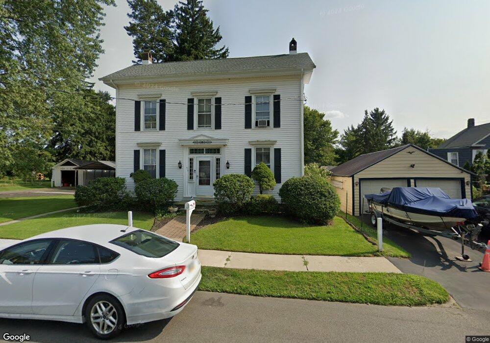
210 Paul St Belvidere, NJ 07823
Estimated Value: $335,152 - $367,000
Studio
--
Bath
1,728
Sq Ft
$201/Sq Ft
Est. Value
About This Home
This home is located at 210 Paul St, Belvidere, NJ 07823 and is currently estimated at $347,288, approximately $200 per square foot. 210 Paul St is a home located in Warren County with nearby schools including Belvidere Elementary School, Third Street Elementary School, and Belvidere High School.
Ownership History
Date
Name
Owned For
Owner Type
Purchase Details
Closed on
May 21, 1999
Sold by
Keenan Thomas J and Keenan Christine M
Bought by
Cook Mark Allen and Cook Denise Gloria
Current Estimated Value
Home Financials for this Owner
Home Financials are based on the most recent Mortgage that was taken out on this home.
Original Mortgage
$127,301
Outstanding Balance
$32,457
Interest Rate
6.88%
Mortgage Type
FHA
Estimated Equity
$314,831
Create a Home Valuation Report for This Property
The Home Valuation Report is an in-depth analysis detailing your home's value as well as a comparison with similar homes in the area
Home Values in the Area
Average Home Value in this Area
Purchase History
| Date | Buyer | Sale Price | Title Company |
|---|---|---|---|
| Cook Mark Allen | $140,000 | -- |
Source: Public Records
Mortgage History
| Date | Status | Borrower | Loan Amount |
|---|---|---|---|
| Open | Cook Mark Allen | $127,301 |
Source: Public Records
Tax History
| Year | Tax Paid | Tax Assessment Tax Assessment Total Assessment is a certain percentage of the fair market value that is determined by local assessors to be the total taxable value of land and additions on the property. | Land | Improvement |
|---|---|---|---|---|
| 2025 | $8,616 | $270,700 | $62,000 | $208,700 |
| 2024 | $8,332 | $270,700 | $62,000 | $208,700 |
Source: Public Records
Map
Nearby Homes
- 15 Fisk St
- 121 Wall St
- 119 Wall St
- 54 Front St
- 329 Water St
- 5-7 Vannatta Place
- 19 Adams St
- 608 3rd St
- 0 Oxford St
- 17 Frelinghuysen St
- 2 Homestead Ct Unit 2
- 95 Kensington Cir Unit 95
- 29 Stafford Ln Unit 29
- 17 Stafford Ln Unit 17
- 107 Kensington Cir Unit 107
- 56 Kensington Cir Unit 56
- 41 Victoria Dr Unit 41
- 2 Stafford Ln Unit 21
- 6 Weybourne Ln Unit 6
- 6015 Brookfield Glen Dr Unit 15
Your Personal Tour Guide
Ask me questions while you tour the home.