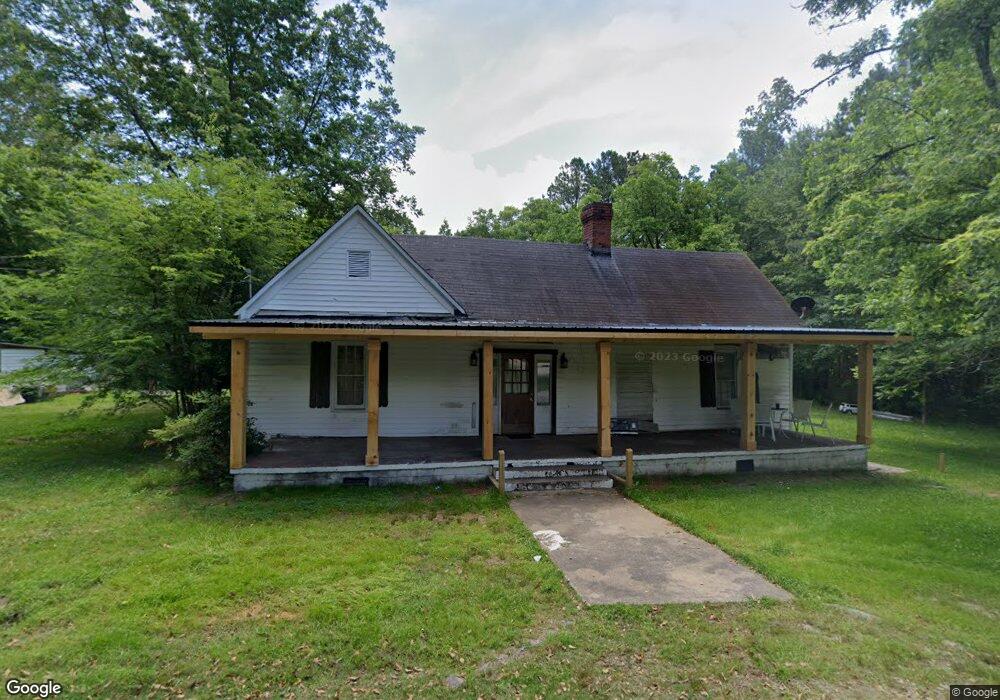
210 Powers St Union Point, GA 30669
Estimated Value: $99,000 - $151,000
3
Beds
2
Baths
1,216
Sq Ft
$104/Sq Ft
Est. Value
About This Home
This home is located at 210 Powers St, Union Point, GA 30669 and is currently estimated at $126,570, approximately $104 per square foot. 210 Powers St is a home located in Greene County with nearby schools including Greene County High School.
Ownership History
Date
Name
Owned For
Owner Type
Purchase Details
Closed on
Sep 27, 2018
Sold by
Milledge Avenue Development Llc
Bought by
Raudales Javier D Aparicio and Aparicio Kayla Eleen
Current Estimated Value
Home Financials for this Owner
Home Financials are based on the most recent Mortgage that was taken out on this home.
Original Mortgage
$29,845
Outstanding Balance
$13,830
Interest Rate
4.16%
Estimated Equity
$112,740
Purchase Details
Closed on
Apr 28, 2016
Sold by
Nunn Michael Ervin
Bought by
Develpomen W D Milledge Avenue
Purchase Details
Closed on
Jan 29, 2015
Sold by
Develo W D Milledge Avenue
Bought by
Nunn Michael Ervin
Home Financials for this Owner
Home Financials are based on the most recent Mortgage that was taken out on this home.
Original Mortgage
$37,750
Interest Rate
3.94%
Mortgage Type
New Conventional
Purchase Details
Closed on
Feb 1, 2004
Sold by
W/D Milledge Ave Dev-See Comm
Bought by
Milledge Milledge W and Milledge Ave D
Purchase Details
Closed on
Nov 12, 2003
Sold by
Branch Banking & Trust Co
Bought by
W/D Milledge Ave Dev-See Comm
Purchase Details
Closed on
Nov 4, 2003
Sold by
Ogeechee Properties Inc
Bought by
Branch Banking & Trust Co
Purchase Details
Closed on
Apr 10, 2001
Sold by
Mccoy Robin M
Bought by
Ogeechee Properties Inc
Purchase Details
Closed on
Apr 9, 2001
Sold by
Mccoy Charles Daniel and Mccoy Robin
Bought by
Mccoy Robin M
Purchase Details
Closed on
Aug 22, 1995
Sold by
Rainey Sarah Virginia
Bought by
Mccoy Charles Daniel and Mccoy Robin
Purchase Details
Closed on
Apr 14, 1995
Sold by
Rainey Ben L and Rainey Conley D
Bought by
Rainey Sarah Virginia
Purchase Details
Closed on
Sep 30, 1994
Sold by
Rainey Ben L
Bought by
Rainey Ben L and Rainey Conley D
Purchase Details
Closed on
Jan 1, 1966
Bought by
Rainey Ben L
Create a Home Valuation Report for This Property
The Home Valuation Report is an in-depth analysis detailing your home's value as well as a comparison with similar homes in the area
Purchase History
| Date | Buyer | Sale Price | Title Company |
|---|---|---|---|
| Raudales Javier D Aparicio | $32,500 | -- | |
| Develpomen W D Milledge Avenue | -- | -- | |
| Nunn Michael Ervin | $37,750 | -- | |
| Milledge Milledge W | -- | -- | |
| W/D Milledge Ave Dev-See Comm | $21,000 | -- | |
| Branch Banking & Trust Co | -- | -- | |
| Ogeechee Properties Inc | $22,000 | -- | |
| Mccoy Robin M | -- | -- | |
| Mccoy Charles Daniel | $13,000 | -- | |
| Rainey Sarah Virginia | -- | -- | |
| Rainey Ben L | -- | -- | |
| Rainey Ben L | -- | -- |
Source: Public Records
Mortgage History
| Date | Status | Borrower | Loan Amount |
|---|---|---|---|
| Open | Raudales Javier D Aparicio | $29,845 | |
| Previous Owner | Nunn Michael Ervin | $37,750 |
Source: Public Records
Tax History
| Year | Tax Paid | Tax Assessment Tax Assessment Total Assessment is a certain percentage of the fair market value that is determined by local assessors to be the total taxable value of land and additions on the property. | Land | Improvement |
|---|---|---|---|---|
| 2025 | $845 | $27,160 | $5,160 | $22,000 |
| 2024 | $795 | $25,120 | $5,160 | $19,960 |
| 2023 | $782 | $25,160 | $5,160 | $20,000 |
| 2022 | $575 | $23,400 | $5,160 | $18,240 |
| 2021 | $561 | $21,520 | $5,160 | $16,360 |
| 2020 | $392 | $11,240 | $2,680 | $8,560 |
| 2019 | $401 | $11,240 | $2,680 | $8,560 |
| 2018 | $262 | $11,240 | $2,680 | $8,560 |
| 2017 | $360 | $11,290 | $2,700 | $8,590 |
| 2016 | $371 | $11,645 | $2,700 | $8,945 |
| 2015 | $341 | $11,645 | $2,700 | $8,945 |
| 2014 | $354 | $12,034 | $2,700 | $9,334 |
Source: Public Records
Map
Nearby Homes
- 509 Carlton Ave
- 1160 Moody St
- 202 Veazey St
- 405 Crawfordville Rd
- 1241 Old Siloam Rd
- 0 Woodland Ct Unit 10543600
- 5401 Union Point Hwy
- 324 N Rhodes St
- 1201 Buffalo Lick Rd
- 0 Buffalo Lick Rd Unit 10551234
- 0 Buffalo Lick Rd Unit 10551325
- 1581 Highway 77 S
- 215 Hunter St
- 1581 Highway 77 S Hwy
- 1071 Alexander St
- 000 Washington Hwy
- 0 Washington Hwy Unit 10686255
- 1251 Brick House Rd
- 1251 Brickhouse Rd
- 1251 Adams Rd
- 208 Powers St
- 103 Wotton Ave
- 206 Powers St
- 105 Wotton Ave
- 104 Wotton Ave
- 204 Powers St
- 107 Wotton Ave
- 202 Powers St
- 106 Wotton Ave
- 109 Wotton Ave Unit 2
- 109 Wotton Ave
- 5081 Lamb Ave
- 5091 Lamb Ave
- 111 Wotton Ave
- 33 ac Union Point Hwy
- 5111 Lamb Ave
- 200 Wotton Ave
- 5020 Lamb Ave
- 5141 Lamb Ave
- 202 Wotton Ave
Your Personal Tour Guide
Ask me questions while you tour the home.