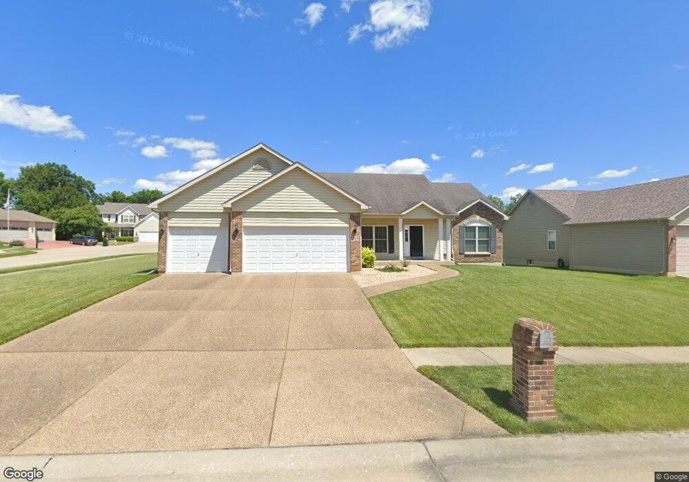
210 Ranger Rd Foristell, MO 63348
Estimated Value: $362,431 - $405,000
3
Beds
2
Baths
1,704
Sq Ft
$225/Sq Ft
Est. Value
About This Home
This home is located at 210 Ranger Rd, Foristell, MO 63348 and is currently estimated at $383,858, approximately $225 per square foot. 210 Ranger Rd is a home located in St. Charles County with nearby schools including Wabash Elementary.
Ownership History
Date
Name
Owned For
Owner Type
Purchase Details
Closed on
Dec 5, 2005
Sold by
Lucas Homes Llc
Bought by
Maher Scott and Maher April
Current Estimated Value
Home Financials for this Owner
Home Financials are based on the most recent Mortgage that was taken out on this home.
Original Mortgage
$182,200
Outstanding Balance
$97,253
Interest Rate
5.62%
Mortgage Type
Fannie Mae Freddie Mac
Estimated Equity
$286,605
Create a Home Valuation Report for This Property
The Home Valuation Report is an in-depth analysis detailing your home's value as well as a comparison with similar homes in the area
Home Values in the Area
Average Home Value in this Area
Purchase History
| Date | Buyer | Sale Price | Title Company |
|---|---|---|---|
| Maher Scott | $227,757 | Emmons Title |
Source: Public Records
Mortgage History
| Date | Status | Borrower | Loan Amount |
|---|---|---|---|
| Open | Maher Scott | $182,200 |
Source: Public Records
Tax History
| Year | Tax Paid | Tax Assessment Tax Assessment Total Assessment is a certain percentage of the fair market value that is determined by local assessors to be the total taxable value of land and additions on the property. | Land | Improvement |
|---|---|---|---|---|
| 2025 | $4,380 | $68,253 | -- | -- |
| 2023 | $4,380 | $63,317 | $0 | $0 |
| 2022 | $3,672 | $49,388 | $0 | $0 |
| 2021 | $3,675 | $49,388 | $0 | $0 |
| 2020 | $3,647 | $46,987 | $0 | $0 |
| 2019 | $3,407 | $46,987 | $0 | $0 |
| 2018 | $2,999 | $39,389 | $0 | $0 |
| 2017 | $2,999 | $39,389 | $0 | $0 |
| 2016 | $2,915 | $36,639 | $0 | $0 |
| 2015 | $2,881 | $36,639 | $0 | $0 |
| 2014 | $2,483 | $33,485 | $0 | $0 |
Source: Public Records
Map
Nearby Homes
- 401 Sceptre Rd
- 615 Courageous Ln
- 612 Courageous Ln
- 1033 Westhaven Blvd
- 3701 Bedford Pointe Ct
- 2 Ashford at Westhaven
- 1032 Westhaven Blvd
- 1030 Westhaven Blvd
- 1021 Westhaven Blvd
- 3 Sterling at Westhaven
- 2 Aspen II at Westhaven
- 1019 Westhaven Blvd
- 3503 Bedford Falls Ct S
- 3 Royal II at Westhaven
- 1016 Westhaven Blvd
- 1014 Westhaven Blvd
- 2 Berwick at Westhaven
- 2 Aspen at Westhaven
- 211 Turning Mill Dr
- 0 Unknown Unit MIS25074486
Your Personal Tour Guide
Ask me questions while you tour the home.