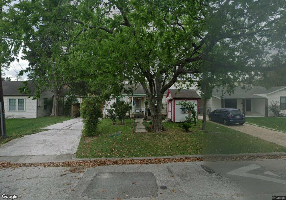
210 Robert Lee Rd Unit LEE Houston, TX 77009
Northside Village NeighborhoodEstimated Value: $264,241 - $528,000
3
Beds
2
Baths
1,918
Sq Ft
$203/Sq Ft
Est. Value
About This Home
This home is located at 210 Robert Lee Rd Unit LEE, Houston, TX 77009 and is currently estimated at $389,060, approximately $202 per square foot. 210 Robert Lee Rd Unit LEE is a home located in Harris County with nearby schools including Jefferson Elementary School, Marshall Middle, and Northside High School.
Ownership History
Date
Name
Owned For
Owner Type
Purchase Details
Closed on
Jun 12, 1998
Sold by
Carmona Enrique and Carmona Oralia
Bought by
Castaneda Raul H and Castaneda Guillerma B
Current Estimated Value
Home Financials for this Owner
Home Financials are based on the most recent Mortgage that was taken out on this home.
Original Mortgage
$78,551
Outstanding Balance
$15,879
Interest Rate
7.17%
Mortgage Type
FHA
Estimated Equity
$373,181
Create a Home Valuation Report for This Property
The Home Valuation Report is an in-depth analysis detailing your home's value as well as a comparison with similar homes in the area
Home Values in the Area
Average Home Value in this Area
Purchase History
| Date | Buyer | Sale Price | Title Company |
|---|---|---|---|
| Castaneda Raul H | -- | Texas American Title Company |
Source: Public Records
Mortgage History
| Date | Status | Borrower | Loan Amount |
|---|---|---|---|
| Open | Castaneda Raul H | $78,551 | |
| Closed | Castaneda Raul H | $3,500 |
Source: Public Records
Tax History Compared to Growth
Tax History
| Year | Tax Paid | Tax Assessment Tax Assessment Total Assessment is a certain percentage of the fair market value that is determined by local assessors to be the total taxable value of land and additions on the property. | Land | Improvement |
|---|---|---|---|---|
| 2025 | $89 | $255,216 | $126,149 | $129,067 |
| 2024 | $89 | $294,990 | $126,149 | $168,841 |
| 2023 | $89 | $305,129 | $126,149 | $178,980 |
| 2022 | $5,000 | $255,463 | $108,834 | $146,629 |
| 2021 | $4,811 | $235,215 | $108,834 | $126,381 |
| 2020 | $4,544 | $211,553 | $108,834 | $102,719 |
| 2019 | $4,317 | $190,652 | $108,834 | $81,818 |
| 2018 | $560 | $175,773 | $89,046 | $86,727 |
| 2017 | $3,565 | $175,773 | $89,046 | $86,727 |
| 2016 | $3,241 | $172,639 | $84,099 | $88,540 |
| 2015 | $691 | $168,234 | $71,732 | $96,502 |
| 2014 | $691 | $105,927 | $49,470 | $56,457 |
Source: Public Records
Map
Nearby Homes
- 213 Sylvester Rd
- 119 Sylvester Rd
- 5510 Fulton St
- 408 Robert Lee Rd
- 5907 Nancy Ann St
- 5511 Enid St
- 5715 Enid St
- 105 Delaney St
- 316 English St
- 317 Avenue of Oaks St
- 1511 Cordell St
- 1737 Tabor St
- 1833 Tabor St
- 1611 Sylvester Rd
- 1607 Sylvester Rd
- 1603 Sylvester Rd
- 1638 Tabor St
- 307 Gale St
- 216 Gale St
- 1630 1/2 Tabor St
- 206 Robert Lee Rd
- 204 Robert Lee Rd
- 216 Robert Lee Rd
- 5414 Angelo St
- 202 Robert Lee Rd
- 5413 Angelo St
- 5410 Angelo St
- 5413 Karcher St
- 309 Eichwurzel Ln
- 211 Eichwurzel Ln
- 304 Robert Lee Rd
- 321 Eichwurzel Ln
- 5409 Angelo St
- 205 Eichwurzel Ln
- 112 Robert Lee Rd
- 5409 Karcher St
- 323 Eichwurzel Ln
- 5406 Angelo St
- 325 Eichwurzel Ln
- 5405 Angelo St