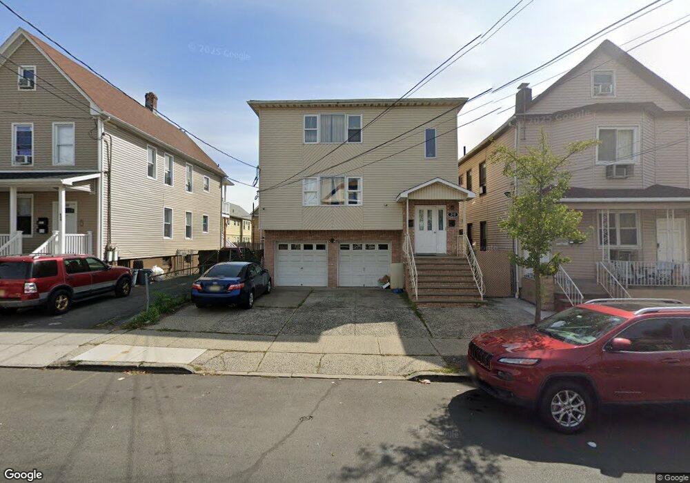
210 S 5th St Unit 212 Elizabethport, NJ 07206
Peters NeighborhoodEstimated Value: $754,000 - $968,000
--
Bed
--
Bath
3,024
Sq Ft
$286/Sq Ft
Est. Value
About This Home
This home is located at 210 S 5th St Unit 212, Elizabethport, NJ 07206 and is currently estimated at $865,574, approximately $286 per square foot. 210 S 5th St Unit 212 is a home located in Union County with nearby schools including Number 15, Christopher Columbus Elementary School and Elizabeth High School.
Ownership History
Date
Name
Owned For
Owner Type
Purchase Details
Closed on
Jul 20, 1999
Sold by
Brito John and Pires Jack
Bought by
Gonzalez Antonio and Gonzalez Dila
Current Estimated Value
Purchase Details
Closed on
Apr 30, 1998
Sold by
Brito John and Pires Jack
Bought by
Brito John and Pires Jack
Purchase Details
Closed on
Feb 25, 1998
Sold by
Tuccillo Giovanni and Tuccillo John
Bought by
Brito John and Pires Jack
Home Financials for this Owner
Home Financials are based on the most recent Mortgage that was taken out on this home.
Original Mortgage
$164,800
Interest Rate
6.87%
Create a Home Valuation Report for This Property
The Home Valuation Report is an in-depth analysis detailing your home's value as well as a comparison with similar homes in the area
Home Values in the Area
Average Home Value in this Area
Purchase History
| Date | Buyer | Sale Price | Title Company |
|---|---|---|---|
| Gonzalez Antonio | $240,000 | -- | |
| Brito John | -- | -- | |
| Brito John | $206,000 | Commonwealth Land Title Ins |
Source: Public Records
Mortgage History
| Date | Status | Borrower | Loan Amount |
|---|---|---|---|
| Previous Owner | Brito John | $164,800 |
Source: Public Records
Tax History Compared to Growth
Tax History
| Year | Tax Paid | Tax Assessment Tax Assessment Total Assessment is a certain percentage of the fair market value that is determined by local assessors to be the total taxable value of land and additions on the property. | Land | Improvement |
|---|---|---|---|---|
| 2025 | $12,620 | $655,900 | $172,000 | $483,900 |
| 2024 | $17,349 | $655,900 | $172,000 | $483,900 |
| 2023 | $17,349 | $55,200 | $12,500 | $42,700 |
| 2022 | $16,880 | $55,200 | $12,500 | $42,700 |
| 2021 | $16,531 | $55,200 | $12,500 | $42,700 |
| 2020 | $16,158 | $55,200 | $12,500 | $42,700 |
| 2019 | $15,911 | $55,200 | $12,500 | $42,700 |
| 2018 | $15,756 | $55,200 | $12,500 | $42,700 |
| 2017 | $15,316 | $55,200 | $12,500 | $42,700 |
| 2016 | $15,317 | $55,200 | $12,500 | $42,700 |
| 2015 | $14,407 | $55,200 | $12,500 | $42,700 |
| 2014 | $13,974 | $55,200 | $12,500 | $42,700 |
Source: Public Records
Map
Nearby Homes
- 433 3rd Ave
- 313 Loomis St
- 232 Niles St
- 234 Niles St
- 31 Spencer St
- 315 S 5th St
- 28 Niles St
- 220 Palmer St
- 325 Spencer St
- 221 Palmer St
- 227 Palmer St
- 566 2nd Ave
- 316-318 John St
- 234 Lt Glenn Zamorski Dr Unit G
- 429 Niles St Unit 431
- 225 Delaware St
- 230 Christine St Unit 32
- 620-622 Elizabeth Ave
- 336 John St Unit 340
- 216 Delaware St
- 208 S 5th St Unit 210
- 214 S 5th St
- 206 S 5th St
- 216 S 5th St Unit 218
- 204 S 5th St
- 220 S 5th St
- 211-PT Loomis St
- 202 S 5th St
- 207 Loomis St Unit 209
- 211 Loomis St
- 222 S 5th St
- 217 Loomis St
- 219 Loomis St
- 219 Loomis St Unit 2
- 211-213 S 5th St
- 219 Loomis St-1st Flr Unit 1
- 200 S 5th St
- 205 Loomis St
- 213-215 S 5th St Unit 1
- 213-215 S 5th St Unit 2