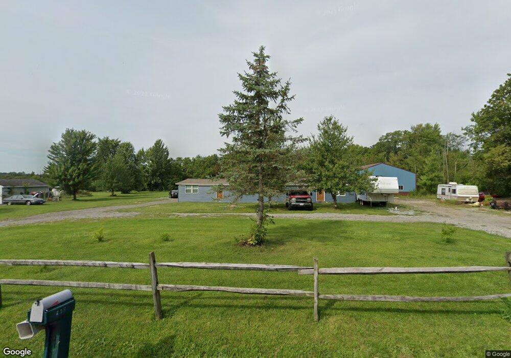
210 S Pevee Rd Harrod, OH 45850
Estimated Value: $306,797 - $330,000
5
Beds
4
Baths
2,080
Sq Ft
$153/Sq Ft
Est. Value
About This Home
This home is located at 210 S Pevee Rd, Harrod, OH 45850 and is currently estimated at $318,399, approximately $153 per square foot. 210 S Pevee Rd is a home located in Allen County with nearby schools including Allen East Elementary School, Allen East Middle School, and Allen East High School.
Ownership History
Date
Name
Owned For
Owner Type
Purchase Details
Closed on
Mar 7, 2011
Sold by
Rowe Angela E
Bought by
Rowe Tex K
Current Estimated Value
Purchase Details
Closed on
Feb 28, 2011
Sold by
Rowe Tex K and Rowe Angela E
Bought by
Rowe Tex K
Purchase Details
Closed on
Nov 10, 1992
Bought by
Rowe Tex K
Create a Home Valuation Report for This Property
The Home Valuation Report is an in-depth analysis detailing your home's value as well as a comparison with similar homes in the area
Home Values in the Area
Average Home Value in this Area
Purchase History
| Date | Buyer | Sale Price | Title Company |
|---|---|---|---|
| Rowe Tex K | -- | Attorney | |
| Rowe Tex K | -- | Attorney | |
| Rowe Tex K | -- | Attorney | |
| Rowe Tex K | $51,500 | -- |
Source: Public Records
Tax History Compared to Growth
Tax History
| Year | Tax Paid | Tax Assessment Tax Assessment Total Assessment is a certain percentage of the fair market value that is determined by local assessors to be the total taxable value of land and additions on the property. | Land | Improvement |
|---|---|---|---|---|
| 2024 | $2,916 | $83,480 | $10,960 | $72,520 |
| 2023 | $2,425 | $63,740 | $8,370 | $55,370 |
| 2022 | $2,400 | $62,590 | $8,370 | $54,220 |
| 2021 | $2,401 | $62,590 | $8,370 | $54,220 |
| 2020 | $1,827 | $57,050 | $7,770 | $49,280 |
| 2019 | $1,827 | $46,760 | $7,770 | $38,990 |
| 2018 | $1,510 | $38,850 | $7,770 | $31,080 |
| 2017 | $1,342 | $33,500 | $7,770 | $25,730 |
| 2016 | $1,018 | $25,410 | $7,770 | $17,640 |
| 2015 | $1,156 | $25,410 | $7,770 | $17,640 |
| 2014 | $1,156 | $27,940 | $7,390 | $20,550 |
| 2013 | $1,125 | $27,940 | $7,390 | $20,550 |
Source: Public Records
Map
Nearby Homes
- 000 Phillips Rd
- 6782 County Road 15
- 200 S Main St
- 118 E Main St
- 312 S Woodlawn Ave
- 2327 N Phillips Rd
- 647 Fisher Rd
- 4071 Township Road 35
- 900 N Front St
- 663 N Mcclure Rd
- 203 Belmont St
- 2864 Ohio 309
- 7165 Faulkner Rd
- 623 S Gilbert St
- 617 S Gilbert St
- 1855 S Cool Rd
- 613 S Gilbert St
- 710 S Main St
- 6616 Bellefontaine Rd
- 301 S Main St
- 254 S Pevee Rd
- 225 S Pevee Rd
- 275 S Pevee Rd
- 100 S Pevee Rd
- 135 N Pevee Rd
- 181 N Pevee Rd
- 595 S Pevee Rd
- 600 S Pevee Rd
- 10122 Reservoir Rd
- 10225 Harding Hwy
- 10155 Harding Hwy
- 10530 Harding Hwy
- 10566 Harding Hwy
- 10065 Harding Hwy
- 10275 Reservoir Rd
- 10800 Reservoir Rd
- 10801 Harding Hwy
- 10810 Reservoir Rd