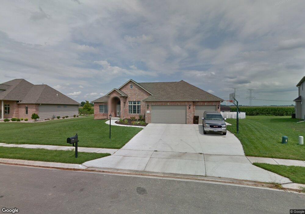
210 S Rhode Island Ave Morton, IL 61550
Estimated Value: $460,000 - $536,000
3
Beds
3
Baths
2,250
Sq Ft
$214/Sq Ft
Est. Value
About This Home
This home is located at 210 S Rhode Island Ave, Morton, IL 61550 and is currently estimated at $482,562, approximately $214 per square foot. 210 S Rhode Island Ave is a home located in Tazewell County with nearby schools including Morton High School, Blessed Sacrament School, and Bethel Lutheran School.
Ownership History
Date
Name
Owned For
Owner Type
Purchase Details
Closed on
Jun 10, 2009
Sold by
Eigsti Construction Inc
Bought by
Noe Joseph M and Noe Marguerite A
Current Estimated Value
Home Financials for this Owner
Home Financials are based on the most recent Mortgage that was taken out on this home.
Original Mortgage
$52,000
Interest Rate
4.83%
Mortgage Type
Purchase Money Mortgage
Purchase Details
Closed on
Oct 3, 2008
Sold by
Davies Thomas E
Bought by
Eigsti Construction Inc
Create a Home Valuation Report for This Property
The Home Valuation Report is an in-depth analysis detailing your home's value as well as a comparison with similar homes in the area
Home Values in the Area
Average Home Value in this Area
Purchase History
| Date | Buyer | Sale Price | Title Company |
|---|---|---|---|
| Noe Joseph M | $65,000 | First Community Title Svcs | |
| Eigsti Construction Inc | $190,000 | First Community Title Svcs |
Source: Public Records
Mortgage History
| Date | Status | Borrower | Loan Amount |
|---|---|---|---|
| Closed | Noe Joseph M | $52,000 |
Source: Public Records
Tax History Compared to Growth
Tax History
| Year | Tax Paid | Tax Assessment Tax Assessment Total Assessment is a certain percentage of the fair market value that is determined by local assessors to be the total taxable value of land and additions on the property. | Land | Improvement |
|---|---|---|---|---|
| 2024 | $8,934 | $137,200 | $24,690 | $112,510 |
| 2023 | $8,934 | $127,820 | $23,000 | $104,820 |
| 2022 | $8,601 | $117,380 | $21,120 | $96,260 |
| 2021 | $8,256 | $112,870 | $20,310 | $92,560 |
| 2020 | $7,998 | $111,750 | $20,110 | $91,640 |
| 2019 | $7,977 | $111,750 | $20,110 | $91,640 |
| 2018 | $7,831 | $111,750 | $20,110 | $91,640 |
| 2017 | $7,629 | $106,550 | $19,170 | $87,380 |
| 2016 | $7,478 | $106,550 | $19,170 | $87,380 |
| 2015 | $7,202 | $0 | $0 | $0 |
| 2013 | $7,129 | $106,550 | $19,170 | $87,380 |
Source: Public Records
Map
Nearby Homes
- 101 N Oregon Ave
- 1043 E Jefferson St
- 314 N Oklahoma Ave
- 329 Pocono Ave
- 353 Pocono Ave
- 300 S Kansas Ave
- 1414 S Missouri Ave
- 324 S Kansas Ave
- 1156 Brentwood Rd
- 120 N Indiana Ave
- 430 N Montana Ave
- 519 Ohio Ct
- 505 E Tyler St
- 328 N 3rd Ave
- 754 Taylor St
- 392 E Forestwood St
- 324 N 2nd Ave
- 501-503 Pierce St
- 315 E Birchwood St
- 452 N Bauman Ave
- 220 S Rhode Island Ave
- 200 S Rhode Island Ave
- 1273 Weatherspoon Dr
- 1278 Weatherspoon Dr
- 1270 Waterford Dr
- 1272 Weatherspoon Dr
- 1267 Weatherspoon Dr
- 140 S Rhode Island Ave
- 140 N Rhode Island Ave
- 1264 Waterford Dr
- 141 S Rhode Island Ave
- 1266 Weatherspoon Dr
- 1261 Weatherspoon Dr
- 1258 Waterford Dr
- 1265 Waterford Dr
- 134 S Rhode Island Ave
- 1260 Weatherspoon Dr
- 135 S Rhode Island Ave
- 1255 Weatherspoon Dr
- 1252 Waterford Dr