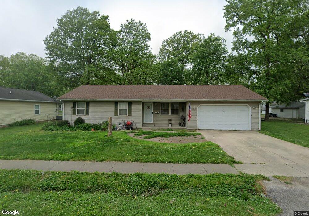
210 S Vine St Freeburg, IL 62243
Estimated Value: $197,000 - $212,000
--
Bed
--
Bath
1,190
Sq Ft
$172/Sq Ft
Est. Value
About This Home
This home is located at 210 S Vine St, Freeburg, IL 62243 and is currently estimated at $204,238, approximately $171 per square foot. 210 S Vine St is a home located in St. Clair County with nearby schools including Freeburg Elementary School, Freeburg Community High School, and St. Joseph Catholic School.
Ownership History
Date
Name
Owned For
Owner Type
Purchase Details
Closed on
Sep 18, 2015
Sold by
Lange Timothy
Bought by
Hill Kelly
Current Estimated Value
Home Financials for this Owner
Home Financials are based on the most recent Mortgage that was taken out on this home.
Original Mortgage
$104,000
Outstanding Balance
$82,266
Interest Rate
4.12%
Mortgage Type
New Conventional
Estimated Equity
$121,972
Purchase Details
Closed on
Jan 23, 2008
Sold by
Lange Edwin W
Bought by
Lange Edwin W and Edwin W Lange Revocable Living Trust
Purchase Details
Closed on
May 1, 2007
Sold by
Swafford Carol J and Swafford Gerald E
Bought by
Lange Edwin W
Purchase Details
Closed on
Aug 14, 2002
Sold by
Reinhardt Frederick F and Swafford Carol J
Bought by
Reinhardt Frederick F and Swafford Carol J
Create a Home Valuation Report for This Property
The Home Valuation Report is an in-depth analysis detailing your home's value as well as a comparison with similar homes in the area
Home Values in the Area
Average Home Value in this Area
Purchase History
| Date | Buyer | Sale Price | Title Company |
|---|---|---|---|
| Hill Kelly | $130,000 | Southern Il Title Estate Tit | |
| Lange Edwin W | -- | None Available | |
| Lange Edwin W | $136,500 | First American Title Insuran | |
| Reinhardt Frederick F | -- | -- |
Source: Public Records
Mortgage History
| Date | Status | Borrower | Loan Amount |
|---|---|---|---|
| Open | Hill Kelly | $104,000 |
Source: Public Records
Tax History Compared to Growth
Tax History
| Year | Tax Paid | Tax Assessment Tax Assessment Total Assessment is a certain percentage of the fair market value that is determined by local assessors to be the total taxable value of land and additions on the property. | Land | Improvement |
|---|---|---|---|---|
| 2024 | $4,506 | $53,894 | $11,069 | $42,825 |
| 2023 | $4,411 | $52,016 | $10,683 | $41,333 |
| 2022 | $4,224 | $48,740 | $10,010 | $38,730 |
| 2021 | $4,092 | $45,886 | $9,424 | $36,462 |
| 2020 | $3,900 | $41,745 | $8,574 | $33,171 |
| 2019 | $3,789 | $42,202 | $8,862 | $33,340 |
| 2018 | $3,726 | $41,644 | $8,745 | $32,899 |
| 2017 | $3,032 | $39,816 | $8,361 | $31,455 |
| 2016 | $2,991 | $38,160 | $8,013 | $30,147 |
| 2014 | $1,019 | $35,879 | $8,222 | $27,657 |
| 2013 | $1,959 | $35,559 | $8,149 | $27,410 |
Source: Public Records
Map
Nearby Homes
- 106 S Vine St
- 207 N Edison St
- 3 Park St
- 401 N Edison St
- 312 W Phillips St
- 206 N Main St
- 302 N Railroad St
- 520 N Edison St
- 103 Draco Dr
- 0 Hickory Dr
- 109 Willow Dr
- 111 Willow Dr
- 420 Foxtail Dr
- 440 Foxtail Dr
- 433 Foxtail Dr
- 304 Torrington Ln
- 359 Sleeping Indian Dr
- 363 Sleeping Indian Dr
- 222 Alamosa Dr
- 227 Alamosa Dr